Category:Iroquois River (Indiana State Road 14)
Jump to navigation
Jump to search
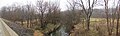
At State Route 14 the Iroquois River is flowing southward after making a loop, north, then east, then south from it's headwaters to the southwest. This location is 3.5 miles (5.6 km) west of U.S. 213.
| Object location | | View all coordinates using: OpenStreetMap |
|---|
Media in category "Iroquois River (Indiana State Road 14)"
The following 10 files are in this category, out of 10 total.
-
 Indiana SR 14 19-01-10 008.jpg 4,608 × 3,072; 2.89 MB
-
 Iroquois River (SR 14) North 19-01-10 003.jpg 4,608 × 3,072; 4.43 MB
-
 Iroquois River (SR 14) North 19-01-10 004.jpg 4,608 × 3,072; 5.57 MB
-
 Iroquois River (SR 14) North 19-01-10 005.jpg 4,608 × 3,072; 4.37 MB
-
 Iroquois River (SR 14) North 19-01-10 006.jpg 4,608 × 3,072; 3.2 MB
-
 Iroquois River (SR 14) North 19-01-10 007.jpg 4,608 × 3,072; 3.37 MB
-
 Iroquois River (SR 14) North 19-01-10 pan.jpg 8,225 × 2,437; 5.1 MB
-
 Iroquois River (SR 14) South 19-01-10 001.jpg 4,608 × 3,072; 4.54 MB
-
 Iroquois River (SR 14) South 19-01-10 002.jpg 4,608 × 3,072; 5.02 MB
-
 Iroquois River (SR 14) South.jpg 12,084 × 2,171; 6.38 MB

_North_19-01-10_003.jpg)
_North_19-01-10_004.jpg)
_North_19-01-10_005.jpg)
_North_19-01-10_006.jpg)
_North_19-01-10_007.jpg)
_South_19-01-10_001.jpg)
_South_19-01-10_002.jpg)
_North_19-01-10_pan.jpg)
_South.jpg)