Category:Ise Bay
Jump to navigation
Jump to search

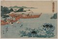
English: Ise-wan (Ise Bay) is a bay located at the mouth of the Kiso Three Rivers between Mie and Aichi Prefectures in Japan.
Deutsch: Ise-Bucht
Français : Baie d'Ise
한국어: 이세 만
Polski: Zatoka Ise
Русский: Исэ (залив)
ไทย: อ่าวอิเซะ
Українська: Затока Ісе
中文:伊势湾
bay in Japan   | |||||
| Upload media | |||||
| Instance of | |||||
|---|---|---|---|---|---|
| Part of | |||||
| Named after | |||||
| Location | |||||
| Area |
| ||||
| Inflows |
| ||||
 | |||||
Subcategories
This category has the following 15 subcategories, out of 15 total.
C
K
M
- Maps of Ise Bay (5 F)
- Port of Morozaki (17 F)
N
P
S
T
- Port of Tsumatsusaka (8 F)
Y
- Yatomi Port (5 F)
Media in category "Ise Bay"
The following 49 files are in this category, out of 49 total.
-
 20171027 NagoyaHwy 6376 (24843275418).jpg 5,472 × 3,648; 3.41 MB
-
 20171027 NagoyaHwy 6377 (37828683475).jpg 5,472 × 3,648; 3.74 MB
-
 20171027 NagoyaHwy 6378 (24843274248).jpg 5,472 × 3,648; 4.37 MB
-
 20171027 NagoyaHwy 6379 (24843273628).jpg 5,472 × 3,648; 4.43 MB
-
 20171027 NagoyaHwy 6380 (24843273088).jpg 5,472 × 3,648; 5.41 MB
-
 20171027 NagoyaHwy 6381 (24843272358).jpg 5,472 × 3,648; 5.11 MB
-
 20171027 NagoyaHwy 6382 (38684174982).jpg 5,472 × 3,648; 5.13 MB
-
 20171027 NagoyaHwy 6383 (24843270968).jpg 3,648 × 5,472; 4.76 MB
-
 20171027 NagoyaHwy 6384 (38684173822).jpg 5,472 × 3,648; 4.94 MB
-
 20171027 NagoyaHwy 6385 (24843269818).jpg 5,472 × 3,648; 5.13 MB
-
 20171027 NagoyaHwy 6387 (38684172402).jpg 5,472 × 3,648; 4.97 MB
-
 20171027 NagoyaHwy 6388 (24843268448).jpg 5,472 × 3,648; 3.31 MB
-
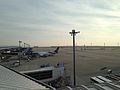
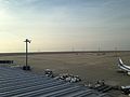 Apron and Ise Bay from Chubu Centrair International Airport 20150125-2.JPG 3,264 × 2,448; 1.71 MB
-
 Apron and Ise Bay from Chubu Centrair International Airport 20150125-3.JPG 3,264 × 2,448; 1.72 MB
-
 Apron and Ise Bay from Chubu Centrair International Airport 20150125-4.JPG 3,264 × 2,448; 1.93 MB
-
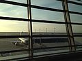
 Apron from departure lobby of Chubu Centrair International Airport 20150125-2.JPG 3,264 × 2,448; 1.15 MB
-
 Apron from departure lobby of Chubu Centrair International Airport 20150125-3.JPG 3,264 × 2,448; 1.42 MB
-
 Apron from departure lobby of Chubu Centrair International Airport 20150125.JPG 3,264 × 2,448; 1.36 MB
-
 Aythya marila mariloides in Ise Bay s2.JPG 5,184 × 2,560; 5.02 MB
-
 Aythya marila mariloides in Ise Bay.JPG 5,184 × 2,048; 5.82 MB
-
 Bridges of Kiso Three Rivers.jpg 3,840 × 2,370; 1.94 MB
-
 Chubu International Airport from Mount Tado.jpg 5,184 × 2,400; 9.01 MB
-
 Hazumisaki3.JPG 6,000 × 4,000; 5.14 MB
-
 Irago Channel view from Toba-Observatory S.jpg 1,440 × 720; 598 KB
-
 Ise bay (cropped).png 339 × 232; 196 KB
-
 Ise Bay and Nōbi Plain from Mount Gozaisho 2011-10-02.jpg 3,580 × 1,232; 1.29 MB
-
 Ise Bay and Yokkaichi, Mie from Mount Gozaisho 2011-10-02.jpg 1,920 × 1,100; 460 KB
-
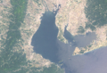
 Ise bay landsat.jpg 359 × 426; 125 KB
-
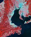
 Ise bay.png 454 × 394; 462 KB
-
 Isemaru1 iwf.jpg 3,008 × 2,000; 2.7 MB
-
 ISS026-E-16159 - View of Japan.jpg 4,288 × 2,929; 1.18 MB
-
 Japan Coast Guard PM28 Isuzu 20170107.jpg 5,472 × 3,648; 5.14 MB
-
 Japanese Cruisers of the Seventh Squadron.jpg 421 × 577; 102 KB
-
 JS Hyūga, Ise Bay 01.jpg 2,527 × 1,451; 2.46 MB
-
 JS Kongō (DDG-173), Ise Bay 01.jpg 1,280 × 960; 909 KB
-
 Kami Island (from Ise Bay Vessel Traffic Service Center).JPG 5,184 × 3,456; 5.29 MB
-
 Kami Island from Mount Ō wide.JPG 5,184 × 3,456; 4.93 MB
-
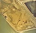 Kisosaki Polder-1975.jpg 3,548 × 3,180; 1.76 MB
-
 Kuwana from Mount Tado.JPG 5,000 × 2,560; 5.48 MB
-
 NDL-DC 1309529-Kawanabe Kyōsai-東海道名所之内 桑名蜃気楼-文久3-crd.jpg 3,199 × 4,723; 2.47 MB
-
 NDL1309529 東海道名所之内 桑名蜃気楼.jpg 4,096 × 6,144; 1.98 MB
-
 Night view from Mount Gozaisho.jpg 6,000 × 4,000; 4.8 MB
-
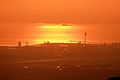 Port of Yokkaichi and Sunshine.jpg 5,184 × 3,456; 4.66 MB
-
 Seigan Island.jpg 2,704 × 1,528; 896 KB
-
 Toba Aquarium 20170107.jpg 5,472 × 3,648; 6.51 MB
-
 Tōkaidō gojūsan tsui, Yokkaichi by Toyokuni III.jpg 2,921 × 4,441; 2.92 MB
-
-
 伊勢湾 - panoramio - Yobito KAYANUMA.jpg 1,600 × 900; 156 KB
-
 伊良湖水道.jpg 4,608 × 3,456; 6.39 MB
.jpg)
.jpg)
.jpg)
.jpg)
.jpg)
.jpg)
.jpg)
.jpg)
.jpg)
.jpg)
.jpg)
.jpg)


.png)


,_Ise_Bay_01.jpg)
.JPG)


