Category:Islam distribution maps of India
Jump to navigation
Jump to search
Media in category "Islam distribution maps of India"
The following 21 files are in this category, out of 21 total.
-
Brit IndianEmpireReligions3.jpg 1,534 × 1,241; 2.33 MB
-
District wise Muslim population percentage India census 2011.png 1,574 × 1,738; 778 KB
-
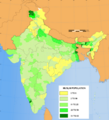
INDIA.PERCENTAGE OF MUSLIMS BY TEHSILS. ACCORDING TO THE 2001 CENSUS.png 1,638 × 1,852; 335 KB
-
Islam in India (2011).svg 1,643 × 1,856; 257 KB
-
Islam In India By Population.png 3,818 × 4,600; 765 KB
-
Islam In India.png 2,000 × 2,208; 871 KB
-
Islam-India-states-2.png 1,594 × 1,868; 550 KB
-
Map of Tibet in 1909 (cropped).jpg 834 × 333; 416 KB
-
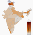
Muslim Demographics of India.png 582 × 614; 59 KB
-
Muslim In India By Percentage.png 3,818 × 4,600; 1,009 KB
-
Muslim percent 1909.jpg 2,358 × 1,970; 2.29 MB
-
Muslim population in India, 2001.png 543 × 599; 251 KB
-
Muslim Population in India.png 2,000 × 2,208; 871 KB
-
Muslim Population-Districts of Assam (2014).svg 765 × 633; 90 KB
-
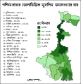
Percentage of Muslim population in West Bengal.svg 512 × 534; 461 KB
-
Uttar Pradesh Muslim percentage 2011.svg 800 × 750; 618 KB
-
Uttar Pradesh religion 2011.png 8,182 × 8,510; 4.01 MB
-
Verbreitung des Islam in Indien 2001.png 1,719 × 1,936; 600 KB
-
WestBengalDistricts muslim population.svg 576 × 601; 150 KB
-
পশ্চিমবঙ্গের জেলাভিত্তিক মুসলিম জনসংখ্যার হার.svg 512 × 534; 68 KB


