Category:Isselhorst
Jump to navigation
Jump to search
human settlement in Germany    | |||||
| Upload media | |||||
| Instance of |
| ||||
|---|---|---|---|---|---|
| Location | Gütersloh, Detmold Government Region, North Rhine-Westphalia, Germany | ||||
| Area |
| ||||
| Elevation above sea level |
| ||||
 | |||||
Subcategories
This category has the following 3 subcategories, out of 3 total.
F
- Friedhof Isselhorst (2 F)
H
Media in category "Isselhorst"
The following 32 files are in this category, out of 32 total.
-
 "Gütersloh-Isselhorst Wassermühle Am Reiherbach April 2021.jpg".jpg 5,472 × 3,648; 14.03 MB
-
 "Gütersloh-Isselhorst Wassermühle Reiherbach SW April 2021.jpg".jpg 5,472 × 3,648; 12.98 MB
-
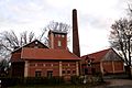 Brennerei in Isselhorst.jpg 3,936 × 2,624; 5.46 MB
-
 Feuerwehrmuseum-Isselhorst.jpg 800 × 533; 404 KB
-
 Guetersloh-krullsbach01.jpg 600 × 450; 421 KB
-
 Gütersloh - Isselhorst-Kirche Maria Königin.jpg 2,592 × 1,944; 524 KB
-
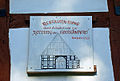
 Heimatmuseum Isselhorst.jpg 4,272 × 2,848; 5.37 MB
-
 Holtkaemperei-isselhorst.jpg 1,200 × 809; 968 KB
-
 Holtkämperei Isselhorst.jpg 1,632 × 918; 231 KB
-
 Isselhorst - Isselhorster Straße 409 - Inschrift.jpg 5,412 × 2,563; 5.75 MB
-
 Isselhorst - Isselhorster Straße 409.jpg 3,360 × 3,704; 4.65 MB
-
 Isselhorst Eseldenkmal.jpg 2,592 × 1,944; 2.2 MB
-
 Isselhorst in Gütersloh.svg 1,000 × 860; 1.86 MB
-
 Isselhorst Luftbild.jpg 3,804 × 2,435; 3.73 MB
-
 Isselhorst, Brennerei.jpg 3,153 × 2,484; 5.34 MB
-
Isselhorst.ogg 1.2 s; 16 KB
-
 Landesgrenzstein Grafschaft Ravensberg A274.jpg 10,944 × 5,472; 31.29 MB
-
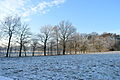 Landschaftsschutzgebiet Gütersloh - Winter am Isselhorster Wasserwerk (1).JPG 5,864 × 3,899; 5.82 MB
-
 Landschaftsschutzgebiet Gütersloh - Winter am Isselhorster Wasserwerk (2).JPG 3,876 × 5,830; 6.28 MB
-
 Landschaftsschutzgebiet Gütersloh - Winter am Isselhorster Wasserwerk (3).JPG 3,973 × 5,976; 6.44 MB
-
 Landschaftsschutzgebiet Gütersloh - Winter am Isselhorster Wasserwerk (4).JPG 5,219 × 3,470; 5.52 MB
-
 Landschaftsschutzgebiet Gütersloh - Winter am Isselhorster Wasserwerk (5).JPG 5,495 × 3,654; 5.56 MB
-
 Landschaftsschutzgebiet Gütersloh - Winter am Isselhorster Wasserwerk (6).JPG 5,936 × 3,947; 6.02 MB
-
 Linde-in-Isselhorst.jpg 1,200 × 846; 1.31 MB
-
 Linde-Isselhorst.jpg 700 × 933; 736 KB
-
 Ortsteile Gütersloh - Isselhorst.svg 549 × 502; 113 KB
-
 Wappen Isselhorst.png 179 × 215; 20 KB
-
 Wappen-kirchspiel-isselhors.jpg 1,200 × 748; 911 KB
-
 Wohnhaus der Maschinenfabrik Schürmann Isselhorst.jpg 5,472 × 3,648; 12.58 MB
-
 Wohnhaus Isselhorst 1828 A050.jpg 5,472 × 3,648; 13.81 MB
-
 Wohnhaus Isselhorst Denkmal A 048.jpg 5,472 × 3,648; 14.49 MB
-
 Zum-grossen-fass.jpg 800 × 514; 350 KB


.JPG)
.JPG)
.JPG)
.JPG)
.JPG)
.JPG)


