Category:Jänickendorf (Steinhöfel)
Jump to navigation
Jump to search
| Object location | | View all coordinates using: OpenStreetMap |
|---|
village in Oder-Spree district, Brandenburg state, Germany   | |||||
| Upload media | |||||
| Instance of |
| ||||
|---|---|---|---|---|---|
| Location | Steinhöfel, Oder-Spree District, Brandenburg, Germany | ||||
 | |||||
Media in category "Jänickendorf (Steinhöfel)"
The following 13 files are in this category, out of 13 total.
-
 Forest in Jänickendorf 2022-05-11 01.jpg 8,368 × 5,584; 24.57 MB
-
 Forest in Jänickendorf 2022-05-11 02.jpg 8,368 × 5,584; 22.5 MB
-
 Forest in Jänickendorf 2022-05-11 03.jpg 8,368 × 5,584; 24.49 MB
-
 Forest in Jänickendorf 2022-05-11 04.jpg 8,368 × 5,584; 24.17 MB
-
 Forest in Jänickendorf 2022-05-11 05.jpg 8,368 × 5,584; 23.58 MB
-
 Jänickendorf - panoramio.jpg 640 × 480; 69 KB
-
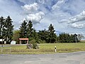
 Steinhöfel-Jänickendorf Ortsansicht 01.jpg 4,032 × 3,024; 3.24 MB
-
 Steinhöfel-Jänickendorf Ortsansicht 02.jpg 4,032 × 3,024; 3.39 MB
-
 Steinhöfel-Jänickendorf Ortsansicht 03.jpg 4,032 × 3,024; 3.13 MB
-
 Steinhöfel-Jänickendorf Ortsansicht 04.jpg 4,032 × 3,024; 3.76 MB
-
 Steinhöfel-Jänickendorf Ortsansicht 05.jpg 4,032 × 3,024; 4.08 MB
-
 Steinhöfel-Jänickendorf Ortsansicht 06.jpg 4,032 × 3,024; 2.99 MB
-
 Steinhöfel-Jänickendorf Ortsansicht 07.jpg 4,032 × 3,024; 5.7 MB


