Category:Janskerkhof 13A, Utrecht
Jump to navigation
Jump to search
| Object location | | View all coordinates using: OpenStreetMap |
|---|
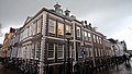
house in Utrecht, Netherlands  | |||||
| Upload media | |||||
| Instance of | |||||
|---|---|---|---|---|---|
| Part of | |||||
| Location | Utrecht, Netherlands | ||||
| Street address |
| ||||
| Heritage designation |
| ||||
 | |||||
|
This is a category about rijksmonument number 36159
|
| Address |
|
Media in category "Janskerkhof 13A, Utrecht"
The following 7 files are in this category, out of 7 total.
-
 32 - Utrecht - 20425451 - RCE.jpg 1,200 × 891; 258 KB
-
 Exterieur VOORGEVEL - Utrecht - 20306509 - RCE.jpg 949 × 1,200; 279 KB
-
 Exterieur VOORGEVEL EN ZIJGEVEL - Utrecht - 20306510 - RCE.jpg 1,200 × 949; 253 KB
-
 Janskerkhof 13A.JPG 2,592 × 1,944; 865 KB
-
 Neude Janskerkhof en Domplein, Utrecht, Netherlands - panoramio (40).jpg 2,048 × 1,155; 502 KB
-
 Overzicht van het Janskerkhof - Utrecht - 20425450 - RCE.jpg 1,200 × 639; 207 KB
-
 Voorgevel - Utrecht - 20235807 - RCE.jpg 801 × 1,200; 218 KB


.jpg)

