Category:Johanneskerk, Lichtenvoorde
Jump to navigation
Jump to search
| Object location | | View all coordinates using: OpenStreetMap |
|---|
church building in Oost Gelre, Netherlands  | |||||
| Upload media | |||||
| Instance of | |||||
|---|---|---|---|---|---|
| Location | Lichtenvoorde, Oost Gelre, Gelderland, Netherlands | ||||
| Street address |
| ||||
| Located on street |
| ||||
| Heritage designation |
| ||||
| Inception |
| ||||
 | |||||
|
This is a category about rijksmonument number 25819
|
| Address |
|
Media in category "Johanneskerk, Lichtenvoorde"
The following 10 files are in this category, out of 10 total.
-
 Avondmaalsbeker - Lichtenvoorde - 20139532 - RCE.jpg 889 × 825; 130 KB
-
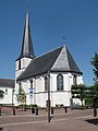
 Exterieur vanuit het zuid-oosten - Lichtenvoorde - 20139530 - RCE.jpg 1,200 × 873; 236 KB
-
 Exterieur vanuit het zuid-oosten - Lichtenvoorde - 20139531 - RCE.jpg 961 × 1,200; 248 KB
-
 Ingang - Lichtenvoorde - 20139535 - RCE.jpg 798 × 1,200; 208 KB
-
 Interieur, aanzicht orgel, orgelnummer 877 - Lichtenvoorde - 20369091 - RCE.jpg 798 × 1,200; 146 KB
-
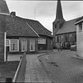
 Kerk en omliggende bebouwing van af "het Hof" - Lichtenvoorde - 20139534 - RCE.jpg 1,200 × 1,200; 319 KB
-
 Kerk met bebouwing ten zuiden ervan - Lichtenvoorde - 20139533 - RCE.jpg 1,200 × 1,200; 236 KB
-
 Lechtenvoorde Johanneskarkw.jpg 480 × 640; 229 KB
-
 Lichtenvoorde johannuskerk.jpg 640 × 480; 248 KB
-
 Lichtenvoorde, kerk2 foto1 2010-07-19 12.02.JPG 2,592 × 3,456; 4.81 MB


