Category:Jorhat
Jump to navigation
Jump to search
city in Upper Assam, Assam, India  | |||||
| Upload media | |||||
| Pronunciation audio | |||||
|---|---|---|---|---|---|
| Instance of |
| ||||
| Part of | |||||
| Location | |||||
| Inception |
| ||||
| Population |
| ||||
| Area |
| ||||
| Elevation above sea level |
| ||||
| official website | |||||
 | |||||
Subcategories
This category has the following 5 subcategories, out of 5 total.
Media in category "Jorhat"
The following 63 files are in this category, out of 63 total.
-
 2013-10-06 Clathrus delicatus Berk. & Broome (1875) 372857.jpg 1,049 × 1,280; 194 KB
-
 A rural scene in Jorhat, Assam.jpg 4,908 × 3,251; 4.09 MB
-
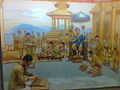
 Ahom kingdom.jpg 3,120 × 4,160; 3.82 MB
-
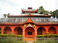
 Asom Bangiya Saraswat Math, Jorhat.jpg 2,880 × 1,907; 2.9 MB
-
 Assam Agriculture University.jpg 718 × 405; 102 KB
-
 At road view from Chowk Bazar foot bridge, Jorhat.jpg 826 × 601; 416 KB
-
 Bartop (Cannon) at Lachit maidam.JPG 1,024 × 768; 573 KB
-
 Bongal Pukhuri.JPG 1,024 × 768; 316 KB
-
 Borpukhuri- jorhat.jpg 2,048 × 1,536; 1.71 MB
-
 Cat Domestic.jpg 5,184 × 3,456; 3.18 MB
-
 Chandrakanta Handique Bhawan.JPG 1,024 × 768; 275 KB
-
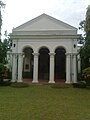
 Complete view of Matha - panoramio.jpg 1,600 × 1,200; 261 KB
-
 Declining.jpg 3,120 × 4,160; 547 KB
-
 Entrance to Lachit madam.JPG 1,024 × 768; 453 KB
-
 Garden of Eden,Jorhat.jpg 720 × 409; 55 KB
-
 Gorokhiya dol1.JPG 1,024 × 768; 462 KB
-
 Gorokhiya dol2.JPG 1,024 × 768; 384 KB
-
 Guest House of JIST.jpg 990 × 768; 163 KB
-
 Hatigarh shiva dewalay, Jorhat.JPG 1,024 × 678; 314 KB
-
 Hotel President (Jorhat) - front entrance.jpg 3,024 × 4,032; 3.77 MB
-
 Hotel President (Jorhat).jpg 4,032 × 3,024; 2.02 MB
-
 Inside Chandrakanta Handique Bhawan.JPG 1,024 × 768; 195 KB
-
 Inside Hatigarh Shiva dewalay, Jorhat.JPG 1,024 × 678; 276 KB
-
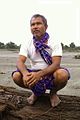 JadavPayeng.jpg 736 × 1,100; 243 KB
-
 Jan Shatabdi Express at Jorhat Town.jpg 1,024 × 768; 424 KB
-
 JB College , Jorhat.jpg 720 × 540; 100 KB
-
 JB College Jorhat.jpg 960 × 631; 353 KB
-
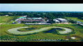
 JIST aerial view.png 3,603 × 2,976; 19.24 MB
-
 Jorbim Boys Hostel 1 during diwali.jpg 2,048 × 1,152; 162 KB
-
 Jorhat Baruah Chariali.jpg 4,928 × 3,264; 695 KB
-
 Jorhat City evening skyline.jpg 991 × 656; 142 KB
-
 Jorhat Gymkhana Club.jpg 550 × 413; 165 KB
-
 Jorhat institute of science and technology.png 1,920 × 1,080; 7.92 MB
-
 Jorhat Medical College.jpg 4,096 × 2,304; 2.48 MB
-
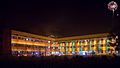
 Jorhat Night View.png 1,280 × 959; 1.38 MB
-
 Jorhat.jpg 1,000 × 738; 554 KB
-
 Kaziranga University Campus.jpg 6,000 × 4,000; 8.56 MB
-
 Lachit Barphukan's maidam.JPG 1,024 × 768; 514 KB
-
 Lachit Barphukan's maidam2.JPG 768 × 1,024; 564 KB
-
 Lachit Bhawan at Lachit maidam.JPG 1,024 × 768; 257 KB
-
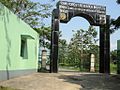
 Main gate of Sukapha Samannay Kshetra.jpg 1,346 × 891; 461 KB
-
 Millenium momentum (Song of Glory) ,Jorhat.jpg 1,600 × 1,200; 328 KB
-
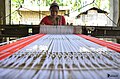 People in Majuli.jpg 4,928 × 3,264; 987 KB
-
 Pond near Hatigarh Shiv dewalay, Jorhat.JPG 1,024 × 678; 275 KB
-
 Rain Forest Research Institute, Jorhat.JPG 1,024 × 768; 432 KB
-
 Saraswata Matha - panoramio (1).jpg 1,066 × 800; 274 KB
-
 Shiva linga at Hatigarh dewalay, Jorhat.JPG 1,024 × 678; 226 KB
-
 Sotai sattra1.JPG 768 × 1,024; 552 KB
-
 Sotai sattra2.JPG 1,024 × 768; 505 KB
-
 Statue of Chakreswar Saikia.jpg 788 × 1,208; 751 KB
-
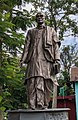
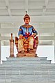 Statue of Sukapha.jpg 1,984 × 2,975; 1.32 MB
-
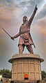 Statue of Valour.jpg 2,256 × 4,011; 3.69 MB
-
 Sukafa kshetra.jpg 640 × 480; 67 KB
-
 Sukafa Samannay Khetre.jpg 2,252 × 1,776; 1.02 MB
-
 Thengal Manor Cock.jpg 1,200 × 1,600; 271 KB
-
 Thengal Manor Front.jpg 1,200 × 1,600; 262 KB
-
 Thengal Manor.jpg 1,200 × 1,600; 261 KB
-
 Tocklai Experimental Station.jpg 712 × 472; 69 KB
-
 Tocklai gate jorhat.jpg 2,048 × 1,536; 1.99 MB
-
 Tribute to Late Hemendra Prasad Barooah.JPG 4,928 × 3,264; 3.53 MB
-
 Vikramjit Kakati MPark.jpg 500 × 194; 77 KB
-
 Vishal-mega-mart.jpg 500 × 374; 41 KB
-
 মইনাপৰীয়া নামঘৰ (যোৰহাট)ৰ সন্মুখভাগ.jpg 1,600 × 1,200; 313 KB
_372857.jpg)


_at_Lachit_maidam.JPG)


_-_front_entrance.jpg)
.jpg)


_,Jorhat.jpg)


.jpg)


%E0%A7%B0_%E0%A6%B8%E0%A6%A8%E0%A7%8D%E0%A6%AE%E0%A7%81%E0%A6%96%E0%A6%AD%E0%A6%BE%E0%A6%97.jpg)