Category:July 2009 in Oxfordshire
Jump to navigation
Jump to search
Deutsch: Bilder, die im Juli 2009 in Oxfordshire aufgenommen worden sind. Bitte beachten Sie, dass dies weder das Datum des Uploads noch das Datum des Scannens eines Fotos ist.
English: Images/pictures taken in Oxfordshire during July 2009. Note this is not the date of the upload, nor the date a photo was scanned.
Español: Fotografías o imágenes tomadas en Oxfordshire durante julio 2009. No es la fecha de subida ni escaneo, sino la fecha en que las fotografías o imágenes se crearon.
Esperanto: Bildoj faritaj en Oxfordshire en julio 2009. Tio ne estas la dato, kiam la bildoj estis alŝutitaj aŭ skanitaj.
Français : Photographies ou images prises en Oxfordshire durant juillet 2009. Ce n'est pas la date du téléchargement ou du scan.
Galego: Fotografías ou imaxes tomadas en Oxfordshire durante xullo 2009. Non é a data de subida nin escaneamento, senón a data na que se crearon as fotografías ou imaxes.
Italiano: Fotografie o immagini scattate a Oxfordshire nel luglio 2009. Nota bene: la data non si riferisce né a quella di upload né a quella in cui la foto è stata digitalizzata.
Norsk bokmål: Bilder tatt i Oxfordshire i løpet av juli 2009. Merk at dette ikke er datoen for opplasting, eller når et bilde har blitt skannet.
Norsk nynorsk: Bilete teke i Oxfordshire i løpet av juli 2009. Merk at dette ikkje er datoen for opplasting, eller når eit bilete har vorte skanna.
Русский: Изображения, сделанные в Oxfordshire в течение июль 2009 (не дата загрузки изображения).
Українська: Зображення, зроблені в Oxfordshire протягом липень 2009. Зауважте, що це не дата завантаження чи дата сканування фотографії.
| July 2008 | ← | July 2009 | → | July 2010 | |||||||
| Jan | Feb | Mar | Apr | May | Jun | Jul | Aug | Sep | Oct | Nov | Dec |
| 13 | 90 | 35 | 55 | 101 | 81 | 89 | 53 | 44 | 42 | 150 | 75 |
|---|---|---|---|---|---|---|---|---|---|---|---|
Subcategories
This category has the following 3 subcategories, out of 3 total.
2
O
Media in category "July 2009 in Oxfordshire"
The following 86 files are in this category, out of 86 total.
-
 1340 Trojan (3715811467).jpg 2,048 × 1,362; 352 KB
-
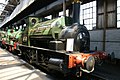 1340 Trojan Didcot Railway Centre (1).jpg 2,048 × 1,362; 359 KB
-
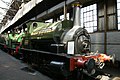
 Hugh llewelyn 165 123 (6280139127).jpg 3,648 × 2,736; 1.9 MB
-
 Clayfield Ride - geograph.org.uk - 1407388.jpg 480 × 640; 152 KB
-
 Footpath alongside Blackhouse Wood - geograph.org.uk - 1407373.jpg 480 × 640; 86 KB
-
 Across Sutton Bridge - geograph.org.uk - 1436845.jpg 640 × 426; 71 KB
-

-
 Balliol College from Broad Street looking west.jpg 2,592 × 1,944; 1.03 MB
-
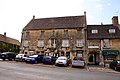
 Butcher's Row in Banbury - geograph.org.uk - 1391513.jpg 640 × 480; 71 KB
-
 Barn by Little Baldon Farm - geograph.org.uk - 1409687.jpg 640 × 427; 70 KB
-
 Biking past - geograph.org.uk - 1408270.jpg 640 × 480; 62 KB
-
 Botley park - geograph.org.uk - 1407020.jpg 640 × 480; 113 KB
-
 Branch Line (3715810763).jpg 2,048 × 1,362; 439 KB
-
 RAF MOD 45150441.jpg 3,600 × 2,400; 5.05 MB
-
 Broad Gauge Transfer Shed Didcot Railway Centre.jpg 2,048 × 1,362; 481 KB
-
 Burford House Hotel - geograph.org.uk - 1417664.jpg 640 × 427; 78 KB
-
 Bus img 3637 (16278696466).jpg 3,072 × 2,304; 2.31 MB
-
 Bus img 3638 (16278698426).jpg 2,624 × 1,968; 1.68 MB
-
 Chipping Norton railway station (site), (geograph 3604567).jpg 1,024 × 768; 271 KB
-
 Cholswell Court offices - geograph.org.uk - 1447264.jpg 640 × 427; 72 KB
-
 Cholswell Road - geograph.org.uk - 1447268.jpg 640 × 416; 83 KB
-
 Closed shop, Bladon - geograph.org.uk - 1407998.jpg 640 × 480; 93 KB
-
 Club on the corner - geograph.org.uk - 1412399.jpg 640 × 480; 76 KB
-
 Cottages, Bladon - geograph.org.uk - 1407991.jpg 640 × 480; 78 KB
-
 Country Level Crossing (3715807629).jpg 2,048 × 1,362; 401 KB
-
 Lock keeper's office - geograph.org.uk - 1428334.jpg 640 × 426; 72 KB
-
 Trees either side - geograph.org.uk - 1429730.jpg 640 × 426; 90 KB
-
 Culham Bridge - geograph.org.uk - 1431198.jpg 640 × 426; 97 KB
-
 Didcot Halt Branch Line Platform (3715811011).jpg 1,362 × 2,048; 449 KB
-

-
 Dual Gauge Points (3715810255).jpg 1,362 × 2,048; 609 KB
-
 Dual Gauge Railway (3715808953).jpg 1,362 × 2,048; 494 KB
-
 Even has a bed - geograph.org.uk - 1433549.jpg 640 × 480; 91 KB
-
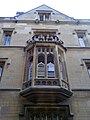 Exeter College Bay Window in Turl Street.jpg 1,944 × 2,592; 770 KB
-
 Faded on the wall - geograph.org.uk - 1408144.jpg 450 × 600; 86 KB
-
 Farmland above Brightwell - geograph.org.uk - 1566207.jpg 640 × 480; 138 KB
-
 Fencing by the bridge - geograph.org.uk - 1435574.jpg 640 × 426; 115 KB
-
 Field by Peep-O-Day Lane - geograph.org.uk - 1398934.jpg 640 × 427; 92 KB
-
 Field near Sutton Courtenay - geograph.org.uk - 1398892.jpg 640 × 427; 81 KB
-
 Field of rape and Hanginglands Copse - geograph.org.uk - 1409672.jpg 640 × 427; 85 KB
-

-
 Fire Fly Replica Didcot Railway Centre.jpg 2,048 × 1,362; 324 KB
-
 Footpath at Happy Valley - geograph.org.uk - 1442867.jpg 640 × 427; 119 KB
-
 Footpath at Sandford Brake - geograph.org.uk - 1447294.jpg 640 × 427; 100 KB
-
 Footpath at Sutton Courtney - geograph.org.uk - 1398895.jpg 640 × 427; 126 KB
-
 Footpath through barley, Kidmore End - geograph.org.uk - 1589892.jpg 640 × 480; 132 KB
-

-
 Footpath to Abingdon by Rye Farm - geograph.org.uk - 1399786.jpg 640 × 427; 74 KB
-
 Footpath to Nuneham Courtney - geograph.org.uk - 1409661.jpg 640 × 427; 91 KB
-
 Footpath to the Thames by Rye Farm - geograph.org.uk - 1399782.jpg 640 × 427; 85 KB
-
 Girls locked up - geograph.org.uk - 1414278.jpg 450 × 600; 72 KB
-
 Going round the bend - geograph.org.uk - 1432432.jpg 640 × 426; 111 KB
-

-
 Head of the river - geograph.org.uk - 1410440.jpg 640 × 480; 90 KB
-
 Heading to Oxford - geograph.org.uk - 1420232.jpg 400 × 600; 58 KB
-
 Islip Station - geograph.org.uk - 1503001.jpg 640 × 417; 75 KB
-
 Level Crossing (3715807379).jpg 2,048 × 1,362; 409 KB
-

-

-
 Magdalen College from the Botanic Gardens Rose Garden.jpg 2,592 × 1,944; 1.02 MB
-
 Main road through Cothill - geograph.org.uk - 1404695.jpg 640 × 427; 74 KB
-
-
 Oxford Taxi - panoramio.jpg 666 × 510; 389 KB
-
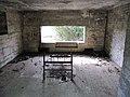
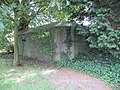 Pillbox at Zouch farm - geograph.org.uk - 2072251.jpg 800 × 600; 146 KB
-
 Pillbox in the corner - geograph.org.uk - 1432524.jpg 640 × 426; 122 KB
-
 Porters Trolly Didcot Railway Centre.jpg 2,048 × 1,362; 320 KB
-
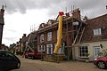 Property renovation in Dorchester - geograph.org.uk - 1419427.jpg 640 × 426; 69 KB
-

-
 Signal and Water Tower (3715807921).jpg 1,362 × 2,048; 441 KB
-
 Smoking Allowed!! (3715808345).jpg 2,048 × 1,362; 251 KB
-

-
 Statue of King Alfred in Wantage Market Square.jpg 427 × 640; 39 KB
-
 Sutton Bridge on the cut - geograph.org.uk - 1417642.jpg 640 × 426; 96 KB
-
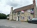 The Cricketers, Warborough - geograph.org.uk - 1392027.jpg 640 × 480; 218 KB
-
 The Merry Miller in Cothill - geograph.org.uk - 1404693.jpg 640 × 427; 69 KB
-

-
 The Platform (3716623930).jpg 2,048 × 1,362; 280 KB
-
 The Plough, Wolvercote - geograph.org.uk - 1388662.jpg 640 × 426; 88 KB
-
 The Red Lion - geograph.org.uk - 1416165.jpg 640 × 480; 83 KB
-
 The Sheldonian Theatre in Oxford - geograph.org.uk - 1421415.jpg 640 × 427; 71 KB
-
 The Sheldonian Theatre in Oxford - geograph.org.uk - 1421440.jpg 640 × 427; 69 KB
-
 The spires of All Souls College - geograph.org.uk - 1420243.jpg 640 × 427; 68 KB
-
 The White House - geograph.org.uk - 1408060.jpg 640 × 480; 81 KB
-
 Third Class Carriage (3716623348).jpg 2,048 × 1,362; 314 KB
-
 Turning to Fyfield - geograph.org.uk - 1430971.jpg 640 × 427; 65 KB
-
 Wallingford Street in Wantage - geograph.org.uk - 1395693.jpg 640 × 427; 62 KB
.jpg)
.jpg)
.jpg)


.jpg)


.jpg)
.jpg)
,_(geograph_3604567).jpg)


.jpg)


.jpg)

.jpg)
.jpg)


.jpg)


.jpg)


.jpg)
.jpg)


.jpg)


.jpg)

