Category:Königlich-Sächsische Triangulirung Station 29 Buchberg
Jump to navigation
Jump to search
| (Wikidata) |
| Object location | | View all coordinates using: OpenStreetMap |
|---|
Triangulation Column, 1nd Order Station, the Royal Saxon Triangulation in Saxony 1862-1890  | |||||
| Upload media | |||||
| Instance of |
| ||||
|---|---|---|---|---|---|
| Part of | |||||
| Location | Laußnitz, Bautzen District, Saxony, Germany | ||||
| Street address |
| ||||
| Heritage designation | |||||
| Inception |
| ||||
 | |||||
Media in category "Königlich-Sächsische Triangulirung Station 29 Buchberg"
The following 3 files are in this category, out of 3 total.
-
 Nagel-Buchberg.jpg 1,944 × 2,592; 1.88 MB
-
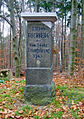 Station 29 Buchberg.jpg 814 × 1,155; 991 KB
-
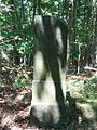 TP Buchberg.jpg 1,704 × 2,272; 1.02 MB

