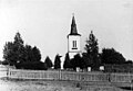
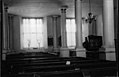
Category:Kalls kyrka
Jump to navigation
Jump to search
| Object location | | View all coordinates using: OpenStreetMap |
|---|
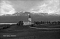
church building in Åre Municipality, Sweden  | |||||
| Upload media | |||||
| Instance of | |||||
|---|---|---|---|---|---|
| Location | Åre Municipality, Jämtland County, Sweden | ||||
| Diocese | |||||
| Has use |
| ||||
| Occupant | |||||
| Heritage designation |
| ||||
 | |||||
Svenska: Kalls kyrka tillhör Kalls församling, Krokom-Åre-Strömsunds kontrakt, Härnösands stift / Diocese of Härnösand.
|
This is a category about an ecclesiastical monument in Sweden, number 21300000003709 in the RAÄ buildings database.
|
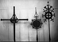
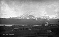
Media in category "Kalls kyrka"
The following 40 files are in this category, out of 40 total.
-
 Kall kyrka från Sölvsved - panoramio.jpg 1,280 × 960; 660 KB
-
 Kalls kyrka - KMB - 16000200041051.jpg 800 × 557; 28 KB
-
 Kalls kyrka - KMB - 16000200041052.jpg 800 × 532; 29 KB
-
 Kalls kyrka - KMB - 16000200041053.jpg 800 × 494; 23 KB
-
 Kalls kyrka - KMB - 16000200041054.jpg 800 × 552; 27 KB
-
 Kalls kyrka - KMB - 16000200041058.jpg 800 × 590; 30 KB
-
 Kalls kyrka - KMB - 16000200041059.jpg 800 × 534; 36 KB
-
 Kalls kyrka - KMB - 16000200041060.jpg 635 × 600; 24 KB
-
 Kalls kyrka - KMB - 16000200041061.jpg 800 × 513; 21 KB
-
 Kalls kyrka - KMB - 16000200041062.jpg 402 × 600; 16 KB
-
 Kalls kyrka - KMB - 16000200041063.jpg 536 × 600; 21 KB
-
 Kalls kyrka - KMB - 16000200041064.jpg 800 × 432; 32 KB
-
 Kalls kyrka - KMB - 16000200041066.jpg 503 × 600; 27 KB
-
 Kalls kyrka - KMB - 16000200041067.jpg 603 × 600; 71 KB
-
 Kalls kyrka - KMB - 16000200041068.jpg 608 × 600; 28 KB
-
 Kalls kyrka - KMB - 16000200041069.jpg 600 × 570; 49 KB
-
 Kalls kyrka - KMB - 16000200041070.jpg 800 × 544; 35 KB
-
 Kalls kyrka - KMB - 16000200041071.jpg 800 × 529; 39 KB
-
 Kalls kyrka - KMB - 16000200041073.jpg 430 × 600; 19 KB
-
 Kalls kyrka - KMB - 16000200041074.jpg 597 × 600; 34 KB
-
 Kalls kyrka - KMB - 16000200041075.jpg 414 × 600; 17 KB
-
 Kalls kyrka - KMB - 16000200041077.jpg 201 × 600; 8 KB
-
 Kalls kyrka - KMB - 16000200041078.jpg 204 × 600; 9 KB
-
 Kalls kyrka - KMB - 16000200041079.jpg 406 × 600; 13 KB
-
 Kalls kyrka - KMB - 16000200041080.jpg 422 × 600; 24 KB
-
 Kalls kyrka - KMB - 16000200041081.jpg 421 × 600; 17 KB
-
 Kalls kyrka - KMB - 16000200041082.jpg 800 × 533; 33 KB
-
 Kalls kyrka - KMB - 16000200041083.jpg 420 × 600; 13 KB
-
 Kalls kyrka - KMB - 16000200041084.jpg 436 × 600; 14 KB
-
 Kalls kyrka - KMB - 16000200041088.jpg 485 × 600; 22 KB
-
 Kalls kyrka - KMB - 16000200041089.jpg 431 × 600; 18 KB
-
 Kalls kyrka - KMB - 16000200041090.jpg 237 × 600; 6 KB
-
 Kalls kyrka - KMB - 16000200041091.jpg 800 × 582; 22 KB
-
 Kalls kyrka - KMB - 16000200041092.jpg 793 × 600; 26 KB
-
 Kalls kyrka - KMB - 16000200041093.jpg 800 × 498; 25 KB
-
 Kalls kyrka - KMB - 16000200041094.jpg 754 × 600; 26 KB
-
 Kalls kyrka - KMB - 16000200041095.jpg 800 × 590; 21 KB
-
 Kalls kyrka - KMB - 16001000320144.jpg 800 × 499; 53 KB
-
 Kalls kyrka old1.jpg 800 × 512; 64 KB
-
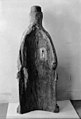
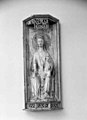
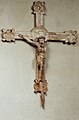 Träskulptur, krucifix - Kalls kyrka, Åre - 9019930.jpg 3,454 × 5,260; 4.68 MB


