Category:Kalmthout
Bước tới điều hướng
Bước tới tìm kiếm
Nederlands: Afbeeldingen van de gemeente Kalmthout in de provincie Antwerpen in het noorden van België. Kalmthout in nabij de gemeenten Woensdrecht, Essen, Zundert, Wuustwezel en Kapellen. (bron [1])
municipality in Antwerp, Belgium | |||||
| Tải lên phương tiện | |||||
| Là một | |||||
|---|---|---|---|---|---|
| Vị trí | Arrondissement of Antwerp, Antwerp, Vùng Flemish, Bỉ | ||||
| Trung tâm hành chính |
| ||||
| Ngôn ngữ chính thức |
| ||||
| Người đứng đầu chính quyền |
| ||||
| Dạng luật pháp |
| ||||
| Dân số |
| ||||
| Diện tích |
| ||||
| trang chủ chính thức | |||||
 | |||||
Thể loại con
Thể loại này có 11 thể loại con sau, trên tổng số 11 thể loại con.
Tập tin trong thể loại “Kalmthout”
15 tập tin sau nằm trong thể loại này, trong tổng số 15 tập tin.
-
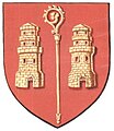
Blason ville be Kalmthout.svg 600×660; 46 kB
-
Bokrijk, Straw barn from Kalmthout-Nieuwmoer.jpg 3.456×2.304; 5,13 MB
-
Coat of arms of Kalmthout.jpg 238×275; 13 kB
-
Vlagkalmthout1.jpg 320×200; 12 kB
-
Kalmthout platteland 22apr2007.jpg 1.600×1.200; 720 kB
-
Kalmthout Vlag - 22597 - onroerenderfgoed.jpg 1.500×1.000; 88 kB
-
Kalmthout vlag.svg 613×406; 21 kB
-
Kalmthout wapen.svg 522×602; 172 kB
-
Kalmthout wapenschild - 269541 - onroerenderfgoed.jpg 1.111×1.440; 179 kB
-
Kanon - Kalmthout - België.JPG 2.048×1.536; 1,55 MB
-
Oorlogsmonument afweergeschut Kalmthout.jpg 4.608×3.456; 6,47 MB
-
Stechovice-2015-04-06-VjezdDoMestyseSeSeznamemPartnerskychObci.JPG 3.456×4.608; 2,98 MB
-
Vangeertenhof.JPG 3.008×2.000; 2,65 MB
-
VillaVandersteen back 1995.jpg 2.322×1.557; 2,26 MB
-
Zicht op de Bredase vaart - 354943 - onroerenderfgoed.jpg 4.096×5.267; 12,01 MB


