Category:Kalu-Ayry, Bashkortostan
Jump to navigation
Jump to search
The village Kalu-Ayry (Калу-Айры), Kulguninsky Village Council, Ishimbaysky District, Bashkortostan, Russia.
Post code 453233
| Object location | | View all coordinates using: OpenStreetMap |
|---|
human settlement in Ishimbaysky District, Republic of Bashkortostan, Russia  | |||||
| Upload media | |||||
| Instance of | |||||
|---|---|---|---|---|---|
| Location | Kulguninsky selsoviet, Ishimbaysky District, Bashkortostan, Russia | ||||
| Population |
| ||||
 | |||||
Media in category "Kalu-Ayry, Bashkortostan"
The following 2 files are in this category, out of 2 total.
-
 Двор на въезде в Калу-Айры - panoramio.jpg 1,600 × 1,200; 852 KB
-
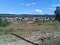 Деревня Калу-Айры - panoramio.jpg 1,600 × 1,200; 830 KB
