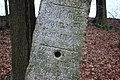
Category:Kamjentny pućnik blisko Prawoćic
Jump to navigation
Jump to search
| Object location | | View all coordinates using: OpenStreetMap |
|---|
| (Wikidata) |
 | |||||
| Upload media | |||||
| Instance of | |||||
|---|---|---|---|---|---|
| Location | Crostwitz, Q93306, Bautzen District, Saxony, Germany | ||||
| Street address |
| ||||
| Heritage designation | |||||
| Inception |
| ||||
 | |||||
Media in category "Kamjentny pućnik blisko Prawoćic"
The following 3 files are in this category, out of 3 total.
-
 Prawoćicy – kamjentny pućnik 1.jpg 3,800 × 2,533; 6.81 MB
-
 Prawoćicy – kamjentny pućnik 2.jpg 3,800 × 2,533; 7.12 MB
-
 Prawoćicy – kamjentny pućnik 3.jpg 3,800 × 2,533; 6.55 MB

