Category:Kaniów Airfield
Jump to navigation
Jump to search
| Object location | | View all coordinates using: OpenStreetMap |
|---|

 Fragment lotniska Kaniów (czerwiec 2012) | |||||
| Upload media | |||||
| Instance of | |||||
|---|---|---|---|---|---|
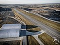
| Location | Kaniów, Gmina Bestwina, Bielsko County, Silesian Voivodeship, Poland | ||||
| Date of official opening |
| ||||
| Elevation above sea level |
| ||||
| ICAO airport code |
| ||||
| official website | |||||
 | |||||
Polski: Lotnisko Kaniów (kod ICAO: EPKW), Bielski Park Technologiczny Lotnictwa, Przedsiębiorczości i Innowacji Sp. z o.o.
English: Kaniów Airfield.
Media in category "Kaniów Airfield"
The following 12 files are in this category, out of 12 total.
-
 Airfield EPKW in Kaniów, 2017.07.15 (01).jpg 4,160 × 2,336; 1.91 MB
-
 Airfield EPKW in Kaniów, 2017.07.15 (02).jpg 4,160 × 2,336; 1.61 MB
-
 Airfield EPKW in Kaniów, 2017.07.15 (03).jpg 4,160 × 2,336; 1.96 MB
-
 Airfield EPKW in Kaniów, 2017.07.15 (04).jpg 4,160 × 2,336; 1.21 MB
-
 Airfield EPKW in Kaniów, 2017.07.15 (05).jpg 4,160 × 2,336; 1.01 MB
-
 Airfield EPKW in Kaniów, 2017.07.15 (06).jpg 4,160 × 2,336; 1.25 MB
-
 Airfield EPKW in Kaniów, 2017.07.15 (07).jpg 4,160 × 2,336; 2.05 MB
-
 Airfield EPKW in Kaniów, 2017.07.15 (08).jpg 4,160 × 2,336; 2.17 MB
-
 Airfield EPKW in Kaniów, 2017.07.15 (09).jpg 4,160 × 2,336; 1.82 MB
-
 Airfield EPKW in Kaniów, 2017.07.15 (10).jpg 4,160 × 2,336; 1.64 MB
-
 EPKW pas.jpg 3,953 × 2,965; 7.26 MB
-
 WYLĄDOWAŁ. - panoramio.jpg 1,600 × 1,200; 2.91 MB
.jpg)
.jpg)
.jpg)
.jpg)
.jpg)
.jpg)
.jpg)
.jpg)
.jpg)
.jpg)
