Category:Kapellestraat 37, Oudewater
Jump to navigation
Jump to search
| Object location | | View all coordinates using: OpenStreetMap |
|---|
 | |||||
| Upload media | |||||
| Instance of | |||||
|---|---|---|---|---|---|
| Location | Oudewater, South Holland, Netherlands | ||||
| Street address |
| ||||
| Located on street | |||||
| Heritage designation |
| ||||
 | |||||
|
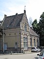
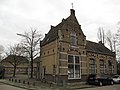
This is a category about rijksmonument number 517472
|
| Address |
|
Media in category "Kapellestraat 37, Oudewater"
The following 4 files are in this category, out of 4 total.
-
 2011-06 Kapellestraat 37 517472 01.jpg 2,112 × 2,816; 2.82 MB
-
 2011-06 Kapellestraat 37 517472 02.jpg 2,816 × 2,112; 2.96 MB
-
 3421 Oudewater, Netherlands - panoramio (83).jpg 4,896 × 3,264; 2.8 MB
-
 RM517472 Oudewater - Kapellestraat 37.jpg 2,592 × 1,944; 1.33 MB


.jpg)