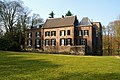
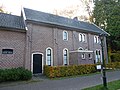
Category:Kasteel Geldrop
Jump to navigation
Jump to search
| Object location | | View all coordinates using: OpenStreetMap |
|---|
garden in Geldrop-Mierlo, Netherlands  | |||||
| Upload media | |||||
| Instance of | |||||
|---|---|---|---|---|---|
| Part of | |||||
| Location | Geldrop, North Brabant, Netherlands | ||||
| Street address |
| ||||
| Located on street |
| ||||
| Heritage designation |
| ||||
 | |||||
|
This is a category about rijksmonumentcomplex number 515916
|
|
This is a category about rijksmonument number 16031
|
|
This is a category about rijksmonument number 515917
|
|
This is a category about rijksmonument number 515918
|
|
This is a category about rijksmonument number 516079
|
|
This is a category about rijksmonument number 516162
|
|
This is a category about rijksmonument number 516163
|
|
This is a category about rijksmonument number 516164
|
|
This is a category about rijksmonument number 516165
|
|
This is a category about rijksmonument number 516166
|
| Address |
|
Subcategories
This category has the following 2 subcategories, out of 2 total.
K
- Kassen, Kasteel Geldrop (15 F)
O
- Oranjerie, Geldrop (7 F)
Media in category "Kasteel Geldrop"
The following 30 files are in this category, out of 30 total.
-
 16031 Kasteel Geldrop 2.jpg 7,278 × 5,028; 23.83 MB
-
 16031 Kasteel Geldrop.jpg 5,184 × 3,456; 13.91 MB
-
 515918 Kasteel Geldrop dienstwoning 2.jpg 3,000 × 2,000; 6.62 MB
-
 515918 Kasteel Geldrop dienstwoning.jpg 5,184 × 3,456; 19.34 MB
-
 Bakstenen fruitmuur met latwerk en leifruit - Geldrop - 20405162 - RCE.jpg 1,200 × 1,199; 467 KB
-
 Bakstenen fruitmuur met latwerk en leifruit - Geldrop - 20405163 - RCE.jpg 1,193 × 1,200; 461 KB
-
 Beeld Teun Gijssen.jpg 650 × 1,144; 385 KB
-
 Engelse tuin Kasteel Geldrop Monument 515917.jpg 4,320 × 3,240; 5.91 MB
-
 Exterieur - Geldrop - 20077295 - RCE.jpg 1,200 × 880; 245 KB
-
 Frans Hals after - Portrait of a man (copy of Kassel version).jpg 467 × 650; 90 KB
-
 Frans Hals after - Portrait of a woman (copy of Kassel version).jpg 507 × 650; 132 KB
-
 Geldrop Castle 1831.jpg 1,500 × 1,169; 157 KB
-
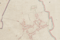 Geldrop on Kadastrale kaart 1811-1832 minuutplan Geldrop.png 4,918 × 3,329; 16.68 MB
-
 Geldrop.jpg 1,000 × 665; 243 KB
-
 Kasteel Geldrop - Aggregaathuisje.JPG 2,000 × 3,008; 2.25 MB
-
 Kasteel Geldrop - dienstwoning.JPG 3,008 × 2,000; 1.84 MB
-
 Kasteel Geldrop, achterzijde.JPG 3,008 × 2,000; 1.85 MB
-
 Kasteel Geldrop.jpg 1,920 × 1,080; 519 KB
-
 Kasteel Geldrop.JPG 3,008 × 2,000; 1.58 MB
-
 Kasteeltuin bij Mierloseweg 3 Geldrop Monument 516163.jpg 4,320 × 3,240; 5.45 MB
-
 Overzicht achtergevel en linker zijgevel - Geldrop - 20347531 - RCE.jpg 1,183 × 1,200; 460 KB
-
 Overzicht van de bakstenen fruitmuur met het latwerk - Geldrop - 20405173 - RCE.jpg 1,188 × 1,200; 363 KB
-
 Overzicht van de buitenzijde van de bakstenen fruitmuur - Geldrop - 20405124 - RCE.jpg 1,200 × 1,193; 381 KB
-
 Overzicht van de tuin met de fruitmuur en de koude bakken - Geldrop - 20405159 - RCE.jpg 1,188 × 1,200; 288 KB
-
 Overzicht van gedeelte van de bakstenen fruitmuur - Geldrop - 20405166 - RCE.jpg 1,200 × 1,194; 396 KB
-

-
 Overzicht voorgevel en rechter zijgevel - Geldrop - 20347532 - RCE.jpg 1,174 × 1,200; 485 KB
-
 Rentmeestershuis Kasteel Geldrop Monument 516079.jpg 4,320 × 3,240; 6.15 MB
-
 Rijksmonument-16031.jpg 4,032 × 3,024; 5.07 MB
-
 Schansmuren bij Mierloseweg 1 Geldrop Monument 516164.JPG 4,320 × 3,240; 5.62 MB


.jpg)
.jpg)


