Category:Katyčiai in topographic maps
Jump to navigation
Jump to search
Media in category "Katyčiai in topographic maps"
The following 7 files are in this category, out of 7 total.
-
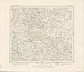 Karte des Deutschen Reiches - 009 - Heydekrug (1880).jpg 7,582 × 6,588; 16.6 MB
-
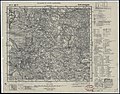
 Ltopo X-11.jpg 11,064 × 9,641; 16.41 MB
-
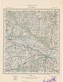
 Shubert map - R11L01.jpg 7,586 × 5,899; 17.22 MB
-
 KdwR J20 1921.jpg 4,048 × 4,008; 5.27 MB
-
 KAM map 1401.jpg 4,165 × 3,512; 3.12 MB
-
 P27 S33 Silute 1935.jpg 11,123 × 8,681; 15.62 MB
-
 R100 n-34-032.jpg 4,564 × 5,906; 2.17 MB
.jpg)


