Category:Katzenbuckel (Bedburg-Hau)
Jump to navigation
Jump to search
street in Till-Moyland, Bedburg-Hau, NRW, Germany  | |||||
| Upload media | |||||
| Instance of | |||||
|---|---|---|---|---|---|
| Location | Till-Moyland, Bedburg-Hau, Kleve, Düsseldorf Government Region, North Rhine-Westphalia, Germany | ||||
 | |||||
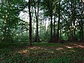
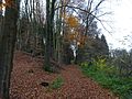
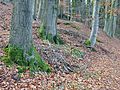
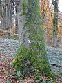
Nederlands: Katzenbuckel is een bosweg in Till-Moyland. De weg begint aan de Kalkarer Straße ter hoogte van Schloss Moyland, overkruist de Moyländer Graben in het LSG-Rheinaue Galeien-Moyland. Na een T-splitsing aan de Moyländer Höhen in het
LSG-Moylaender Wald loopt de bosweg richting Schneppenbaum met aan de rechter zijde het natuurgebied NSG-Moyländer Bruch. Deze weg is onderdeel van de wandelroute Voltaire Weg in Bedburg-Hau.
Media in category "Katzenbuckel (Bedburg-Hau)"
The following 47 files are in this category, out of 47 total.
-
 Kasteel Moyland bij Kleef door Lodewijk Johannes Kleijn (1827-1897).jpg 6,012 × 3,842; 2.77 MB
-
 Kasteel Moyland bij Kleef, RP-T-1977-8.jpg 6,579 × 4,222; 3.03 MB
-
 Bedburg-Hau Kalkarer Straße 11 Katzenbuckel PM18-04.jpg 4,896 × 3,672; 8.94 MB
-
 Bedburg-Hau Kalkarer Straße 11 Katzenbuckel PM18-05.jpg 4,896 × 3,672; 7.42 MB
-
 Bedburg-Hau Kalkarer Straße 11 Katzenbuckel PM18-06.jpg 4,896 × 3,672; 8.62 MB
-
 Bedburg-Hau Kalkarer Straße 11 Katzenbuckel PM18-07.jpg 4,896 × 3,672; 7.79 MB
-
 Bedburg-Hau Kalkarer Straße 11 Katzenbuckel PM18-08.jpg 4,896 × 3,672; 7.88 MB
-
 Bedburg-Hau Kalkarer Straße 11 Katzenbuckel PM18-09.jpg 4,896 × 3,672; 8.14 MB
-
 Bedburg-Hau Kalkarer Straße 11 Katzenbuckel PM18-10.jpg 4,896 × 3,672; 8.71 MB
-
 Bedburg-Hau Katzenbuckel links Moyländer Bruch PM18-01.jpg 4,896 × 3,672; 7.72 MB
-
 Katzenbuckel Till-Moyland PM16-45.jpg 3,648 × 2,736; 3.12 MB
-
 Bedburg-Hau Schloß Moyland Katzenbuckel PM19-01.jpg 4,598 × 3,327; 3.97 MB
-
 Kalkarer Straße (Bedburg-Hau) PM16 01.jpg 3,648 × 2,736; 5.7 MB
-
 Katzenbuckel Till-Moyland PM16-41.jpg 3,648 × 2,736; 5.55 MB
-
 Katzenbuckel Till-Moyland PM16-42.jpg 3,648 × 2,736; 5.55 MB
-
 Katzenbuckel Till-Moyland PM16-43.jpg 3,648 × 2,736; 5.9 MB
-
 Katzenbuckel Till-Moyland PM16-44.jpg 3,648 × 2,736; 4.83 MB
-
 Katzenbuckel Till-Moyland PM16-51.jpg 3,648 × 2,736; 5.65 MB
-
 Katzenbuckel Till-Moyland PM16-52.jpg 3,648 × 2,736; 3.19 MB
-
 Katzenbuckel Till-Moyland PM16-53.jpg 3,648 × 2,736; 5.05 MB
-
 Katzenbuckel Till-Moyland PM16-54.jpg 3,648 × 2,736; 5.22 MB
-
 Katzenbuckel Till-Moyland PM16-55.jpg 3,648 × 2,736; 5.49 MB
-
 Katzenbuckel Till-Moyland PM16-61.jpg 2,736 × 3,648; 5.57 MB
-
 Katzenbuckel Till-Moyland PM16-62.jpg 2,736 × 3,648; 4.39 MB
-
 Katzenbuckel Till-Moyland PM16-63.jpg 2,736 × 3,648; 5.56 MB
-
 Katzenbuckel Till-Moyland PM16-64.jpg 3,648 × 2,736; 5.64 MB
-
 Katzenbuckel Till-Moyland PM16-65.jpg 2,736 × 3,648; 5.39 MB
-
 Katzenbuckel Till-Moyland PM16-70.jpg 3,648 × 2,736; 5.46 MB
-
 Katzenbuckel Till-Moyland PM16-71.jpg 3,648 × 2,736; 5.67 MB
-
 Katzenbuckel Till-Moyland PM16-72.jpg 3,648 × 2,736; 4.66 MB
-
 Katzenbuckel Till-Moyland PM16-73.jpg 3,648 × 2,736; 4.65 MB
-
 Katzenbuckel Till-Moyland PM16-74.jpg 2,736 × 3,648; 4.87 MB
-
 Katzenbuckel Till-Moyland PM16-75.jpg 3,648 × 2,736; 3.27 MB
-
 Katzenbuckel Till-Moyland PM16-76.jpg 3,648 × 2,736; 3.45 MB
-
 Katzenbuckel Till-Moyland PM16-77.jpg 3,648 × 2,736; 5.7 MB
-
 Katzenbuckel Till-Moyland PM16-78.jpg 3,648 × 2,736; 5.53 MB
-
 Katzenbuckel Till-Moyland PM16-79.jpg 3,648 × 2,736; 2.98 MB
-
 Katzenbuckel Till-Moyland PM16-81.jpg 3,648 × 2,736; 5.1 MB
-
 Till-Moyland Katzenbuckel PM16-1.jpg 4,896 × 3,672; 8.01 MB
-
 Till-Moyland Katzenbuckel PM16-2.jpg 3,672 × 4,896; 8.99 MB
-
 Till-Moyland Katzenbuckel PM16-3.jpg 3,672 × 4,896; 7.58 MB
-
 Till-Moyland Katzenbuckel PM16-4.jpg 3,672 × 4,896; 7.63 MB
-
 Till-Moyland Katzenbuckel PM16-5.jpg 3,672 × 4,896; 7.68 MB
-
 Till-Moyland Katzenbuckel PM19-01.jpg 4,896 × 3,672; 7.65 MB
-
 Till-Moyland Katzenbuckel PM19-05.jpg 4,896 × 3,672; 8.09 MB
-
 Bosweg naar Slot Moyland bij Kleef, RP-T-1994-23-57(V) (rotation 2).jpg 1,968 × 2,493; 307 KB
-
 Bosweg naar Slot Moyland bij Kleef, RP-T-1994-23-57(V).jpg 2,546 × 2,024; 371 KB
.jpg)


_PM16_01.jpg)


_(rotation_2).jpg)
.jpg)