Category:Kazakh Uplands
Jump to navigation
Jump to search
- The Kazakh Uplands — a region of the Eurasian Steppe in Kazakhstan.
steppe in Kazakhstan  | |||||
| Upload media | |||||
| Instance of |
| ||||
|---|---|---|---|---|---|
| Location |
| ||||
| Has part(s) | |||||
| Elevation above sea level |
| ||||
 | |||||
Subcategories
This category has the following 26 subcategories, out of 26 total.
A
- Alkamergen (7 F)
- Auliekol (lake) (4 F)
B
C
D
- Degelen (4 F)
K
- Karasor, May District (8 F)
- Kent Range (11 F)
- Koktinkoli (6 F)
- Kon (river) (4 F)
M
- Meshkeysor (5 F)
- Mount Ku (2 F)
- Myrzhyk (6 F)
R
- Rudnichnoye (3 F)
S
- Saumalkol, Bayanaul District (2 F)
- Shoshkakol (5 F)
T
- Taldy (3 F)
U
- Ulytau (4 F)
Y
Z
- Zhaksy-Zhalgyztau (lake) (2 F)
- Zhamantuz, Aktogay District (4 F)
Media in category "Kazakh Uplands"
The following 21 files are in this category, out of 21 total.
-
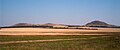
 Aksoran.jpg 3,840 × 2,160; 1.87 MB
-
 Ayr-23 59 Sentinel-2 L2A.jpg 729 × 478; 186 KB
-
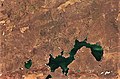
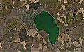
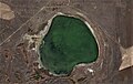
 Balyktykol-23 59 Sentinel-2 L2A.jpg 897 × 588; 153 KB
-
 Botakara-23 59 Sentinel-2 L2A.jpg 1,047 × 601; 201 KB
-
 Jangiztau winter.jpg 816 × 160; 24 KB
-
 Kyzyltau 2023-04-08-23 59 Sentinel-2 L2A True color.jpg 995 × 553; 242 KB
-
 Qaraghandy Province.jpg 800 × 600; 57 KB
-
 Saumalkol AD 2022-09-22-23 59 Sentinel-2 L2A.jpg 781 × 487; 174 KB
-
 Saumalkol-BZ 2021-09-03-23 59 Sentinel-2 L2A.jpg 900 × 617; 112 KB
-
 Saumalkol-BZ 2022-06-22-23 59 Sentinel-2 L2A.jpg 981 × 617; 111 KB
-
 Saumalkol-East-23 59 Sentinel-2 L2A.jpg 802 × 514; 129 KB
-
 Saumalkol-KD 2022-06-28-23 59 Sentinel-2 L2A True color.jpg 445 × 441; 59 KB
-
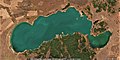 Shalkar-23 59 Sentinel-2 L2A.jpg 1,190 × 598; 238 KB
-
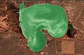
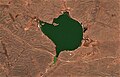
 Shalkarkol 2022-10-25-23 59 Sentinel-2 L2A (2).jpg 795 × 491; 135 KB
-
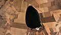 Shybyndy-23 59 Sentinel-2 L2A.jpg 904 × 528; 144 KB
-
 Syrymbet from SW.jpg 652 × 271; 50 KB
-
 Zerendi 2022-10-04-23 59 Sentinel-2 L2A.jpg 921 × 607; 203 KB
-
 Zheltau 2022-10-04-23 59 Sentinel-2 L2A.jpg 954 × 607; 125 KB
-
 Zheltau 2023-04-13-23 59 Sentinel-2 L2A True color.jpg 1,366 × 606; 325 KB
-
 Кар обл1.JPG 2,048 × 1,536; 800 KB
-
 Қызылтас.JPG 3,264 × 2,448; 3.74 MB


.jpg)


