Category:Keizersgracht 465, Amsterdam
Jump to navigation
Jump to search
| Object location | | View all coordinates using: OpenStreetMap |
|---|
 | |||||
| Upload media | |||||
| Instance of |
| ||||
|---|---|---|---|---|---|
| Location | Amsterdam, North Holland, Netherlands | ||||
| Street address |
| ||||
| Located on street | |||||
| Heritage designation |
| ||||
 | |||||
|
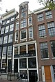
This is a category about rijksmonument number 2362
|
| Address |
|
Media in category "Keizersgracht 465, Amsterdam"
The following 10 files are in this category, out of 10 total.
-
 Amsterdam - Keizersgracht 465.JPG 3,056 × 4,592; 4.99 MB
-
 Amsterdam 4004 43.jpg 2,592 × 3,888; 4.2 MB
-
 Gebroeders Douwes, Afb 010005000397.jpg 2,058 × 1,338; 442 KB
-
 Gebroeders Douwes, Afb B00000031540.jpg 7,098 × 4,452; 2.77 MB
-
 Leidsestraat 31 2989.jpg 3,890 × 3,172; 8.61 MB
-
 RM2361 RM2364 Keizersgracht 463-471.jpg 3,264 × 2,448; 2.01 MB
-
 Stadsarchief Amsterdam, Afb 012000007736.jpg 1,852 × 2,766; 629 KB
-
 Stadsarchief Amsterdam, Afb 012000007745.jpg 1,912 × 2,634; 846 KB
-
 Stadsarchief Amsterdam, Afb OSIM00001004760.jpg 1,619 × 1,177; 224 KB
-
 Wijnkelder - Amsterdam - 20018189 - RCE.jpg 1,200 × 955; 211 KB


