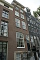
Category:Keizersgracht 503, Amsterdam
Jump to navigation
Jump to search
| Object location | | View all coordinates using: OpenStreetMap |
|---|
 | |||||
| Upload media | |||||
| Instance of |
| ||||
|---|---|---|---|---|---|
| Location | Amsterdam, North Holland, Netherlands | ||||
| Street address |
| ||||
| Located on street | |||||
| Heritage designation |
| ||||
 | |||||
|
This is a category about rijksmonument number 2374
|
| Address |
|
Media in category "Keizersgracht 503, Amsterdam"
The following 8 files are in this category, out of 8 total.
-
 Amsterdam - Keizersgracht 501.JPG 3,056 × 4,592; 4.92 MB
-
 Amsterdam - Keizersgracht 503 en 505.JPG 3,056 × 4,592; 4.48 MB
-
 Amsterdam 4004 39.jpg 3,888 × 2,592; 3.05 MB
-
 Amsterdam Keizersgracht 0503-0505 001.JPG 656 × 2,995; 721 KB
-
 De Keizersgracht ter hoogte van de Nieuwe Spiegelstraat gezien naar de Leidsestraat.jpg 2,052 × 1,332; 400 KB
-
 En hoger, voorgevels - Amsterdam - 20018193 - RCE.jpg 1,200 × 961; 269 KB
-

-
 RM2373 RM2374 Keizersgracht 503-505.jpg 3,264 × 2,448; 2.42 MB


