Category:Keizersgracht 506, Amsterdam
Jump to navigation
Jump to search
| Object location | | View all coordinates using: OpenStreetMap |
|---|
 | |||||
| Upload media | |||||
| Instance of |
| ||||
|---|---|---|---|---|---|
| Location | Amsterdam, North Holland, Netherlands | ||||
| Street address |
| ||||
| Located on street | |||||
| Heritage designation |
| ||||
 | |||||
|
This is a category about rijksmonument number 2627
|
| Address |
|
Media in category "Keizersgracht 506, Amsterdam"
The following 9 files are in this category, out of 9 total.
-
 Amsterdam (8697324363).jpg 4,348 × 3,307; 7.76 MB
-
 Amsterdam - Keizersgracht 506.JPG 3,056 × 4,592; 4.67 MB
-
 Amsterdam - Keizersgracht 508.JPG 2,930 × 4,286; 2.88 MB
-

-
 Slijpen, SFA022808571.jpg 3,542 × 2,512; 1.21 MB
-
 Slijpen, SFA022808572.jpg 3,542 × 2,512; 1.24 MB
-
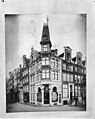
 Stadsarchief Amsterdam, Afb PBKD00276000008.jpg 1,488 × 904; 145 KB
-
 Winkelpand met hoekerker en hoog schilddak - Amsterdam - 20022114 - RCE.jpg 956 × 1,200; 239 KB
-

.jpg)

_met_de_ingang_van_de_Leidsestraat,_gezien_in_de_richting_van_het_Leidseplein.jpg)


