Category:Kennethmont (civil parish)
Jump to navigation
Jump to search
Scottish parish in Aberdeenshire, Scotland, UK | |||||
| Upload media | |||||
| Instance of | |||||
|---|---|---|---|---|---|
| Named after |
| ||||
| Location |
| ||||
| Population |
| ||||
| Area |
| ||||
 | |||||
Subcategories
This category has the following 2 subcategories, out of 2 total.
K
- Kennethmont railway station (2 F)
L
- Leith Hall (26 F)
Media in category "Kennethmont (civil parish)"
The following 142 files are in this category, out of 142 total.
-
 2 Wind Turbines, Hill of Glanderston - geograph.org.uk - 2970225.jpg 640 × 480; 72 KB
-
 2006 Autumn (4000076055).jpg 2,272 × 1,704; 1.3 MB
-
 Aberdeen to Inverness Railway near Glanderstone - geograph.org.uk - 6189221.jpg 1,600 × 900; 525 KB
-
 Aberdeen-Inverness railway line looking towards Gartly - geograph.org.uk - 5411240.jpg 1,600 × 1,200; 501 KB
-
 Aberdeen-Inverness railway line near Glanderstone - geograph.org.uk - 5411233.jpg 1,600 × 1,200; 439 KB
-

-
 Ardlair and Broadgate - geograph.org.uk - 4712430.jpg 640 × 427; 390 KB
-
 Ardlair Field - geograph.org.uk - 2583224.jpg 3,456 × 2,304; 943 KB
-
 Ardlair Recumbent Stone Circle (1) - geograph.org.uk - 4712152.jpg 640 × 427; 382 KB
-
 Ardlair Recumbent Stone Circle (2) - geograph.org.uk - 4712167.jpg 640 × 427; 360 KB
-
 Ardlair Recumbent Stone Circle (4) - geograph.org.uk - 4712184.jpg 640 × 427; 361 KB
-
 Ardlair Recumbent Stone Circle (5) - geograph.org.uk - 4712189.jpg 640 × 427; 354 KB
-
 Ardlair Recumbent Stone Circle (7) - geograph.org.uk - 4712207.jpg 640 × 427; 329 KB
-
 B9002 - geograph.org.uk - 4430705.jpg 800 × 534; 359 KB
-
 B9002 Bridge - geograph.org.uk - 2582107.jpg 3,456 × 2,304; 1.1 MB
-
 Barns at Weets Croft - geograph.org.uk - 6309911.jpg 640 × 427; 426 KB
-
 Barr Hill - geograph.org.uk - 6309848.jpg 640 × 427; 269 KB
-
 Beech Foliage - geograph.org.uk - 6309909.jpg 640 × 427; 609 KB
-
 Berrybrae - geograph.org.uk - 1275886.jpg 640 × 427; 227 KB
-
 Bonded Warehouses at Ardmore Distillery - geograph.org.uk - 5525645.jpg 1,600 × 1,200; 505 KB
-
 Bonded warehouses, Ardmore distillery - geograph.org.uk - 5566446.jpg 3,008 × 2,000; 2.42 MB
-
 Bonded warehouses, Ardmore distillery - geograph.org.uk - 5566450.jpg 2,910 × 1,404; 1.46 MB
-
 Bridge at Newton - geograph.org.uk - 6309830.jpg 640 × 427; 446 KB
-
 Bridge over a burn, Leith Hall - geograph.org.uk - 1017509.jpg 633 × 475; 256 KB
-
 Broken Gates by Newseat - geograph.org.uk - 2583318.jpg 3,456 × 2,304; 1.41 MB
-
 Burnt out tree - geograph.org.uk - 1520010.jpg 640 × 480; 128 KB
-
 Butterbur leaves in grounds of Leith Hall - geograph.org.uk - 6165287.jpg 1,600 × 1,200; 1.16 MB
-
 Den of Wraes - geograph.org.uk - 2740128.jpg 640 × 360; 222 KB
-
 Den of Wraes - geograph.org.uk - 6309919.jpg 640 × 427; 473 KB
-
 Elegant bridge - geograph.org.uk - 5568005.jpg 3,008 × 2,000; 2.98 MB
-
 Entrance to Leith Hall - geograph.org.uk - 1151868.jpg 640 × 480; 86 KB
-
 Farmland in Strathbogie - geograph.org.uk - 5670097.jpg 640 × 480; 38 KB
-
 Field at Slack - geograph.org.uk - 6309915.jpg 640 × 427; 320 KB
-
 Field at Weets - geograph.org.uk - 6309857.jpg 640 × 427; 459 KB
-
 Field at Wraes - geograph.org.uk - 6309922.jpg 640 × 427; 318 KB
-
 Field near Slack - geograph.org.uk - 6309916.jpg 640 × 427; 371 KB
-
 Field, Candy - geograph.org.uk - 4430724.jpg 800 × 534; 380 KB
-
 Fields near Wardhead - geograph.org.uk - 6309822.jpg 640 × 427; 355 KB
-
 Fire damaged gorse and trees - geograph.org.uk - 1519980.jpg 640 × 480; 122 KB
-
 Fire damaged hillside - geograph.org.uk - 1519973.jpg 640 × 480; 82 KB
-
 Flinder - geograph.org.uk - 1275875.jpg 640 × 427; 166 KB
-

-
 Glimpse of a distillery - geograph.org.uk - 5566454.jpg 3,008 × 2,000; 2.68 MB
-
 Grilsay - geograph.org.uk - 1275881.jpg 640 × 427; 286 KB
-
 Hard going in Gartly Moor Forest - geograph.org.uk - 1514694.jpg 640 × 480; 89 KB
-
 Harvested field - geograph.org.uk - 5567201.jpg 3,008 × 2,000; 3.03 MB
-
 Harvested field - geograph.org.uk - 5567219.jpg 3,008 × 2,000; 2.92 MB
-
 Hill o'Christ from Dunnideer - geograph.org.uk - 1509023.jpg 640 × 480; 53 KB
-
 Hill of Christ's Kirk - geograph.org.uk - 1271207.jpg 640 × 427; 223 KB
-
 Hill of Christ's kirk from SE - geograph.org.uk - 929285.jpg 640 × 480; 80 KB
-
 Inverness to Abrdeen railway - geograph.org.uk - 4430637.jpg 800 × 534; 359 KB
-
 Kennethmont - geograph.org.uk - 4430751.jpg 800 × 429; 250 KB
-
 Kennethmont old kirk - geograph.org.uk - 5566470.jpg 2,292 × 1,717; 1.93 MB
-
 Kennethmont old kirkyard - geograph.org.uk - 5567173.jpg 3,008 × 2,000; 2.95 MB
-
 Kennethmont primary school - geograph.org.uk - 5566477.jpg 2,589 × 1,741; 1.95 MB
-
 Kennethmont war memorial (close up) - geograph.org.uk - 5567197.jpg 2,375 × 1,781; 2.5 MB
-
 Kennethmont war memorial - geograph.org.uk - 5567185.jpg 2,000 × 2,816; 2.47 MB
-
 Law Quarry - geograph.org.uk - 2583248.jpg 3,456 × 2,304; 1.1 MB
-
 Leith Hall - geograph.org.uk - 2765368.jpg 685 × 1,024; 290 KB
-
 Leith Hall - geograph.org.uk - 3291024.jpg 1,144 × 762; 153 KB
-
 Leith Hall - geograph.org.uk - 6192077.jpg 1,024 × 767; 154 KB
-
 Leith Hall Armorial Panel - geograph.org.uk - 1872819.jpg 640 × 427; 303 KB
-
 Leith Hall gardens - geograph.org.uk - 989068.jpg 428 × 640; 100 KB
-
 Leith Hall policies* - geograph.org.uk - 5567216.jpg 3,008 × 2,000; 2.68 MB
-
 Leith Hall, south elevation - geograph.org.uk - 5567985.jpg 2,600 × 1,712; 1.66 MB
-
 Leith Hall, view from the south-east - geograph.org.uk - 5567997.jpg 2,315 × 1,502; 1.68 MB
-
 Leith-Hay arms at Leith Hall - geograph.org.uk - 4500366.jpg 1,277 × 1,281; 270 KB
-
 Leith-Hay vault, Kennethmont old kirkyard - geograph.org.uk - 5567206.jpg 2,681 × 1,842; 2.5 MB
-
 Line south of Gartly - geograph.org.uk - 6189226.jpg 1,600 × 900; 651 KB
-
 Little Flinder and Hill of Flinder - geograph.org.uk - 1275867.jpg 640 × 427; 214 KB
-
 Little Mains of Wardhouse - geograph.org.uk - 6309805.jpg 640 × 427; 367 KB
-
 Looking down the line - geograph.org.uk - 5567167.jpg 3,008 × 2,000; 2.81 MB
-
 Mains of Seggieden - geograph.org.uk - 4712479.jpg 640 × 427; 320 KB
-
 Minor road between Newton and Barr Hill - geograph.org.uk - 5962062.jpg 4,000 × 3,000; 3.86 MB
-

-
 Minor road joining the B9002 near Kennethmont Primary School - geograph.org.uk - 5962084.jpg 4,000 × 3,000; 3.15 MB
-
 Minor road near Gartly Moor - geograph.org.uk - 3848708.jpg 1,600 × 1,200; 485 KB
-
 Minor road near Wraes - geograph.org.uk - 3848709.jpg 1,600 × 1,200; 460 KB
-

-
 Near Broadgate - geograph.org.uk - 1275887.jpg 640 × 427; 245 KB
-
 New Flinder - geograph.org.uk - 1275868.jpg 427 × 640; 246 KB
-
 New Flinder - geograph.org.uk - 1275873.jpg 640 × 427; 209 KB
-
 Newton Farm - geograph.org.uk - 6309828.jpg 640 × 427; 367 KB
-
 Not Made to Measure - geograph.org.uk - 2583313.jpg 3,456 × 2,304; 1.27 MB
-
 Ordnance Survey Cut Mark - geograph.org.uk - 5967203.jpg 4,000 × 3,000; 4.48 MB
-
 Ordnance Survey Cut Mark with Bolt - geograph.org.uk - 5967152.jpg 4,000 × 3,000; 5.75 MB
-
 Ordnance Survey Flush Bracket - geograph.org.uk - 5967110.jpg 3,874 × 2,907; 2.77 MB
-
 Ordnance Survey Flush Bracket S4937 - geograph.org.uk - 5967127.jpg 4,000 × 3,000; 4.67 MB
-
 Panorama of Glen of Cults - geograph.org.uk - 1707077.jpg 640 × 480; 85 KB
-
 Pill box set into bank alongside B9002 - geograph.org.uk - 6155646.jpg 1,600 × 1,200; 1.16 MB
-
 Pivot Mark on hill side boulder above Leith Hall - geograph.org.uk - 6019232.jpg 2,448 × 3,264; 4.87 MB
-
 Priestwells Road - geograph.org.uk - 2583324.jpg 3,456 × 2,304; 1.46 MB
-
 Rail Line by the Bogie - geograph.org.uk - 2582156.jpg 3,456 × 2,304; 1.14 MB
-
 Rannes public hall, Kennethmont - geograph.org.uk - 5567157.jpg 2,420 × 1,858; 2.1 MB
-
 Road (B9002) leaving Kennethmont - geograph.org.uk - 5962097.jpg 4,000 × 3,000; 3.19 MB
-
 Road (B9002) passing the Ardmore Distillery - geograph.org.uk - 5962075.jpg 4,000 × 3,000; 2.99 MB
-
 Road at the entrance to Mains of Craighall - geograph.org.uk - 5962100.jpg 4,000 × 3,000; 3.57 MB
-
 Road junction at Wraes - geograph.org.uk - 3848710.jpg 1,600 × 1,200; 605 KB
-
 Ruts in the Field - geograph.org.uk - 1260999.jpg 640 × 427; 190 KB
-
 Severely charred Scots Pine - geograph.org.uk - 1519997.jpg 640 × 480; 112 KB
-
 Sheds at Weets Croft - geograph.org.uk - 6309912.jpg 640 × 427; 325 KB
-
 Sheep at Weets - geograph.org.uk - 6309852.jpg 640 × 427; 385 KB
-
-

-
 Sleepytown - geograph.org.uk - 1260872.jpg 640 × 427; 175 KB
-
 Solitary Tree at Wraes - geograph.org.uk - 6309921.jpg 640 × 427; 347 KB
-
 Standing Stone - geograph.org.uk - 4712124.jpg 427 × 640; 544 KB
-
 Standing Stone - geograph.org.uk - 4712134.jpg 427 × 640; 488 KB
-
 Standing Stones - geograph.org.uk - 4712114.jpg 515 × 640; 434 KB
-
 Stubble, Glanderstone - geograph.org.uk - 2738833.jpg 640 × 360; 194 KB
-
 Suie Road from Kennethmont towards Clatt - geograph.org.uk - 5962090.jpg 4,000 × 3,000; 3.09 MB
-
 Symbol Stone and Standing Stone - geograph.org.uk - 4712148.jpg 640 × 427; 447 KB
-
 Tap O' Noth vitrified iron age fort - geograph.org.uk - 1018726.jpg 633 × 475; 147 KB
-
 The courtyard, Leith Hall - geograph.org.uk - 1017551.jpg 475 × 633; 158 KB
-
 The drive approaching Leith Hall - geograph.org.uk - 6165303.jpg 1,600 × 1,200; 954 KB
-
 The Gallows Tree, Leith Hall - geograph.org.uk - 1017566.jpg 475 × 633; 208 KB
-
 The Old Boathouse, Leith Hall - geograph.org.uk - 2765364.jpg 685 × 1,024; 259 KB
-
 The pond at Leith Hall - geograph.org.uk - 1017527.jpg 633 × 475; 249 KB
-
 The pond at Leith Hall - geograph.org.uk - 1017534.jpg 633 × 475; 217 KB
-
 The Quarry - geograph.org.uk - 6309839.jpg 640 × 427; 227 KB
-
 The Shevock - geograph.org.uk - 6309801.jpg 640 × 427; 381 KB
-
 The Shevock - geograph.org.uk - 6309835.jpg 640 × 427; 442 KB
-
 The stables at Leith Hall - geograph.org.uk - 1017497.jpg 633 × 475; 169 KB
-
 Track heading down through fields - geograph.org.uk - 1519967.jpg 640 × 480; 119 KB
-
 Track in Gartly Forest - geograph.org.uk - 1707122.jpg 640 × 480; 85 KB
-

-
 Unmapped Burn - geograph.org.uk - 6309844.jpg 640 × 427; 387 KB
-
 Village Chinese restaurant - geograph.org.uk - 5568009.jpg 2,496 × 1,813; 2.3 MB
-
 Wardhouse - geograph.org.uk - 6309898.jpg 640 × 427; 406 KB
-
 Wardhouse - geograph.org.uk - 6309899.jpg 640 × 427; 388 KB
-
 Wardhouse Home Farm - geograph.org.uk - 6309877.jpg 427 × 640; 364 KB
-
 Wardhouse Home Farm - geograph.org.uk - 6309881.jpg 640 × 427; 442 KB
-
 Wardhouse Keeper's Cottage - geograph.org.uk - 6309904.jpg 640 × 427; 500 KB
-
 White Hill - geograph.org.uk - 1275870.jpg 640 × 427; 226 KB
-

-
 Windflowers (Anemone nemorosa) - geograph.org.uk - 1275913.jpg 640 × 427; 319 KB
-
 Wood Anemone (Anemone nemorosa) - geograph.org.uk - 1275914.jpg 640 × 447; 239 KB
-
 Woodland Carpet - geograph.org.uk - 1275910.jpg 427 × 640; 326 KB
-

-
 Woodland, Kennethmont - geograph.org.uk - 4430738.jpg 800 × 534; 500 KB
-
 Woodland, Wrae - geograph.org.uk - 2740126.jpg 640 × 360; 234 KB
-
 Wraes Woodland - geograph.org.uk - 2740133.jpg 640 × 360; 208 KB

.jpg)


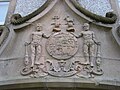
_of_the_Leith-Hay_family_-_geograph.org.uk_-_1273777.jpg)


_-_geograph.org.uk_-_4712152.jpg)
_-_geograph.org.uk_-_4712167.jpg)
_-_geograph.org.uk_-_4712184.jpg)
_-_geograph.org.uk_-_4712189.jpg)
_-_geograph.org.uk_-_4712207.jpg)


_-_geograph.org.uk_-_5567197.jpg)


_leaving_Kennethmont_-_geograph.org.uk_-_5962097.jpg)
_passing_the_Ardmore_Distillery_-_geograph.org.uk_-_5962075.jpg)


_-_geograph.org.uk_-_1275917.jpg)
_-_geograph.org.uk_-_1275913.jpg)
_-_geograph.org.uk_-_1275914.jpg)


