Category:Kerk, Vinkega
Jump to navigation
Jump to search
| Object location | | View all coordinates using: OpenStreetMap |
|---|
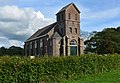
church in Friesland  | |||||
| Upload media | |||||
| Instance of | |||||
|---|---|---|---|---|---|
| Location | Weststellingwerf, Friesland, Netherlands | ||||
 | |||||
Media in category "Kerk, Vinkega"
The following 4 files are in this category, out of 4 total.
-
 Aanzicht, Kerk ? - Vinkega - 20242547 - RCE.jpg 3,272 × 2,212; 2.29 MB
-
 Finkegea, tsjerke.jpg 5,290 × 3,660; 8.14 MB
-
 Torenspits uit Haarlem voor kerk in Vinkega.jpg 1,431 × 3,100; 1.3 MB
-
 Vinkega kerk herbouw kerktoren 2022.jpg 3,080 × 2,643; 1.59 MB


