Category:Kerkpad 4, Ferwerd
Jump to navigation
Jump to search
| Object location | | View all coordinates using: OpenStreetMap |
|---|
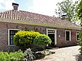
house in Ferwerderadiel, Netherlands  | |||||
| Upload media | |||||
| Instance of | |||||
|---|---|---|---|---|---|
| Location | Ferwert, Noardeast-Fryslân, Friesland, Netherlands | ||||
| Street address |
| ||||
| Located on street |
| ||||
| Heritage designation |
| ||||
 | |||||
|
This is a category about rijksmonument number 15600
|
| Address |
|
Media in category "Kerkpad 4, Ferwerd"
The following 11 files are in this category, out of 11 total.
-
 2023 Ferwert, Tsjerkepaad 4 (kosterij).jpg 2,946 × 1,958; 2.21 MB
-
 Achtergevel - Ferwerd - 20073381 - RCE.jpg 1,200 × 1,200; 447 KB
-
 Achtergevel - Ferwerd - 20073384 - RCE.jpg 1,197 × 1,200; 508 KB
-
 Achtergevels - Ferwerd - 20073380 - RCE.jpg 1,200 × 1,200; 479 KB
-
 Achterkant Kosterij.jpg 2,592 × 1,936; 2.35 MB
-
 Kerkpad4 Ferwerd.jpg 1,824 × 1,368; 819 KB
-
 Linker zijgevel - Ferwerd - 20073378 - RCE.jpg 1,190 × 1,200; 355 KB
-
 Rechter zijgevel - Ferwerd - 20073379 - RCE.jpg 1,185 × 1,200; 418 KB
-
 Voorgevel - Ferwerd - 20073377 - RCE.jpg 1,190 × 1,200; 402 KB
-
 Voorgevel - Ferwerd - 20073382 - RCE.jpg 1,195 × 1,200; 410 KB
-
 Zij- en achtergevel - Ferwerd - 20073383 - RCE.jpg 1,195 × 1,200; 525 KB
.jpg)


