Category:Kerkpad 4, Harlingen
Jump to navigation
Jump to search
| Object location | | View all coordinates using: OpenStreetMap |
|---|
house in Harlingen, Netherlands  | |||||
| Upload media | |||||
| Instance of | |||||
|---|---|---|---|---|---|
| Location | Harlingen, Friesland, Netherlands | ||||
| Located on street | |||||
| Heritage designation |
| ||||
 | |||||
|
This is a category about rijksmonument number 20449
|
| Address |
|
Media in category "Kerkpad 4, Harlingen"
The following 2 files are in this category, out of 2 total.
-
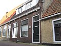 K05-04-2010-10-05-10.16.23.jpg 4,000 × 3,000; 1.14 MB
-
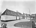 Overzicht - Harlingen - 20101751 - RCE.jpg 1,200 × 952; 214 KB
