Category:Kerkplein 2, Driebergen-Rijsenburg
Jump to navigation
Jump to search
| Object location | | View all coordinates using: OpenStreetMap |
|---|
building in Utrechtse Heuvelrug, Netherlands  | |||||
| Upload media | |||||
| Instance of | |||||
|---|---|---|---|---|---|
| Location | Driebergen-Rijsenburg, Utrecht, Netherlands | ||||
| Street address |
| ||||
| Located on street | |||||
| Heritage designation |
| ||||
 | |||||
|
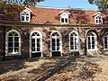
This is a category about rijksmonument number 14096
|
| Address |
|
Media in category "Kerkplein 2, Driebergen-Rijsenburg"
The following 4 files are in this category, out of 4 total.
-
 En kerkplein - Driebergen-Rijsenburg - 20063851 - RCE.jpg 1,200 × 1,186; 357 KB
-
 Huizen rechts van de kerk - Rijsenburg - 20187540 - RCE.jpg 1,200 × 814; 225 KB
-
 Overzicht van af de Hoofdstraat - Rijsenburg - 20187543 - RCE.jpg 1,200 × 961; 261 KB
-
 RM14096 Kerkplein 2.JPG 4,320 × 3,240; 2.42 MB


