Category:Kerkstraat 2, Ameide
Jump to navigation
Jump to search
| Object location | | View all coordinates using: OpenStreetMap |
|---|
building in Zederik, Netherlands  | |||||
| Upload media | |||||
| Instance of | |||||
|---|---|---|---|---|---|
| Location | Ameide, South Holland, Netherlands | ||||
| Street address |
| ||||
| Located on street |
| ||||
| Heritage designation |
| ||||
 | |||||
|
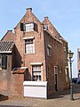
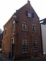
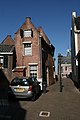
This is a category about rijksmonument number 7569
|
| Address |
|
Media in category "Kerkstraat 2, Ameide"
The following 7 files are in this category, out of 7 total.
-
 Back.Kerkstraat.2.Ameide.jpg 1,363 × 1,815; 630 KB
-
 Front.Kerkstraat.2.Ameide.jpg 1,968 × 2,626; 922 KB
-
 Kerkstr.2. aanzicht - Ameide - 20008322 - RCE.jpg 827 × 1,200; 187 KB
-
 Kerkstr.2. aanzicht gevels - Ameide - 20008323 - RCE.jpg 827 × 1,200; 221 KB
-
 M 6, voorgevel - Ameide - 20008324 - RCE.jpg 1,192 × 1,200; 372 KB
-
 M 6, zij- en achtergevel - Ameide - 20008325 - RCE.jpg 1,191 × 1,200; 323 KB
-
 Werk-Woonhuis.jpg 534 × 800; 263 KB


