Category:Kerkstraat 43, Makkum
Jump to navigation
Jump to search
| Object location | | View all coordinates using: OpenStreetMap |
|---|
 | |||||
| Upload media | |||||
| Instance of |
| ||||
|---|---|---|---|---|---|
| Location | Makkum, Friesland, Netherlands | ||||
| Street address |
| ||||
| Located on street | |||||
| Heritage designation |
| ||||
 | |||||
|
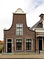
This is a category about rijksmonument number 39383
|
| Address |
|
Media in category "Kerkstraat 43, Makkum"
The following 4 files are in this category, out of 4 total.
-
 Burgerwoningen - Makkum - 20525272 - RCE.jpg 1,200 × 900; 184 KB
-
 Kerkstraat43 Makkum.jpg 2,736 × 3,648; 683 KB
-
 Voorgevels - Makkum - 20150377 - RCE.jpg 804 × 1,200; 164 KB
-
 Voorgevels - Makkum - 20150378 - RCE.jpg 1,200 × 802; 167 KB


