Category:Kerkstraat 50, Vollenhove
Jump to navigation
Jump to search
| Object location | | View all coordinates using: OpenStreetMap |
|---|
 | |||||
| Upload media | |||||
| Instance of |
| ||||
|---|---|---|---|---|---|
| Location | Vollenhove, Vollenhove | ||||
| Street address |
| ||||
| Located on street |
| ||||
| Heritage designation |
| ||||
 | |||||
|
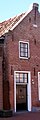
This is a category about rijksmonument number 10568
|
| Address |
|
Media in category "Kerkstraat 50, Vollenhove"
The following 2 files are in this category, out of 2 total.
-
 Kerkstraat50 Vollenhove.jpg 752 × 2,264; 175 KB
-
 Voorgevel - Vollenhove - 20245183 - RCE.jpg 807 × 1,200; 171 KB
