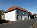
Category:Kerkstraat 87, Doenrade
Jump to navigation
Jump to search
| Object location | | View all coordinates using: OpenStreetMap |
|---|
building in Doenrade, Netherlands  | |||||
| Upload media | |||||
| Instance of | |||||
|---|---|---|---|---|---|
| Location | Doenrade, Beekdaelen, Limburg, Netherlands | ||||
| Street address |
| ||||
| Located on street |
| ||||
| Heritage designation |
| ||||
 | |||||
|
This is a category about rijksmonument number 33351
|
| Address |
|
Media in category "Kerkstraat 87, Doenrade"
The following 2 files are in this category, out of 2 total.
-
 Aanzicht - Doenrade - 20057834 - RCE.jpg 1,200 × 805; 229 KB
-
 Doenrade-Kerkstraat 87.JPG 4,000 × 3,000; 4 MB
