Category:Kersal, Salford
Jump to navigation
Jump to search
English: Kersal is situated in the Salford City Council ward of Kersal in the City of Salford
Subcategories
This category has the following 6 subcategories, out of 6 total.
K
- Kersal Cell, Salford (3 F)
- Kersal Moor (29 F)
M
O
- Oaklands Road, Salford (3 F)
P
- St Paul's Church, Kersal (10 F)
- Peninsula Stadium, Salford (4 F)
Media in category "Kersal, Salford"
The following 56 files are in this category, out of 56 total.
-
 A nature reserve in Kersal Dale - geograph.org.uk - 4346992.jpg 4,435 × 3,056; 6.52 MB
-
 Along the perimeter of the flood basin - geograph.org.uk - 5789419.jpg 5,152 × 3,864; 7.71 MB
-
 Beetham Tower from Kersal - geograph.org.uk - 4768069.jpg 2,736 × 3,648; 4.86 MB
-
 Boardwalk, Kersal Dale - geograph.org.uk - 4759125.jpg 480 × 640; 142 KB
-
 Boardwalk, River Irwell - geograph.org.uk - 4759167.jpg 3,648 × 2,736; 4.88 MB
-
 Broughton Park from the flood basin - geograph.org.uk - 5789392.jpg 5,152 × 3,864; 6.68 MB
-
 Charlestown from Kersal - geograph.org.uk - 4759186.jpg 3,648 × 2,736; 4.52 MB
-
 Christie Lane, Kersal - geograph.org.uk - 2896772.jpg 640 × 480; 119 KB
-
 Christie Lane, Kersal - geograph.org.uk - 2896775.jpg 640 × 480; 119 KB
-
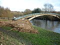
 Footbridge over the River Irwell at Lower Kersal - geograph.org.uk - 4387517.jpg 1,600 × 1,200; 423 KB
-
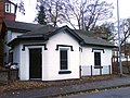 Former Toll House - Kersal.jpg 1,600 × 1,200; 706 KB
-
 From the flood basin to the Beetham - geograph.org.uk - 5789412.jpg 5,152 × 3,864; 7.27 MB
-
 Irwell after Storm Frank - geograph.org.uk - 4784683.jpg 3,648 × 2,736; 4.94 MB
-
 Kersal (Salford City Council ward).png 2,000 × 1,902; 303 KB
-
 Kersal - geograph.org.uk - 5191298.jpg 5,032 × 3,082; 1.62 MB
-
 Kersal - Nevile Road - geograph.org.uk - 1185189.jpg 640 × 480; 195 KB
-
 Kersal - New Flats On Vine Street - geograph.org.uk - 1185192.jpg 640 × 480; 195 KB
-
 Kersal - Vine Street - geograph.org.uk - 1185191.jpg 640 × 480; 230 KB
-
 Kersal Bar Toll House, Bury New Road, Salford - geograph.org.uk - 3867814.jpg 4,000 × 3,000; 1.37 MB
-
 Kersal Bar Toll House, Kersal, Salford - geograph.org.uk - 3860989.jpg 4,000 × 3,000; 1.52 MB
-
 Kersal Bar Toll House.jpg 4,000 × 3,000; 1.34 MB
-
 Kersal Dale after the storm - geograph.org.uk - 4784668.jpg 3,648 × 2,736; 4.27 MB
-
 Kersal Dale inundated - geograph.org.uk - 4784658.jpg 3,648 × 2,736; 4.87 MB
-
 Kersal Flats from under the bridge - geograph.org.uk - 905961.jpg 640 × 480; 66 KB
-
 Kersal, canal - geograph.org.uk - 1547992.jpg 640 × 480; 106 KB
-
 Kersal, pipeline - geograph.org.uk - 1547981.jpg 640 × 480; 103 KB
-
 Kersal, towpath - geograph.org.uk - 1547998.jpg 640 × 480; 102 KB
-
 Littleton Road - geograph.org.uk - 6392914.jpg 3,918 × 2,939; 2.45 MB
-
 Lower Kersal - geograph.org.uk - 4346967.jpg 4,592 × 2,332; 7.88 MB
-
 Lower Kersal Playing Fields - geograph.org.uk - 2283521.jpg 1,280 × 960; 546 KB
-
 Manchester city centre from the flood basin - geograph.org.uk - 5789386.jpg 5,152 × 3,864; 6.62 MB
-
 Matlock Avenue-Calton Avenue crossroads - geograph.org.uk - 4743677.jpg 1,024 × 616; 97 KB
-
 Mayfield Road - geograph.org.uk - 4347006.jpg 4,001 × 2,369; 7.81 MB
-
 Moorside Road, Kersal - geograph.org.uk - 2896803.jpg 640 × 480; 172 KB
-
 Pendleton from Kersal - geograph.org.uk - 4759176.jpg 3,648 × 2,736; 4.04 MB
-
 Racecourse Hotel, Lower Kersal - geograph.org.uk - 4387508.jpg 1,600 × 1,200; 465 KB
-
 River Irwell after the storm - geograph.org.uk - 4784676.jpg 3,648 × 2,736; 4.95 MB
-
 River Irwell and Kersal Dale (3) - geograph.org.uk - 5788425.jpg 5,152 × 3,864; 7.7 MB
-
 River Irwell at Kersal - geograph.org.uk - 4784672.jpg 3,648 × 2,736; 3.99 MB
-
 River Irwell at Kersal Dale (1) - geograph.org.uk - 5788415.jpg 5,152 × 3,864; 7.15 MB
-
 River Irwell at Kersal Dale (2) - geograph.org.uk - 5788419.jpg 5,152 × 3,864; 7.81 MB
-
 River Irwell at Kersal Dale (4) - geograph.org.uk - 5788430.jpg 5,152 × 3,864; 6.71 MB
-
 River Irwell at Kersal Dale - geograph.org.uk - 4387524.jpg 1,600 × 1,200; 548 KB
-
 River Irwell, downriver - geograph.org.uk - 4759159.jpg 3,648 × 2,736; 4.59 MB
-
 River Irwell, Kersal, Salford - geograph.org.uk - 2987.jpg 640 × 480; 46 KB
-
 River Irwell, Kersal, Salford - geograph.org.uk - 2999.jpg 640 × 480; 63 KB
-
 River Irwell, Lower Kersal - geograph.org.uk - 4743528.jpg 1,600 × 900; 269 KB
-
 River Irwell, upriver - geograph.org.uk - 4759143.jpg 3,648 × 2,736; 4.76 MB
-
 Salford Sports Village - geograph.org.uk - 1876523.jpg 4,224 × 2,816; 5.35 MB
-
 Salford Sports Village - geograph.org.uk - 4387528.jpg 1,600 × 1,200; 313 KB
-
 St Paul's Road, Kersal - geograph.org.uk - 3120691.jpg 3,872 × 2,592; 4.84 MB
-
 The Church of St Paul at Kersal - geograph.org.uk - 4639305.jpg 3,000 × 4,000; 2.91 MB
-
 The mire at Kersal Dale - geograph.org.uk - 4759128.jpg 3,648 × 2,736; 5.07 MB
-
 To Kersal Dale - geograph.org.uk - 5789428.jpg 5,152 × 3,864; 7.77 MB
-
 To Kersal Dale from Vine Street - geograph.org.uk - 4768072.jpg 2,736 × 3,648; 5.14 MB
-
 Washed up by the Irwell - geograph.org.uk - 4784679.jpg 3,648 × 2,736; 4.21 MB


.png)


_-_geograph.org.uk_-_5788425.jpg)

_-_geograph.org.uk_-_5788415.jpg)
_-_geograph.org.uk_-_5788419.jpg)
_-_geograph.org.uk_-_5788430.jpg)


