Category:Kettleness
Jump to navigation
Jump to search
English: Kettleness is a small village on the coast near Goldsborough in the civil parish of Lythe, North Yorkshire, UK. Kettleness farm and Kettleness mine are to the west in the civil parish of Barnby
hamlet in Scarborough, North Yorkshire, England  | |||||
| Upload media | |||||
| Instance of | |||||
|---|---|---|---|---|---|
| Location | Lythe, Scarborough, North Yorkshire, Yorkshire and the Humber, England | ||||
 | |||||
Subcategories
This category has the following 2 subcategories, out of 2 total.
K
- Kettleness Tunnel (4 F)
Media in category "Kettleness"
The following 41 files are in this category, out of 41 total.
-
 Alum works at Kettleness 01.jpg 4,000 × 3,000; 4.75 MB
-
 Alum works at Kettleness 02.jpg 4,000 × 3,000; 4.53 MB
-
 Boulder field at Kettleness - geograph.org.uk - 1156840.jpg 640 × 426; 84 KB
-
 Cleveland Way Finger Post, Kettleness - geograph.org.uk - 1736541.jpg 849 × 1,280; 419 KB
-
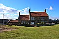
 Cliff House, Kettleness.jpg 4,000 × 3,000; 1.36 MB
-
 Clifftop cottage, Kettleness - geograph.org.uk - 1865926.jpg 640 × 426; 343 KB
-
 Clifftop path, Kettleness - geograph.org.uk - 1865924.jpg 640 × 426; 243 KB
-
 Cottages at Kettleness - geograph.org.uk - 1865932.jpg 640 × 426; 309 KB
-
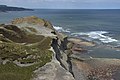
 Crumbling cliffs above Runswick Bay - geograph.org.uk - 573159.jpg 480 × 640; 135 KB
-
 Kettle Ness - geograph.org.uk - 1420774.jpg 640 × 480; 256 KB
-
 Kettle Ness - geograph.org.uk - 573154.jpg 640 × 480; 117 KB
-
 Kettle Ness - geograph.org.uk - 573161.jpg 640 × 480; 119 KB
-
 Kettle Ness - geograph.org.uk - 977614.jpg 640 × 514; 115 KB
-
 Kettleness - geograph.org.uk - 2243170.jpg 640 × 480; 65 KB
-
 Kettleness - geograph.org.uk - 4211687.jpg 4,320 × 2,160; 1.58 MB
-
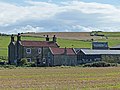
 Kettleness Farm, Kettleness - geograph.org.uk - 1736542.jpg 1,280 × 853; 388 KB
-
 Kettleness Farmhouse 01.jpg 4,000 × 3,000; 4.77 MB
-
 Kettleness Farmhouse 02.jpg 4,000 × 3,000; 3.2 MB
-
 Kettleness from the Cleveland Way - geograph.org.uk - 1736540.jpg 1,280 × 853; 390 KB
-
 Old Alum quarry at Kettleness - geograph.org.uk - 4211697.jpg 4,320 × 3,240; 2.02 MB
-
 Ordnance Survey Sheet NZ 81 Whitby, Published 1954.jpg 7,385 × 7,518; 5.33 MB
-
 Runswick Bay - geograph.org.uk - 2681941.jpg 1,600 × 769; 226 KB
-
 Runswick Bay - geograph.org.uk - 2725969.jpg 640 × 565; 74 KB
-
 Sea coast at Kettleness - geograph.org.uk - 1865930.jpg 640 × 426; 248 KB
-
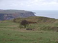 Site of Kettleness ironstone mine - geograph.org.uk - 690043.jpg 640 × 480; 112 KB
-
 Somewhere to relax at Kettleness - geograph.org.uk - 881499.jpg 640 × 475; 92 KB
-
 St John Baptist's Church, Kettleness - geograph.org.uk - 2252930.jpg 2,000 × 1,361; 229 KB
-
 The Cleveland Way near Kettleness - geograph.org.uk - 1865928.jpg 640 × 426; 277 KB
-
 Waterfall at Kettleness Sands - geograph.org.uk - 1156812.jpg 640 × 426; 37 KB
-
 Wreckage at Kettle Ness - geograph.org.uk - 1158083.jpg 640 × 426; 95 KB
-
 Cleveland Way, Kettleness - geograph.org.uk - 89497.jpg 640 × 480; 71 KB
-

-
 Disused quarries at Kettleness - geograph.org.uk - 455367.jpg 640 × 480; 221 KB
-
 Hill Stones, Kettleness, Barnby - geograph.org.uk - 67259.jpg 640 × 434; 106 KB
-
 Kettle Ness, Barnby - geograph.org.uk - 67261.jpg 640 × 438; 136 KB
-
 Kettleness - geograph.org.uk - 1604.jpg 640 × 427; 50 KB
-
 Kettleness - geograph.org.uk - 455363.jpg 640 × 480; 161 KB
-
 Late Evening at Kettleness - geograph.org.uk - 189500.jpg 640 × 354; 27 KB
-
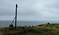 Post, Kettleness - geograph.org.uk - 218031.jpg 640 × 384; 30 KB
-
 Scab Nab, Kettleness - geograph.org.uk - 466736.jpg 640 × 480; 183 KB
-


