Category:Kettlethorpe, Lincolnshire
Jump to navigation
Jump to search
village and civil parish in West Lindsey, Lincolnshire, England  | |||||
| Upload media | |||||
| Instance of | |||||
|---|---|---|---|---|---|
| Location | West Lindsey, Lincolnshire, East Midlands, England | ||||
| Population |
| ||||
 | |||||
Subcategories
This category has the following 5 subcategories, out of 5 total.
Media in category "Kettlethorpe, Lincolnshire"
The following 136 files are in this category, out of 136 total.
-
 A bend in Lincoln Road (A156) - geograph.org.uk - 3535018.jpg 640 × 480; 62 KB
-
 A waterskier on the River Trent - geograph.org.uk - 4947842.jpg 800 × 513; 85 KB
-
 A1133 towards Torksey - geograph.org.uk - 5195601.jpg 4,772 × 3,156; 5.51 MB
-
 A156 towards Gainsborough - geograph.org.uk - 3534347.jpg 640 × 480; 86 KB
-
 A57 heading east - geograph.org.uk - 3536272.jpg 640 × 480; 87 KB
-

-
 A57 towards Newton on Trent - geograph.org.uk - 3448265.jpg 3,318 × 2,022; 2.79 MB
-
 Across the Fossdyke Navigation - geograph.org.uk - 5929427.jpg 5,376 × 3,024; 4.37 MB
-

-
 Barging down the River Trent - geograph.org.uk - 4155824.jpg 1,280 × 772; 192 KB
-
 Barrier on the former A57 - geograph.org.uk - 5883826.jpg 640 × 480; 107 KB
-
 Bend in the A156 Lincoln Road - geograph.org.uk - 3492366.jpg 2,256 × 1,504; 1.57 MB
-
 Bend on Roadwood Lane - geograph.org.uk - 4217843.jpg 3,088 × 2,056; 3.79 MB
-
 Big Hill - geograph.org.uk - 2577418.jpg 1,024 × 768; 153 KB
-
 Blossom Farm, Laughterton - geograph.org.uk - 2563602.jpg 1,024 × 768; 188 KB
-

-
 Boats on the Fossdyke Canal at Hardwick - geograph.org.uk - 4931275.jpg 800 × 529; 125 KB
-
 Chicken farm beside Fossdyke Navigation - geograph.org.uk - 5929429.jpg 5,376 × 3,024; 3.09 MB
-
 Church Farm Barns - geograph.org.uk - 1333985.jpg 640 × 426; 92 KB
-
 Church path - geograph.org.uk - 2802163.jpg 640 × 427; 129 KB
-
 Crop field, Park Farm - geograph.org.uk - 3536271.jpg 640 × 480; 81 KB
-

-
 Down the lane to Kettlethorpe - geograph.org.uk - 5931189.jpg 5,209 × 2,929; 2.56 MB
-
 Drain near Laughterton - geograph.org.uk - 5931349.jpg 5,376 × 3,024; 6.86 MB
-
 Drinsey Farm - geograph.org.uk - 5883852.jpg 640 × 480; 83 KB
-
 Drinsey Nook - Fossdyke Navigation - geograph.org.uk - 2668628.jpg 640 × 480; 78 KB
-

-
 Edge of the Trent - geograph.org.uk - 3160546.jpg 640 × 427; 172 KB
-
 Entrance to Mark Bush Farm - geograph.org.uk - 3027966.jpg 2,256 × 1,504; 880 KB
-
 Entrance to poultry farm at Markbush Farm - geograph.org.uk - 5996881.jpg 1,600 × 639; 443 KB
-
 Farm Buildings near Thorney - geograph.org.uk - 2609779.jpg 640 × 394; 46 KB
-

-
 Farm track beside Road Wood - geograph.org.uk - 3536261.jpg 640 × 480; 72 KB
-
 Farmland next to the Fossdyke Canal - geograph.org.uk - 4931102.jpg 800 × 553; 113 KB
-
 Ferry Cottages - geograph.org.uk - 5929434.jpg 5,376 × 3,024; 5.86 MB
-
 Fields towards Fossdyke and Hardwick - geograph.org.uk - 1337199.jpg 640 × 480; 66 KB
-
 Fishing area along the Fossdyke Canal - geograph.org.uk - 4932529.jpg 800 × 600; 125 KB
-
 Fishing on the Fossdyke - geograph.org.uk - 3534343.jpg 640 × 480; 54 KB
-
 Footbridge near Laughterton - geograph.org.uk - 5931217.jpg 5,376 × 3,024; 4.04 MB
-
 Formerly the A57 - geograph.org.uk - 5883830.jpg 640 × 480; 126 KB
-
 Formerly the A57 - geograph.org.uk - 5926351.jpg 5,376 × 3,024; 4.7 MB
-
 Fossdyke Canal at Hardwick - geograph.org.uk - 4932052.jpg 800 × 593; 188 KB
-
 Fossdyke Canal at Hardwick - geograph.org.uk - 4932053.jpg 800 × 537; 124 KB
-
 Fossdyke Navigation - geograph.org.uk - 5928367.jpg 5,376 × 3,024; 2.92 MB
-
 Fossdyke Navigation looking towards Lincoln - geograph.org.uk - 5931440.jpg 5,376 × 3,024; 4.1 MB
-
 Fosse Farm next to the Fossdyke Canal - geograph.org.uk - 4930983.jpg 800 × 572; 146 KB
-
 Friendship Inn, Laughterton - geograph.org.uk - 5931222.jpg 5,376 × 3,024; 3.1 MB
-
 Frozen Fossdyke - geograph.org.uk - 2804386.jpg 640 × 427; 88 KB
-
 Gateway to Lodge Farm, Kettlethorpe - geograph.org.uk - 1337193.jpg 640 × 480; 67 KB
-
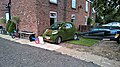 Green car - geograph.org.uk - 5931276.jpg 5,376 × 3,024; 6.54 MB
-
 Green space in Laughterton - geograph.org.uk - 1291107.jpg 640 × 480; 198 KB
-
 House on Westmoor Lane, near Kettlethorpe - geograph.org.uk - 5931173.jpg 5,376 × 3,024; 2.92 MB
-
 Houses at Church Laneham - geograph.org.uk - 3160517.jpg 640 × 467; 208 KB
-
 Houses at Church Laneham - geograph.org.uk - 3160523.jpg 640 × 427; 167 KB
-
 Houses on Kettlethorpe Lane - geograph.org.uk - 5780754.jpg 1,600 × 1,046; 723 KB
-
 Isolated tree - geograph.org.uk - 2576267.jpg 1,024 × 768; 160 KB
-
 Keep the flag flying - geograph.org.uk - 2577426.jpg 1,024 × 768; 133 KB
-
 Kettlethorpe - geograph.org.uk - 1334016.jpg 640 × 426; 92 KB
-
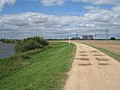
 Kettlethorpe to Fenton, aerial 2017 - geograph.org.uk - 5626500.jpg 800 × 533; 72 KB
-
 Km 67 and Cottam Power Station - geograph.org.uk - 2576155.jpg 1,024 × 768; 158 KB
-
 Lancaster LM292 crash memorial plaque - geograph.org.uk - 6502601.jpg 3,352 × 1,883; 2.25 MB
-
 Laugherton Shop and Post Office - geograph.org.uk - 3535032.jpg 640 × 480; 57 KB
-
 Lay-by beside A57 - geograph.org.uk - 5926340.jpg 5,376 × 3,024; 6.8 MB
-
 Lincoln Lane (2) - geograph.org.uk - 2576247.jpg 1,024 × 768; 326 KB
-
 Lincoln Lane - geograph.org.uk - 2576189.jpg 1,024 × 768; 210 KB
-
 Lincoln Road ( A156) - geograph.org.uk - 3535016.jpg 640 × 480; 103 KB
-
 Lincoln Road ( A156) - geograph.org.uk - 3535019.jpg 640 × 480; 94 KB
-
 Marsh Lane, Laughterton - geograph.org.uk - 1291102.jpg 640 × 480; 203 KB
-
 Marsh Lane, Laughterton - geograph.org.uk - 2561772.jpg 1,024 × 768; 173 KB
-
 Marsh Lane, Laughterton - geograph.org.uk - 5195596.jpg 4,928 × 3,264; 6.27 MB
-
 Meeting a big boat - geograph.org.uk - 3160537.jpg 640 × 427; 149 KB
-
 Memorial on Laughterton Village Green - geograph.org.uk - 5883906.jpg 640 × 480; 128 KB
-
 Memorial on the green to two aircraft crashes in 1944 - geograph.org.uk - 6502591.jpg 3,072 × 4,608; 6.24 MB
-

-

-
 Narrowboat on the Fossdyke Canal - geograph.org.uk - 4930994.jpg 800 × 513; 107 KB
-
 Narrowboat on the Trent - geograph.org.uk - 110532.jpg 640 × 427; 46 KB
-

-

-
 No litter, penalty £400 - geograph.org.uk - 5926343.jpg 5,376 × 3,024; 7.17 MB
-
 Old A57-New A57 - geograph.org.uk - 4287959.jpg 1,024 × 768; 204 KB
-
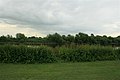
 Paddock near Fenton - geograph.org.uk - 5931344.jpg 5,109 × 2,875; 3.26 MB
-
 Paintball in the woods - geograph.org.uk - 5926344.jpg 5,376 × 3,024; 7.09 MB
-
 Park Farm Road - geograph.org.uk - 5926355.jpg 5,376 × 3,024; 5.19 MB
-

-
 River Trent - geograph.org.uk - 2116019.jpg 640 × 427; 72 KB
-
 River Trent and riverside green (2) - geograph.org.uk - 849408.jpg 640 × 427; 194 KB
-
 River Trent and riverside green (3) - geograph.org.uk - 849409.jpg 640 × 427; 193 KB
-
 River Trent opposite Laughterton Marsh - geograph.org.uk - 4223637.jpg 3,932 × 2,118; 4.66 MB
-
 Roadway to Hall Farm - geograph.org.uk - 2576177.jpg 1,024 × 768; 148 KB
-
 Roadwood Lane - geograph.org.uk - 3536267.jpg 640 × 480; 100 KB
-
 Rough Wood - geograph.org.uk - 5883913.jpg 640 × 480; 136 KB
-
 Sharp bend - geograph.org.uk - 5926350.jpg 5,376 × 3,024; 7.32 MB
-
 Short Stirling EH940 crash memorial plaque - geograph.org.uk - 6502594.jpg 3,120 × 1,924; 2.24 MB
-
 St Peter and St Paul's Church, Kettlethorpe - geograph.org.uk - 5931195.jpg 5,154 × 2,635; 3.94 MB
-
 St Peter ^ St Paul Church, Kettlethorpe - geograph.org.uk - 5780755.jpg 1,600 × 1,065; 656 KB
-
 St Peter ^ St Paul Church, Kettlethorpe - geograph.org.uk - 5887658.jpg 1,600 × 1,065; 698 KB
-
 St Peter ^ St Paul Church, Kettlethorpe - geograph.org.uk - 5887659.jpg 1,600 × 1,065; 765 KB
-
 St Peter ^ St Paul Church, Kettlethorpe - geograph.org.uk - 5887660.jpg 1,600 × 1,065; 508 KB
-
 St Peter ^ St Paul Church, Kettlethorpe - geograph.org.uk - 5887661.jpg 1,065 × 1,600; 414 KB
-
 St Peter ^ St Paul Church, Kettlethorpe - geograph.org.uk - 5887662.jpg 897 × 1,600; 625 KB
-
 St Peter ^ St Paul Church, Kettlethorpe - geograph.org.uk - 5887665.jpg 979 × 1,600; 908 KB
-
 St Peter ^ St Paul Church, Kettlethorpe - geograph.org.uk - 5887740.jpg 1,600 × 1,065; 437 KB
-
 St Peter ^ St Paul Church, Kettlethorpe - geograph.org.uk - 5887746.jpg 931 × 1,600; 765 KB
-
 St Peter ^ St Paul Church, Kettlethorpe - geograph.org.uk - 5887751.jpg 1,065 × 1,600; 389 KB
-
 St Peter ^ St Paul Church, Kettlethorpe - geograph.org.uk - 5887754.jpg 1,065 × 1,600; 324 KB
-
 St Peter ^ St Paul Church, Kettlethorpe - geograph.org.uk - 5887758.jpg 1,600 × 1,065; 445 KB
-
 St Peter ^ St Paul Church, Kettlethorpe - geograph.org.uk - 5887759.jpg 1,600 × 1,065; 840 KB
-
 Stormy skies over the Fossdyke Canal - geograph.org.uk - 4931558.jpg 800 × 477; 68 KB
-
 The Fossdyke Navigation at Drinsey Nook - geograph.org.uk - 5883851.jpg 640 × 480; 110 KB
-
 The Friendship Inn - geograph.org.uk - 5883909.jpg 640 × 480; 71 KB
-
 The Friendship Inn, Laugherton - geograph.org.uk - 3535031.jpg 640 × 480; 50 KB
-
 The new Laughterton - geograph.org.uk - 2563616.jpg 1,024 × 768; 170 KB
-
 The path to Hall Farm - geograph.org.uk - 2577406.jpg 1,024 × 768; 206 KB
-
 The path to Laughterton - geograph.org.uk - 2577409.jpg 1,024 × 768; 139 KB
-
 The Trent bank - geograph.org.uk - 2576143.jpg 1,024 × 768; 162 KB
-
 Track to Fosse Farm - geograph.org.uk - 3535017.jpg 640 × 480; 71 KB
-
 Tractor on Laugherton Marsh - geograph.org.uk - 3160533.jpg 640 × 456; 176 KB
-
 Tree by the junction - geograph.org.uk - 1579539.jpg 640 × 422; 72 KB
-
 Turf field off the A156 - geograph.org.uk - 3534345.jpg 640 × 480; 58 KB
-
 Turf field off the A156 - geograph.org.uk - 3534354.jpg 640 × 480; 53 KB
-
 Turf field, Thorney Gate Farm - geograph.org.uk - 3536263.jpg 640 × 480; 54 KB
-
 Turf near Drinsey Nook - geograph.org.uk - 1337201.jpg 640 × 480; 44 KB
-
 Turn left for Park Farm off the A57 - geograph.org.uk - 4056971.jpg 899 × 1,024; 135 KB
-
 Undulating field at Laughterton - geograph.org.uk - 2563612.jpg 1,024 × 768; 184 KB
-
 Village green at Laughterton - geograph.org.uk - 4203514.jpg 1,500 × 1,125; 2.55 MB
-
 Westmoor Lane (track) - geograph.org.uk - 3536270.jpg 640 × 480; 109 KB
-
 Westmoor Lane - geograph.org.uk - 1334027.jpg 640 × 426; 117 KB
-
 Westmoor Lane - geograph.org.uk - 4287954.jpg 1,024 × 768; 274 KB
-
 Wet all around - geograph.org.uk - 3160506.jpg 640 × 442; 168 KB
-
 Willows beside the River Trent - geograph.org.uk - 4223640.jpg 3,998 × 2,246; 4.39 MB
-
 Wind turbine - geograph.org.uk - 4388373.jpg 683 × 1,024; 138 KB
-

-

-
 Wind-powered chicken farm - geograph.org.uk - 5883856.jpg 640 × 480; 73 KB
-
 WW2 crash memorial beside the A1133 - geograph.org.uk - 6502615.jpg 4,608 × 3,072; 6.19 MB
_-_geograph.org.uk_-_3535018.jpg)


_-_geograph.org.uk_-_2673328.jpg)


_-_geograph.org.uk_-_2576247.jpg)

_-_geograph.org.uk_-_3535016.jpg)
_-_geograph.org.uk_-_3535019.jpg)


_-_geograph.org.uk_-_849408.jpg)
_-_geograph.org.uk_-_849409.jpg)


_-_geograph.org.uk_-_3536270.jpg)


