Category:Kidsgrove
Jump to navigation
Jump to search
English: Kidsgrove is a town in the borough of Newcastle-under-Lyme, Staffordshire, England, near the border with Cheshire. It forms part of The Potteries Urban Area in North Staffordshire, along with Stoke-on-Trent and Newcastle-under-Lyme. It has a population of 24,112 (2001 census). The majority of the town is in the Kidgsrove ward, whilst the western part is in Ravenscliffe.
Italiano: Kidsgrove è una cittadina di 24.112 abitanti, situata nella contea dello Staffordshire in Inghilterra.
Nederlands: Kidsgrove is een plaats in het bestuurlijke gebied Newcastle-under-Lyme, in het Engelse graafschap Staffordshire. De plaats telt 24.112 inwoners.
Română: Kidsgrove este un oraş în comitatul Staffordshire, regiunea West Midlands, Anglia. Oraşul se află în districtul Newcastle-under-Lyme.
town and civil parish in Staffordshire UK  | |||||
| Upload media | |||||
| Instance of | |||||
|---|---|---|---|---|---|
| Location | Newcastle-under-Lyme, Staffordshire, West Midlands, England | ||||
| Population |
| ||||
| Said to be the same as | Kidsgrove (Wikimedia duplicated page, civil parish) | ||||
 | |||||
Subcategories
This category has the following 16 subcategories, out of 16 total.
H
- Harecastle diversion (12 F)
- Harecastle railway tunnel (7 F)
K
- Kidsgrove railway station (27 F)
- Kidsgrove Town Hall (3 F)
- Kidsgrove War Memorial (1 F)
M
N
R
- St Saviour's Church, Rookery (2 F)
S
T
Media in category "Kidsgrove"
The following 200 files are in this category, out of 342 total.
(previous page) (next page)-
 A George VI postbox on Leak Road, Talke - geograph.org.uk - 2853276.jpg 480 × 640; 174 KB
-
 A path crossing Parrot's Dringle - geograph.org.uk - 3092852.jpg 640 × 427; 120 KB
-
 A34 ^ A5011 crossroads at Talke - geograph.org.uk - 5217376.jpg 5,184 × 2,920; 6.37 MB
-

-
 A50, Kidsgrove Road - geograph.org.uk - 3517016.jpg 640 × 493; 48 KB
-

-
 A500 west of Talke intersection - geograph.org.uk - 2343758.jpg 640 × 480; 60 KB
-
 A5011 near Talke - geograph.org.uk - 5542363.jpg 640 × 427; 396 KB
-
 Access to the Potteries Loop - geograph.org.uk - 5324882.jpg 1,280 × 851; 772 KB
-

-
 Aldi Supermarket - Kidsgrove - geograph.org.uk - 3990708.jpg 3,761 × 2,415; 3.7 MB
-
 Alpacas below Mow Cop (2) - geograph.org.uk - 6080489.jpg 1,024 × 768; 130 KB
-
 Autumn foliage by the WCML south of Kidsgrove - geograph.org.uk - 5164294.jpg 3,264 × 2,448; 4.12 MB
-
 Barns, Foxholes - geograph.org.uk - 2098563.jpg 640 × 480; 102 KB
-
 Bathpool - panoramio (1).jpg 1,280 × 768; 653 KB
-
 Bathpool - the Ski slope extension bridge that never was - panoramio.jpg 2,048 × 1,536; 1.03 MB
-
 Bathpool and Kidsgrove Ski Slope - panoramio.jpg 5,184 × 3,456; 6.49 MB
-
 Bathpool at Dusk - geograph.org.uk - 4250635.jpg 960 × 540; 46 KB
-
 Bathpool car park - Kidsgrove end - panoramio.jpg 2,048 × 1,536; 1.17 MB
-
 Bathpool Park - geograph.org.uk - 1481382.jpg 640 × 480; 84 KB
-
 Bathpool Park - geograph.org.uk - 5164479.jpg 4,896 × 3,672; 7.1 MB
-
 Bathpool Park - geograph.org.uk - 5164502.jpg 3,264 × 2,448; 2.97 MB
-
 Bathpool Park - geograph.org.uk - 5167358.jpg 4,896 × 3,672; 6.9 MB
-
 Bathpool Park - geograph.org.uk - 5167365.jpg 4,896 × 3,672; 6.84 MB
-
 Bathpool Park - geograph.org.uk - 5167399.jpg 4,896 × 3,672; 6.95 MB
-
 Bathpool Park, Kidsgrove - geograph.org.uk - 4163208.jpg 1,600 × 1,200; 611 KB
-
 Bathpool Park.jpg 1,278 × 750; 234 KB
-
 Bathpool railway.jpg 1,300 × 830; 304 KB
-
 Bathpool Reservoir - geograph.org.uk - 1528001.jpg 640 × 428; 64 KB
-
 Bathpool Reservoir - geograph.org.uk - 1528004.jpg 640 × 428; 92 KB
-
 Bathpool Reservoir - geograph.org.uk - 1528010.jpg 640 × 428; 127 KB
-
 Bench in Parrot's Drumble - geograph.org.uk - 4802183.jpg 3,264 × 2,448; 3.8 MB
-

-
 Bignall Hill Reservoir - geograph.org.uk - 4132634.jpg 1,600 × 1,200; 393 KB
-
 Birchenwood Country Park - geograph.org.uk - 509540.jpg 640 × 392; 16 KB
-
 Birchenwood Tunnel - geograph.org.uk - 5324058.jpg 1,280 × 851; 788 KB
-
 Bluebell Wood - panoramio.jpg 1,536 × 2,048; 1.41 MB
-
 Bluebells at Bathpool - geograph.org.uk - 1310750.jpg 640 × 480; 146 KB
-
 Boathorse Road at Ravenscliffe - geograph.org.uk - 4578725.jpg 800 × 600; 133 KB
-
 Boathorse Road in Kidsgrove - geograph.org.uk - 4578803.jpg 800 × 570; 139 KB
-
 Bowling Green, Clough Hall Park - panoramio.jpg 2,048 × 1,536; 1.01 MB
-
 Bowls and Tennis at Birchenwood - geograph.org.uk - 509534.jpg 640 × 480; 26 KB
-
 Braces on St Martin's church - geograph.org.uk - 2853186.jpg 480 × 640; 182 KB
-
 Bridge 132 - geograph.org.uk - 2397303.jpg 640 × 349; 68 KB
-

-

-
 Businesses on Congleton Road, Butt Lane - geograph.org.uk - 5463417.jpg 4,032 × 3,024; 2.69 MB
-
 Butt Lane Baptist Church - geograph.org.uk - 5463368.jpg 4,032 × 3,024; 3.54 MB
-
 Butt Lane Co-Op - geograph.org.uk - 5463380.jpg 4,032 × 3,024; 2.38 MB
-
 Butt Lane Industrial Co-Operative Society building (geograph 5463359).jpg 4,032 × 3,024; 2.49 MB
-
 Canal bridge, Kidsgrove Junction - geograph.org.uk - 3026193.jpg 1,514 × 980; 821 KB
-

-
 Carriage Drive - panoramio.jpg 1,536 × 2,048; 1.67 MB
-
 Carriage Drive lodge - panoramio.jpg 2,048 × 1,536; 1.4 MB
-
 Castleview Road, (Mow Cop Castle) - geograph.org.uk - 3215767.jpg 640 × 480; 55 KB
-

-
-
 Cheshire Rambler Railtour – Kidsgrove Junction - geograph.org.uk - 6470313.jpg 1,280 × 829; 370 KB
-
 Church Farm Guesthouse - geograph.org.uk - 2853312.jpg 640 × 480; 86 KB
-
 Church Street, Butt Lane - geograph.org.uk - 5463372.jpg 4,032 × 3,024; 2.3 MB
-
 Churches in Kidsgrove, Staffordshire - geograph.org.uk - 3174148.jpg 1,024 × 684; 463 KB
-
 Closed pub in Butt Lane - geograph.org.uk - 5463341.jpg 4,032 × 3,024; 3.28 MB
-
 Coalpit Hill - geograph.org.uk - 4597482.jpg 4,608 × 3,456; 4.23 MB
-
 Coalpit Hill, Talke - geograph.org.uk - 2099104.jpg 640 × 474; 68 KB
-
 Congleton Road in Kidsgrove (geograph 4568278).jpg 1,024 × 734; 158 KB
-
 Congleton Road, Butt Lane - geograph.org.uk - 5463344.jpg 4,032 × 3,024; 2.43 MB
-
 Coppice Road - geograph.org.uk - 3927139.jpg 3,074 × 2,038; 2.7 MB
-
 Crags at Mow Cop - geograph.org.uk - 6602064.jpg 6,000 × 4,000; 4.16 MB
-

-

-
 Cycle lane along Newcastle Road in Talke - geograph.org.uk - 4568317.jpg 1,024 × 802; 241 KB
-
 Disused quarry on Mow Cop - geograph.org.uk - 5406052.jpg 4,032 × 3,024; 3.77 MB
-
 Dunkirk, bridge over disused railway - geograph.org.uk - 4749890.jpg 3,264 × 2,448; 2.85 MB
-
 Electricity pylon - geograph.org.uk - 2205571.jpg 640 × 430; 104 KB
-
 End of the gardens - geograph.org.uk - 851469.jpg 640 × 480; 70 KB
-
 Everest Road, White Hill - geograph.org.uk - 3215756.jpg 640 × 480; 63 KB
-
 Everest Road, White Hill - geograph.org.uk - 3215760.jpg 640 × 480; 62 KB
-
 Field and gate near the A500 - geograph.org.uk - 3092871.jpg 640 × 427; 90 KB
-
 Field between trees - geograph.org.uk - 3092839.jpg 640 × 427; 82 KB
-
 Field path leading up to Harriseahead - geograph.org.uk - 6686834.jpg 5,184 × 2,912; 3.59 MB
-
 Footbridge across WCML in Bathpool Park - geograph.org.uk - 5167277.jpg 4,896 × 3,672; 6.66 MB
-
 Footbridge over WCML in Bathpool Park - geograph.org.uk - 5164522.jpg 4,896 × 3,672; 7.2 MB
-
 Footpath at Mow House Farm - geograph.org.uk - 6080474.jpg 1,024 × 768; 188 KB
-
 Footpath through wood in Bathpool Park - geograph.org.uk - 5167249.jpg 3,264 × 2,448; 3.36 MB
-
 Former Potteries Loop Line east of Kidsgrove - geograph.org.uk - 5324962.jpg 1,280 × 851; 728 KB
-
 Former Potteries Loop Line east Of Kidsgrove - geograph.org.uk - 5325004.jpg 1,280 × 851; 698 KB
-
 Former Potteries Loop Line, Kidsgrove - geograph.org.uk - 5324916.jpg 1,280 × 851; 801 KB
-
 Former Potteries Loop Line, near Kidsgrove - geograph.org.uk - 5324946.jpg 1,280 × 851; 711 KB
-
 Former quarry at Mow Cop - geograph.org.uk - 6080345.jpg 1,024 × 768; 198 KB
-
 Former St. Thomas' school - geograph.org.uk - 2261279.jpg 1,200 × 803; 268 KB
-
 Freeport Mall at Talke - geograph.org.uk - 1817667.jpg 1,500 × 1,000; 128 KB
-
 Freeport Talke, car park - geograph.org.uk - 4499552.jpg 3,229 × 2,121; 1.93 MB
-
 Freeport Talke, north-east entrance - geograph.org.uk - 4500102.jpg 3,116 × 2,223; 1.43 MB
-
 Freeport Talke, south-east entrance - geograph.org.uk - 4505186.jpg 3,264 × 2,448; 1.86 MB
-
 Freeport, Talke - geograph.org.uk - 2100305.jpg 640 × 480; 74 KB
-
 Frozen lake in Bathpool Park - geograph.org.uk - 4280840.jpg 1,600 × 1,200; 139 KB
-
 GAP outlet at Freeport Talke - geograph.org.uk - 4269687.jpg 1,600 × 1,200; 345 KB
-
 Gate to St Martin's memorial garden - geograph.org.uk - 2853130.jpg 640 × 480; 193 KB
-
 Graffiti at Bathpool Park - panoramio.jpg 2,048 × 1,536; 1.06 MB
-
 Hall Green Branch Canal, Kidsgrove Bridge No 97 - geograph.org.uk - 4421056.jpg 3,600 × 2,700; 6.3 MB
-
 Hall Green Branch Canal, Poole Aqueduct and Bridge No 96 - geograph.org.uk - 4421046.jpg 3,600 × 2,700; 6.47 MB
-
 Harriseahead from Mow Cop castle - geograph.org.uk - 6080495.jpg 1,024 × 768; 100 KB
-
 Harriseahead Lane - geograph.org.uk - 4509587.jpg 1,600 × 1,200; 595 KB
-
 Heathcote Street, Kidsgrove - geograph.org.uk - 2390384.jpg 1,496 × 1,122; 616 KB
-
 High Street, Harriseahead - geograph.org.uk - 4510237.jpg 1,600 × 1,200; 539 KB
-
 Hillside Methodist Chapel - geograph.org.uk - 6689233.jpg 5,184 × 3,888; 4.17 MB
-
 Holly trees on Bignall Hill - geograph.org.uk - 5715200.jpg 4,032 × 3,024; 2.5 MB
-
 House near Mow Cop castle - geograph.org.uk - 6080493.jpg 1,024 × 768; 190 KB
-
 Houses at Talke - geograph.org.uk - 2099033.jpg 640 × 480; 64 KB
-
 Houses by the A5011 - geograph.org.uk - 4597490.jpg 4,608 × 2,677; 2.44 MB
-
 Housing in Kidsgrove, Staffordshire - geograph.org.uk - 3173854.jpg 1,024 × 587; 437 KB
-
 I can see (two) rainbows - geograph.org.uk - 2467740.jpg 725 × 1,024; 86 KB
-
 Impressive house in Kidsgrove, Staffordshire - geograph.org.uk - 3173959.jpg 1,024 × 768; 462 KB
-

-

-
 Industrial building, Church Lane, Mow Cop - geograph.org.uk - 6080478.jpg 1,024 × 768; 205 KB
-
 Jamage Industrial Estate, B^Q - geograph.org.uk - 4506433.jpg 3,264 × 2,448; 2.87 MB
-
 Jamage Industrial Estate, Diglake Close - geograph.org.uk - 4505349.jpg 3,253 × 2,036; 3.64 MB
-
 Jamage Industrial Estate, Lodge Tyre - geograph.org.uk - 4506428.jpg 3,264 × 2,448; 2.1 MB
-
 Jamage Industrial Estate, National Veterinary Services - geograph.org.uk - 4505355.jpg 3,238 × 1,996; 2.99 MB
-
 Jamage Industrial Estate, site to let - geograph.org.uk - 4506408.jpg 3,264 × 2,448; 1.88 MB
-

-
 Junction of Cedar Avenue and Congleton Road, Butt Lane - geograph.org.uk - 5463391.jpg 4,032 × 3,024; 2.25 MB
-
 Kids Wood - geograph.org.uk - 5324439.jpg 1,280 × 851; 749 KB
-
 Kidsgrove , The A500 - geograph.org.uk - 6292554.jpg 6,000 × 4,000; 5.37 MB
-
 Kidsgrove , The A500 - geograph.org.uk - 6292555.jpg 6,000 × 4,000; 5.2 MB
-
 Kidsgrove Cricket Club - geograph.org.uk - 185235.jpg 640 × 479; 68 KB
-
 Kidsgrove Delivery Office on Congleton Road - geograph.org.uk - 4568258.jpg 1,024 × 768; 320 KB
-
 Kidsgrove fire station - geograph.org.uk - 266813.jpg 640 × 426; 180 KB
-
 Kidsgrove Fire Station - geograph.org.uk - 5175642.jpg 3,264 × 2,448; 1.42 MB
-
 Kidsgrove Gas and Light Company - geograph.org.uk - 2397314.jpg 528 × 640; 85 KB
-
 Kidsgrove Junction - geograph.org.uk - 5324214.jpg 1,280 × 851; 750 KB
-
 Kidsgrove Junction - geograph.org.uk - 5324431.jpg 1,280 × 851; 651 KB
-

-
 Kidsgrove Methodist Church - geograph.org.uk - 2261276.jpg 1,200 × 815; 149 KB
-
 Kidsgrove Methodist Sunday School, Staffordshire - geograph.org.uk - 3174008.jpg 1,024 × 714; 445 KB
-
 Kidsgrove Rotary with the District Darts Trophy.jpg 3,264 × 1,952; 2.56 MB
-
 Kidsgrove Ski Centre dry ski slopes - geograph.org.uk - 5167306.jpg 4,896 × 3,672; 6.55 MB
-
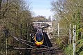
 Kidsgrove Station - geograph.org.uk - 4836632.jpg 640 × 405; 85 KB
-

-
 Kidsgrove, Aldi - geograph.org.uk - 4762914.jpg 2,448 × 2,448; 1.11 MB
-
 Kidsgrove, cul-de-sac off Unity Way - geograph.org.uk - 5175621.jpg 3,264 × 2,448; 1.96 MB
-
 Kidsgrove, footpath off Beech Drive - geograph.org.uk - 5175648.jpg 3,264 × 2,448; 4.1 MB
-
 Kidsgrove, lock-up garages off Unity Way - geograph.org.uk - 5175651.jpg 3,264 × 2,448; 2.41 MB
-
 Kidsgrove, Maple Avenue - geograph.org.uk - 5175630.jpg 3,264 × 2,448; 1.6 MB
-
 Kidsgrove, path between houses on Maple Avenue - geograph.org.uk - 5175627.jpg 2,448 × 3,264; 1.96 MB
-
 Kidsgrove, path through playing fields - geograph.org.uk - 5175658.jpg 4,896 × 3,672; 6.61 MB
-
 Kidsgrove, rugby pitch - geograph.org.uk - 5175666.jpg 4,896 × 3,672; 6.88 MB
-
 Kidsgrove, shops on Unity Way - geograph.org.uk - 5175615.jpg 3,264 × 2,448; 1.6 MB
-
 Kidsgrove, Tesco - geograph.org.uk - 4762910.jpg 2,411 × 2,089; 1,009 KB
-
 Kidsgrove, The Plough Inn - geograph.org.uk - 4762913.jpg 2,411 × 1,833; 875 KB
-
 King William IV, Talke - geograph.org.uk - 2387164.jpg 1,496 × 1,122; 563 KB
-
 Kingsley Road, Talke Pits - geograph.org.uk - 2387153.jpg 1,496 × 1,122; 611 KB
-
 Layby on the A5011 near Talke - geograph.org.uk - 5542361.jpg 640 × 427; 370 KB
-
 Leg O'Mutton fishing pool - panoramio.jpg 2,048 × 1,536; 944 KB
-
 Light canalside industry near Kidsgrove, Staffordshire - geograph.org.uk - 4168238.jpg 1,440 × 1,080; 1.74 MB
-
 Linley Road (A5011) near Talke - geograph.org.uk - 5542359.jpg 640 × 427; 394 KB
-
 Liverpool Road, Kidsgrove - geograph.org.uk - 2100233.jpg 640 × 474; 73 KB
-
 Local stores in Butt Lane - geograph.org.uk - 5463435.jpg 3,842 × 2,594; 2.43 MB
-
 Locks on Trent ^ Mersey Canal at Red Bull, Kidsgrove - geograph.org.uk - 5217370.jpg 5,184 × 2,920; 4.37 MB
-
 Low Bridge - Kidsgrove - geograph.org.uk - 3990720.jpg 2,151 × 2,116; 1.77 MB
-
 Mainwaring Farm, Mow Cop - geograph.org.uk - 3491997.jpg 2,592 × 1,936; 1.18 MB
-
 Market Street railway station (site), Staffordshire - geograph.org.uk - 4339790.jpg 1,600 × 1,200; 408 KB
-
 Merelake - geograph.org.uk - 2098397.jpg 640 × 480; 101 KB
-
 Merelake Way, southern end - geograph.org.uk - 4971370.jpg 4,896 × 3,672; 3.25 MB
-
 Methodist church, Kidsgrove - geograph.org.uk - 2100242.jpg 640 × 426; 65 KB
-
-
 Miller ^ Carter Steakhouse in Talke - geograph.org.uk - 4568327.jpg 1,024 × 768; 209 KB
-
 Mow Cop as seen from the southern end of Harriseahead - geograph.org.uk - 6686840.jpg 5,184 × 2,912; 3.53 MB
-
 Mow Cop Castle - geograph.org.uk - 6602059.jpg 6,000 × 4,000; 4.55 MB
-
 Mow Cop Road - geograph.org.uk - 2349648.jpg 640 × 480; 64 KB
-
 Mow Cop Road - geograph.org.uk - 5944307.jpg 800 × 600; 79 KB
-
 Mow Cop Service Reservoir - geograph.org.uk - 6080490.jpg 1,024 × 768; 132 KB
-
 Mow House Farm - geograph.org.uk - 6080476.jpg 1,024 × 768; 119 KB
-
 New Police Enquiry Station - geograph.org.uk - 1449359.jpg 640 × 480; 90 KB
-

-
 Newcastle Road in Talke - geograph.org.uk - 4568304.jpg 1,024 × 756; 222 KB
-
 Newcastle-under-Lyme District , The A500 - geograph.org.uk - 4206894.jpg 4,608 × 3,456; 7.32 MB
-
 North portal of Harecastle South Railway Tunnel.jpg 1,600 × 1,200; 798 KB
-
 North-east corner of the Bath Pool - geograph.org.uk - 5167296.jpg 4,896 × 3,672; 6.45 MB
-
 Old Butt Lane - geograph.org.uk - 2128732.jpg 640 × 480; 53 KB
-
 Oldhill Wood near Talke - geograph.org.uk - 4318686.jpg 2,592 × 1,944; 646 KB
-
 Outdoor exercise machine at Bathpool Park - panoramio.jpg 2,048 × 1,536; 1.26 MB
-
 Parrot's Drumble - geograph.org.uk - 4802198.jpg 3,264 × 2,448; 3.88 MB
-
 Parrot's Drumble - geograph.org.uk - 4802210.jpg 4,896 × 3,672; 6.41 MB
-
 Parrot's Drumble - geograph.org.uk - 4802213.jpg 4,896 × 3,672; 4.88 MB
-
 Parrots Drumble - geograph.org.uk - 645929.jpg 640 × 479; 50 KB
-
 Passenger train, Kidsgrove Station - geograph.org.uk - 2464528.jpg 2,546 × 2,135; 1.8 MB
-
 Path at Bathpool Park - geograph.org.uk - 4280781.jpg 1,600 × 997; 351 KB
-
 Path at Mow Cop - geograph.org.uk - 6602052.jpg 6,000 × 4,000; 3.88 MB
-
 Path at Mow Cop leads to Castle Road - geograph.org.uk - 4249733.jpg 1,024 × 768; 238 KB
-
 Path in Bathpool Park - geograph.org.uk - 5167348.jpg 4,896 × 3,672; 7.13 MB
-
 Path through woods in Bathpool Park - geograph.org.uk - 5167244.jpg 3,672 × 4,896; 5.77 MB
-
 Path under railway in Bathpool Park - geograph.org.uk - 5164495.jpg 4,896 × 3,672; 6.39 MB
-
 Pentecostal Church - geograph.org.uk - 2261296.jpg 1,200 × 880; 293 KB
-
 Picnic table by Bath Pool - geograph.org.uk - 5167336.jpg 4,896 × 3,672; 6.74 MB
-
 Platform, Kidsgrove Station - geograph.org.uk - 4925242.jpg 1,973 × 1,446; 581 KB
-
 Playing Fields - geograph.org.uk - 158443.jpg 640 × 473; 52 KB
-
 Pond near Birchenwood Tunnel - geograph.org.uk - 5324953.jpg 1,280 × 851; 831 KB
-
 Potteries Loop Line at Mount Road, Kidsgrove - geograph.org.uk - 5324898.jpg 1,280 × 851; 810 KB


_-_geograph.org.uk_-_6080489.jpg)


.jpg)


.jpg)


_-_geograph.org.uk_-_3215767.jpg)
_in_Kidsgrove,_Staffordshire_-_geograph.org.uk_-_3174136.jpg)


.jpg)


_rainbows_-_geograph.org.uk_-_2467740.jpg)


_-_geograph.org.uk_-_6080481.jpg)


,_Staffordshire_(geograph_4248093).jpg)


_near_Talke_-_geograph.org.uk_-_5542359.jpg)


,_Staffordshire_-_geograph.org.uk_-_4339790.jpg)


