Category:Killearnan (civil parish)
Jump to navigation
Jump to search
civil parish in Highland, Scotland | |||||
| Upload media | |||||
| Instance of | |||||
|---|---|---|---|---|---|
| Location |
| ||||
| Population |
| ||||
| Area |
| ||||
 | |||||
Subcategories
This category has the following 8 subcategories, out of 8 total.
C
- Carn Glas (11 F)
- Chapelton Bridge (7 F)
K
- Killearnan Free Church (13 F)
- Killearnan Parish Church (7 F)
M
- Milton of Redcastle (6 F)
R
- Redcastle railway station (4 F)
- Redcastle, Black Isle (15 F)
T
- Tore, Highland (38 F)
Media in category "Killearnan (civil parish)"
The following 200 files are in this category, out of 600 total.
(previous page) (next page)-
 A bend in the A9 near Torepark - geograph.org.uk - 4807817.jpg 640 × 423; 52 KB
-
 A channel of bog in Monadh Mòr bog forest - geograph.org.uk - 4844077.jpg 1,600 × 1,200; 999 KB
-
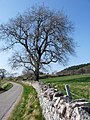 A healthy beech waits for spring heat to burst into life - geograph.org.uk - 2890603.jpg 1,200 × 1,600; 674 KB
-
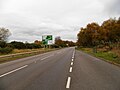
 A road near Tore - geograph.org.uk - 4718669.jpg 1,024 × 575; 231 KB
-
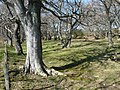 A stand of beech in Coulmore grounds - geograph.org.uk - 2932966.jpg 1,600 × 1,200; 836 KB
-
 A trackway in the woods - geograph.org.uk - 3408173.jpg 1,200 × 900; 631 KB
-
 A832 at Fettes - geograph.org.uk - 6169222.jpg 1,024 × 780; 79 KB
-
 A832 close to Linnie farm - geograph.org.uk - 2611694.jpg 1,280 × 960; 1.73 MB
-
 A832 Eastbound - geograph.org.uk - 5712766.jpg 640 × 427; 425 KB
-
 A832 from Tore to Avoch - geograph.org.uk - 2016076.jpg 800 × 531; 205 KB
-
 A832 from Tore to Avoch - geograph.org.uk - 2016085.jpg 800 × 531; 216 KB
-
 A832 from Tore to Muir of Ord - geograph.org.uk - 2014946.jpg 800 × 531; 163 KB
-
 A832 near Garguston - geograph.org.uk - 5712843.jpg 640 × 480; 381 KB
-
 A832 near Garguston Farm - geograph.org.uk - 2015017.jpg 800 × 531; 148 KB
-
 A832 near Garguston Farm - geograph.org.uk - 5712760.jpg 640 × 427; 310 KB
-
 A832 near Tore - geograph.org.uk - 2016079.jpg 800 × 531; 206 KB
-
 A832 near Tore - geograph.org.uk - 3718510.jpg 1,600 × 1,200; 357 KB
-
 A832 near Tore - geograph.org.uk - 5711754.jpg 640 × 480; 377 KB
-
 A832 south of Teanahuig Wood - geograph.org.uk - 2453538.jpg 2,807 × 1,715; 901 KB
-
 A832 Westbound at Blairdhu - geograph.org.uk - 5712759.jpg 640 × 480; 364 KB
-
 A832 Westbound, Linnie - geograph.org.uk - 5712727.jpg 640 × 427; 428 KB
-
 A832, by Linnie - geograph.org.uk - 6276449.jpg 3,200 × 2,203; 2.63 MB
-
 A832, Garguston - geograph.org.uk - 5712764.jpg 640 × 427; 376 KB
-
 A832, Tore - geograph.org.uk - 4091975.jpg 640 × 480; 73 KB
-
 A835 at Muckernich towards Tore - geograph.org.uk - 6303676.jpg 1,024 × 768; 101 KB
-
 A835 heading west - geograph.org.uk - 4091984.jpg 640 × 480; 70 KB
-
 A835 heading west - geograph.org.uk - 4091996.jpg 640 × 480; 60 KB
-
 A9 approaching Tore - geograph.org.uk - 5711751.jpg 640 × 480; 314 KB
-
 A9 Lay-by 194 - geograph.org.uk - 4691384.jpg 640 × 480; 67 KB
-
 A9 Lay-by 194 - geograph.org.uk - 4691388.jpg 640 × 480; 54 KB
-
 A9 Layby 194 - geograph.org.uk - 5711759.jpg 640 × 480; 349 KB
-
 A9 Layby number 192 - geograph.org.uk - 5711111.jpg 640 × 427; 339 KB
-
 A9 looking north at Torepark - geograph.org.uk - 5434725.jpg 1,800 × 1,013; 1.18 MB
-
 A9 Northbound, near to Artafallie - geograph.org.uk - 5711108.jpg 640 × 427; 308 KB
-
 A9 towards Alness - geograph.org.uk - 4807815.jpg 640 × 426; 58 KB
-
 A9 towards Inverness - geograph.org.uk - 2610757.jpg 1,280 × 960; 1.27 MB
-
 A9 trunk road near Croftnacriech - geograph.org.uk - 2014813.jpg 800 × 531; 150 KB
-
 Abandoned croft house at Drynie Park - geograph.org.uk - 4285912.jpg 800 × 533; 95 KB
-
 Access gate to Kilcoy Castle - geograph.org.uk - 1531748.jpg 640 × 480; 127 KB
-
 Access track to woodland - geograph.org.uk - 3408267.jpg 1,200 × 909; 625 KB
-
 Allangrange Station - geograph.org.uk - 4718646.jpg 1,024 × 575; 201 KB
-
 Approach to Easter and Wester Muckernich - geograph.org.uk - 4267537.jpg 1,400 × 1,050; 772 KB
-
 Approach to Easter Muckernich - geograph.org.uk - 4267564.jpg 1,400 × 1,050; 517 KB
-
 Approaching the A9 from Mains of Tore - geograph.org.uk - 2015979.jpg 800 × 531; 159 KB
-
 Approaching the corner on the old drive to Coulmore - geograph.org.uk - 4265425.jpg 1,400 × 1,050; 583 KB
-
 Avoid distractions whilst driving - geograph.org.uk - 4718680.jpg 1,024 × 575; 227 KB
-
 Balagunloune Service Reservoir - geograph.org.uk - 5221533.jpg 640 × 480; 120 KB
-
 Bare field, by Parkton - geograph.org.uk - 4927895.jpg 2,638 × 2,100; 1.92 MB
-
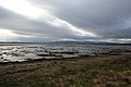
 Beauly Firth - geograph.org.uk - 6086436.jpg 640 × 480; 92 KB
-
 Beauly Firth - geograph.org.uk - 6398340.jpg 1,024 × 683; 169 KB
-
 Beauly Firth - geograph.org.uk - 6412321.jpg 800 × 533; 100 KB
-
 Beauly Firth - low tide near Milton of Redcastle - geograph.org.uk - 4851710.jpg 1,600 × 900; 470 KB
-
 Beauly Firth at dusk - geograph.org.uk - 6351937.jpg 1,600 × 900; 376 KB
-
 Beauly Firth at dusk from Milton of Redcastle - geograph.org.uk - 6351938.jpg 1,600 × 900; 357 KB
-
 Beauly Firth at Redcastle - geograph.org.uk - 6422751.jpg 1,024 × 683; 196 KB
-
 Beauly Firth below Coulmore - geograph.org.uk - 2456389.jpg 3,067 × 2,002; 1.2 MB
-
 Beauly Firth Crannog - geograph.org.uk - 6399357.jpg 1,024 × 683; 153 KB
-
 Beauly Firth from Corgrain Point - geograph.org.uk - 2347398.jpg 3,456 × 2,304; 1.24 MB
-
 Beauly Firth from Shore Road - geograph.org.uk - 2890950.jpg 1,600 × 1,200; 574 KB
-
 Beauly Firth near Spital Shore - geograph.org.uk - 4864691.jpg 1,600 × 1,199; 695 KB
-
 Beauly Firth shoreline - geograph.org.uk - 4752736.jpg 3,072 × 2,304; 1.52 MB
-
 Beauly Firth shoreline, by Lettoch - geograph.org.uk - 4040307.jpg 2,974 × 2,000; 2.16 MB
-
 Beech tree on the Beauly Loop Cycle Route - geograph.org.uk - 4831673.jpg 1,600 × 1,197; 640 KB
-
 Beeches of Blairdhu - geograph.org.uk - 2890955.jpg 1,600 × 1,200; 501 KB
-
 Birch woodland in Monadh Mor - geograph.org.uk - 1285476.jpg 640 × 480; 127 KB
-
 Black Isle December farming landscape - geograph.org.uk - 5235564.jpg 1,600 × 900; 335 KB
-
 Black Isle Light railway - or was... - geograph.org.uk - 2282008.jpg 1,000 × 669; 384 KB
-
 Blairdhu - geograph.org.uk - 201720.jpg 640 × 480; 84 KB
-
 Boat Shed - geograph.org.uk - 1636452.jpg 640 × 447; 93 KB
-
 Boat shed near Coulmore - geograph.org.uk - 2890593.jpg 1,600 × 1,160; 501 KB
-
 Boathouse by Coulmore - geograph.org.uk - 3884426.jpg 1,024 × 614; 145 KB
-
 Boathouse on the Beauly Firth by Coulmore - geograph.org.uk - 4831662.jpg 1,600 × 1,200; 685 KB
-
 Boathouse, Beauly Firth - geograph.org.uk - 6270175.jpg 4,608 × 3,456; 3.55 MB
-
 Bog Forest of Monadh Mòr SSSI - geograph.org.uk - 3612649.jpg 1,200 × 900; 743 KB
-
 Bog woodland habitat of Monadh Mor - geograph.org.uk - 1093694.jpg 640 × 480; 91 KB
-
 Boundary wall of Coulmore - geograph.org.uk - 4265458.jpg 1,400 × 1,050; 573 KB
-
 Bridge on the former Black Isle Railway - geograph.org.uk - 5872809.jpg 1,024 × 640; 187 KB
-
 Bridge on the Redcastle Estate - geograph.org.uk - 4783519.jpg 800 × 600; 201 KB
-

-
 Bridge over the closed Black Isle Railway - geograph.org.uk - 5872513.jpg 1,024 × 768; 408 KB
-
 Bus shelter and farm building - geograph.org.uk - 4091928.jpg 640 × 480; 86 KB
-
 By Allangrange Station - geograph.org.uk - 4718642.jpg 1,024 × 575; 225 KB
-
 Cairn Irenan - geograph.org.uk - 5882610.jpg 640 × 457; 83 KB
-
 Cairns at Kilcoy I - Carn Glas - geograph.org.uk - 3881917.jpg 1,400 × 1,050; 740 KB
-
 Cairns at Kilcoy II - geograph.org.uk - 3881877.jpg 1,400 × 1,049; 689 KB
-
 Cairns at Kilcoy III - geograph.org.uk - 3881890.jpg 1,400 × 1,050; 778 KB
-
 Caravan Park at Coul Point - geograph.org.uk - 3654357.jpg 1,280 × 960; 1.01 MB
-
 Caravan Park at Coul Point - geograph.org.uk - 6112548.jpg 640 × 480; 111 KB
-
 Caravan Park, Coul Point - geograph.org.uk - 3884007.jpg 1,024 × 768; 205 KB
-
 Caravans parked by the Beauly Firth - geograph.org.uk - 4783493.jpg 800 × 600; 96 KB
-
 Carn Glas Chambered Cairn - geograph.org.uk - 5881030.jpg 1,024 × 731; 192 KB
-
 Carn Glas Chambered Cairn - geograph.org.uk - 5881035.jpg 1,024 × 768; 235 KB
-
 Cattle and sheep in the fields of Coulmore - geograph.org.uk - 4087907.jpg 1,400 × 1,050; 460 KB
-
 Cleared area of Muckernich Wood - geograph.org.uk - 5305849.jpg 1,600 × 900; 517 KB
-
 Cleared area of Muckernich Wood - geograph.org.uk - 5306503.jpg 1,600 × 900; 458 KB
-
 Climbing over the Black Isle - geograph.org.uk - 4718695.jpg 1,024 × 575; 175 KB
-

-
 Cnoc na h-Eireachd. - geograph.org.uk - 36081.jpg 640 × 480; 82 KB
-
 Coille Cnoc na h-Eireachd - geograph.org.uk - 1334257.jpg 640 × 480; 148 KB
-
 Coille Cnoc na h-Eireachd - geograph.org.uk - 5221552.jpg 480 × 640; 161 KB
-
 Combine harvester, by Tore - geograph.org.uk - 6277101.jpg 3,029 × 2,000; 3.03 MB
-
 Communal garden, Redcastle - geograph.org.uk - 6131809.jpg 1,600 × 900; 818 KB
-
 Concrete hut, by Redcastle - geograph.org.uk - 4928793.jpg 2,500 × 2,005; 2.09 MB
-
 Concrete hut, Redcastle - geograph.org.uk - 4928916.jpg 2,005 × 2,550; 2.04 MB
-
 Corgrain Point - geograph.org.uk - 3147583.jpg 800 × 600; 104 KB
-
 Corgrain Point Sunset - geograph.org.uk - 6421576.jpg 800 × 534; 146 KB
-
 Corgrain Shoreline - geograph.org.uk - 2347402.jpg 3,456 × 2,304; 1.23 MB
-
 Coulmore Bay - geograph.org.uk - 3559732.jpg 800 × 600; 170 KB
-
 Coulmore Caravan Park - geograph.org.uk - 1442006.jpg 640 × 480; 79 KB
-
 Coulmore House - geograph.org.uk - 171180.jpg 640 × 480; 100 KB
-
 Coulmore House from the North Shore road - geograph.org.uk - 2057082.jpg 1,448 × 972; 450 KB
-
 Council Roads Depot, Kilcoy - geograph.org.uk - 3927375.jpg 1,024 × 768; 156 KB
-
 Craigrory from Coul Point - geograph.org.uk - 1636444.jpg 640 × 480; 82 KB
-
 Craigrory Shoreline - geograph.org.uk - 2347545.jpg 3,456 × 2,304; 1.33 MB
-
 Crannog by Milton of Redcastle - geograph.org.uk - 4851698.jpg 1,600 × 1,200; 279 KB
-
 Croftcrunie Farm, Tore - geograph.org.uk - 5837280.jpg 1,600 × 1,065; 495 KB
-
 Cutting, A835 - geograph.org.uk - 4718712.jpg 1,024 × 575; 333 KB
-
 Cycle path, Muckernich - geograph.org.uk - 4718689.jpg 1,024 × 575; 228 KB
-
 Derelict cottage, Mains of Kilcoy - geograph.org.uk - 3927383.jpg 1,024 × 768; 142 KB
-
 Derelict House - geograph.org.uk - 5734204.jpg 640 × 400; 76 KB
-
 Derelict jetty east of Corgrain Point - geograph.org.uk - 4783459.jpg 800 × 600; 139 KB
-
 Derelict pier at Milton - geograph.org.uk - 4783539.jpg 800 × 599; 108 KB
-
 Disused railway embankment - geograph.org.uk - 2611697.jpg 1,024 × 768; 257 KB
-
 Ditch and bank of sea defence, Spital Shore - geograph.org.uk - 4864684.jpg 1,600 × 1,200; 945 KB
-
 Drive to Tore Mains - geograph.org.uk - 2188252.jpg 1,024 × 768; 272 KB
-
 Driveway to Coulmore - geograph.org.uk - 6160293.jpg 1,024 × 768; 318 KB
-
 Driveway to Coulmore House - geograph.org.uk - 171177.jpg 640 × 480; 113 KB
-
 Dry Stone Wall Teandore - geograph.org.uk - 5227101.jpg 640 × 480; 157 KB
-
 Drynie Park road - geograph.org.uk - 5845757.jpg 1,024 × 768; 257 KB
-
 Eastbound A832 - geograph.org.uk - 5712840.jpg 640 × 480; 415 KB
-
 Edge of Gallowhill Wood - geograph.org.uk - 4265457.jpg 1,400 × 1,050; 681 KB
-
 Edge of the Redcastle Estate - geograph.org.uk - 6351936.jpg 1,600 × 1,066; 819 KB
-
 Electrical Station - geograph.org.uk - 4885533.jpg 480 × 640; 115 KB
-
 Embankment without a railway - geograph.org.uk - 2611701.jpg 1,280 × 960; 1.32 MB
-
 End of a road - geograph.org.uk - 2610738.jpg 1,280 × 960; 1.19 MB
-
 End of the public road at Balgunearie - geograph.org.uk - 2014783.jpg 800 × 531; 215 KB
-
-
 Entrance to Linnie Wood - geograph.org.uk - 6249289.jpg 1,024 × 768; 289 KB
-
 Entrance to recycling yard, by Greenhill - geograph.org.uk - 4584601.jpg 2,850 × 2,098; 2.17 MB
-
 Entrance to Wood End - geograph.org.uk - 3651199.jpg 1,280 × 911; 1.57 MB
-
 Estate bridge over the Redcastle Burn - geograph.org.uk - 6283468.jpg 640 × 480; 148 KB
-
 Estate buildings at Coulmore - geograph.org.uk - 4087919.jpg 1,400 × 1,050; 524 KB
-
 Estate track, Redcastle - geograph.org.uk - 3758358.jpg 1,024 × 768; 344 KB
-
 Estate tree, Redcastle - geograph.org.uk - 6131803.jpg 1,600 × 1,600; 1.04 MB
-
 Estate trees, Redcastle - geograph.org.uk - 6404286.jpg 1,600 × 1,067; 563 KB
-
 Farm buildings at Garguston - geograph.org.uk - 2014978.jpg 800 × 531; 155 KB
-
 Farm buildings at Mains of Tore - geograph.org.uk - 4367161.jpg 800 × 600; 95 KB
-
 Farm road to Lettoch - geograph.org.uk - 2014855.jpg 800 × 531; 149 KB
-
 Farm road to Lettoch - geograph.org.uk - 6160289.jpg 1,024 × 768; 97 KB
-
 Farm south of Tore Park - geograph.org.uk - 2453535.jpg 2,986 × 1,926; 867 KB
-

-
 Farm track to Linnie - geograph.org.uk - 3718366.jpg 1,600 × 1,200; 464 KB
-
 Farmland and Gallowhill Wood - geograph.org.uk - 3739151.jpg 4,608 × 3,456; 4.61 MB
-
 Farmland and woodland - geograph.org.uk - 4091980.jpg 640 × 480; 82 KB
-
 Farmland and woodland - geograph.org.uk - 4091992.jpg 640 × 480; 92 KB
-
 Farmland at Linnie - geograph.org.uk - 4267519.jpg 1,400 × 1,050; 417 KB
-
 Farmland at Redcastle Mains - geograph.org.uk - 4517567.jpg 1,600 × 1,200; 497 KB
-
 Farmland by Cnoc an Torra - geograph.org.uk - 6151725.jpg 1,024 × 768; 177 KB
-
 Farmland by the Beauly Firth - geograph.org.uk - 3739112.jpg 4,608 × 3,456; 4.48 MB
-

-
 Farmland near Coulmore - geograph.org.uk - 2014877.jpg 800 × 531; 236 KB
-
 Farmland near Mains of Tore - geograph.org.uk - 2016012.jpg 800 × 531; 185 KB
-
 Farmland near Tore - geograph.org.uk - 1117649.jpg 640 × 480; 95 KB
-
 Fettes house in winter - geograph.org.uk - 1636505.jpg 640 × 480; 24 KB
-
 Fettes War Memorial - geograph.org.uk - 2282009.jpg 1,000 × 669; 215 KB
-
 Fiddlefield - geograph.org.uk - 5895093.jpg 1,024 × 640; 161 KB
-

-
 Field and house at Ploverfield - geograph.org.uk - 2014771.jpg 800 × 531; 202 KB
-
 Field between Fettes and Kilcoy - geograph.org.uk - 4831681.jpg 1,600 × 1,202; 849 KB
-
 Field by Gallowhill Wood - geograph.org.uk - 3739145.jpg 4,608 × 3,456; 6.23 MB
-
 Field Crofthouse - geograph.org.uk - 5775196.jpg 640 × 400; 93 KB
-
 Field drain at Blairdhu - geograph.org.uk - 6112737.jpg 640 × 480; 115 KB
-
 Field drain Mains of Tore - geograph.org.uk - 5775209.jpg 1,024 × 768; 477 KB
-
 Field near Blairdhu - geograph.org.uk - 2014949.jpg 800 × 531; 174 KB
-
 Field near Corgrain Point - geograph.org.uk - 6160298.jpg 1,024 × 768; 305 KB
-
 Field near Coulmore - geograph.org.uk - 2014866.jpg 800 × 531; 197 KB
-
 Field overlooking the Beauly Firth - geograph.org.uk - 5734182.jpg 640 × 400; 66 KB
-
 Field, Linnie Farm - geograph.org.uk - 3939989.jpg 1,024 × 768; 153 KB
-
 Field, Muckernich - geograph.org.uk - 1334284.jpg 640 × 480; 87 KB
-
 Field, Tore - geograph.org.uk - 4718657.jpg 1,024 × 575; 158 KB
-
 Fields and old railway bridge, by Blairdhu - geograph.org.uk - 3840264.jpg 3,000 × 2,012; 1.72 MB
-
 Fields around Parkton Farm - geograph.org.uk - 1107244.jpg 640 × 480; 92 KB
-
 Fields at Drynie Park - geograph.org.uk - 362222.jpg 640 × 482; 57 KB
-
 Fields at Milton beside the Beauly Firth - geograph.org.uk - 5837753.jpg 1,600 × 1,065; 683 KB
-
 Fields between Garguston and the Beauly Firth - geograph.org.uk - 5207820.jpg 1,600 × 900; 394 KB
-
 Fields near Bogallan - geograph.org.uk - 5842633.jpg 2,592 × 1,944; 1.62 MB
-
 Fields near Drynie Park - geograph.org.uk - 2015310.jpg 800 × 531; 181 KB
-
 Fields near Spital Shore - geograph.org.uk - 2737870.jpg 2,519 × 1,048; 799 KB
-
 Fields, by Drynie Park - geograph.org.uk - 4584497.jpg 2,850 × 1,839; 2.26 MB
-
 Fields, by Mains of Tore - geograph.org.uk - 6277068.jpg 3,000 × 2,256; 3.19 MB
-
 Footpath from a Monadh Mòr viewpoint - geograph.org.uk - 4832150.jpg 1,600 × 1,200; 816 KB
-

-

-
 Foreshore by Redcastle - geograph.org.uk - 2347383.jpg 3,456 × 2,304; 1.07 MB
-
 Forest path in Monadh Mor Forest - geograph.org.uk - 6303689.jpg 1,024 × 768; 284 KB
-
 Forest road into woods near Tore - geograph.org.uk - 2016000.jpg 800 × 531; 260 KB
-
 Forest track near Torepark - geograph.org.uk - 6100985.jpg 1,024 × 768; 157 KB
-
 Forestry access track - geograph.org.uk - 3791496.jpg 1,024 × 768; 168 KB
-
 Forestry Operations - geograph.org.uk - 6002846.jpg 1,024 × 768; 327 KB
-
 Forestry operations at Broomhill - geograph.org.uk - 6414028.jpg 1,024 × 683; 263 KB


&filefrom=Forestry+plantation+-+geograph.org.uk+-+174557.jpg#mw-category-media)