Category:Kincardine, Stirling
Jump to navigation
Jump to search
Scottish parish in Stirling council area | |||||
| Upload media | |||||
| Instance of | |||||
|---|---|---|---|---|---|
| Part of |
| ||||
| Location |
| ||||
| Population |
| ||||
| Area |
| ||||
| Different from | |||||
 | |||||
Subcategories
This category has the following 5 subcategories, out of 5 total.
Media in category "Kincardine, Stirling"
The following 200 files are in this category, out of 282 total.
(previous page) (next page)-
 3 Massey Fergusons - geograph.org.uk - 2787245.jpg 1,024 × 768; 159 KB
-
 A frosty field, Ochtertyre - geograph.org.uk - 5322696.jpg 1,024 × 683; 573 KB
-
 A Land Rover 90 at Myme Farm - geograph.org.uk - 3256294.jpg 1,024 × 768; 180 KB
-
 A thinned woodland - geograph.org.uk - 2851721.jpg 640 × 360; 275 KB
-
 A View Over Flanders Moss NNR - geograph.org.uk - 4013236.jpg 4,592 × 3,448; 2.99 MB
-
 A84 - geograph.org.uk - 2166234.jpg 640 × 426; 56 KB
-

-
 A84 junction from B8075 - geograph.org.uk - 3067182.jpg 640 × 371; 71 KB
-
 A84 looking towards School - geograph.org.uk - 3067190.jpg 640 × 431; 95 KB
-
 A84 roundabout at Drip bridge - geograph.org.uk - 3068067.jpg 640 × 431; 72 KB
-
 A84 west near The Saughs - geograph.org.uk - 3068113.jpg 640 × 500; 104 KB
-
 A84-A873 junction - geograph.org.uk - 6080863.jpg 1,600 × 1,067; 675 KB
-

-
 Agricultural industry in Thornhill - geograph.org.uk - 6036926.jpg 1,600 × 1,067; 323 KB
-
 Approaching the crossroads in Thornhill on the B822 - geograph.org.uk - 4939019.jpg 3,412 × 2,221; 2.87 MB
-
 Approaching woodland strip on B8075 - geograph.org.uk - 3067084.jpg 640 × 420; 53 KB
-
 Arable land Blaidrummond Moss - geograph.org.uk - 1231052.jpg 640 × 480; 53 KB
-
 Arable land, Baad - geograph.org.uk - 2630728.jpg 640 × 360; 254 KB
-
 Arable land, Baad - geograph.org.uk - 2630736.jpg 640 × 360; 229 KB
-
 Arable land, Meldrum - geograph.org.uk - 5756728.jpg 800 × 534; 180 KB
-
 Ash lined road - geograph.org.uk - 5593851.jpg 1,024 × 683; 433 KB
-
 B8031 junction from A873 - geograph.org.uk - 3068207.jpg 640 × 461; 66 KB
-
 B8075, Kirk Lane - geograph.org.uk - 4463196.jpg 1,024 × 650; 164 KB
-
 B822 at Littleward - geograph.org.uk - 6036904.jpg 1,600 × 1,067; 454 KB
-
 B822 road junction for Callander - geograph.org.uk - 3068255.jpg 640 × 434; 60 KB
-
 Baad - geograph.org.uk - 5359248.jpg 1,024 × 576; 243 KB
-
 Baad Cottages - geograph.org.uk - 2635958.jpg 1,024 × 768; 124 KB
-
 Baad lands - geograph.org.uk - 2635955.jpg 1,024 × 768; 72 KB
-
 Bales on Blairdrummond Moss - geograph.org.uk - 5500355.jpg 4,896 × 3,672; 6.53 MB
-
 Bales, ancient and modern - geograph.org.uk - 1998726.jpg 640 × 359; 79 KB
-
 Barley Under Thunder Clouds - geograph.org.uk - 1354060.jpg 640 × 480; 58 KB
-
 Barley, Chalmerston - geograph.org.uk - 1998721.jpg 640 × 359; 74 KB
-
 Be aware of the bull - geograph.org.uk - 5322701.jpg 1,024 × 683; 460 KB
-
 Big field, Blairdrummond Moss - geograph.org.uk - 2851380.jpg 640 × 360; 173 KB
-
 Black Dub and Dripend - geograph.org.uk - 4841038.jpg 3,264 × 2,448; 2.92 MB
-
 Blair Drummond Corner - geograph.org.uk - 5291932.jpg 1,600 × 1,057; 479 KB
-
 Blair Drummond House - geograph.org.uk - 3930733.jpg 640 × 278; 32 KB
-
 Blair Drummond Smiddy Farm Shop - geograph.org.uk - 5291048.jpg 1,600 × 1,067; 413 KB
-
 Blair Drummond, Briarlands Cottage - geograph.org.uk - 2699089.jpg 1,024 × 768; 123 KB
-

-
 Blairdrummond Moss (2) - geograph.org.uk - 2698954.jpg 1,024 × 768; 65 KB
-
 Blairdrummond Moss (3) - geograph.org.uk - 2698967.jpg 1,024 × 768; 75 KB
-
 Blairdrummond Moss (4) - geograph.org.uk - 2698990.jpg 1,024 × 768; 117 KB
-
 Blairdrummond Moss (5) - geograph.org.uk - 2699045.jpg 1,024 × 768; 73 KB
-
 Blairdrummond Moss - geograph.org.uk - 2629334.jpg 640 × 360; 238 KB
-
 Blairdrummond Moss - geograph.org.uk - 2698900.jpg 1,024 × 768; 88 KB
-
 Blairdrummond Moss - geograph.org.uk - 2851382.jpg 640 × 371; 191 KB
-
 Blairdrummond Moss - geograph.org.uk - 5673279.jpg 1,024 × 683; 305 KB
-
 Blairdrummond Moss farmland - geograph.org.uk - 4463194.jpg 1,024 × 682; 152 KB
-
 Blairdrummond Moss, North Kirk Lane (2) - geograph.org.uk - 2698961.jpg 1,024 × 768; 155 KB
-
 Blairdrummond Moss, North Kirk Lane - geograph.org.uk - 2698930.jpg 1,024 × 768; 72 KB
-
 Blairdrummond Moss, North Kirk Lane Farm - geograph.org.uk - 2698984.jpg 1,024 × 768; 86 KB
-
 Blairdrummond Moss, Rossburn Lane - geograph.org.uk - 2699004.jpg 1,024 × 768; 211 KB
-
 Blairdrummond Moss, Sommer's Lane - geograph.org.uk - 2699027.jpg 1,024 × 768; 154 KB
-
 Blairdrummond Moss, Tigh Beag Farm - geograph.org.uk - 2699042.jpg 1,024 × 768; 141 KB
-
 Blairdrummond Safari Park - geograph.org.uk - 1246944.jpg 640 × 482; 72 KB
-
 Blairdrummond, Cuthill Brae - geograph.org.uk - 2698823.jpg 1,024 × 768; 197 KB
-
 Blairdrummond, drain - geograph.org.uk - 2699086.jpg 1,024 × 768; 255 KB
-
 Blairdrummond, Lime Avenue (2) - geograph.org.uk - 2699056.jpg 1,024 × 768; 226 KB
-
 Blairdrummond, Lime Avenue - geograph.org.uk - 2699051.jpg 1,024 × 768; 155 KB
-
 Blairdrummond, Park House - geograph.org.uk - 2698863.jpg 1,024 × 768; 218 KB
-
 Blairdrummond, pillar box - geograph.org.uk - 2698876.jpg 1,024 × 1,365; 236 KB
-
 Blooming oilseed rape at Cambusdrennie - geograph.org.uk - 4463146.jpg 1,024 × 702; 209 KB
-
 Boat Safari, Blair Drummond - geograph.org.uk - 1011328.jpg 640 × 486; 102 KB
-
 Bog Birch - geograph.org.uk - 5322595.jpg 1,188 × 1,600; 475 KB
-
 Boreland Hill (2) - geograph.org.uk - 2698849.jpg 1,024 × 768; 126 KB
-
 Boreland Hill - geograph.org.uk - 2698774.jpg 1,024 × 768; 108 KB
-
 Boreland Hill - geograph.org.uk - 2905473.jpg 640 × 360; 227 KB
-
 Boreland Hill, copse of trees - geograph.org.uk - 2698818.jpg 1,024 × 768; 172 KB
-
 Briarlands Farm - geograph.org.uk - 2615498.jpg 640 × 360; 194 KB
-
 Briarlands, Lime Avenue - geograph.org.uk - 2699091.jpg 1,024 × 768; 203 KB
-
 Burnbank Burn - geograph.org.uk - 2851710.jpg 640 × 360; 207 KB
-
 Carousel, Blairdrummond Safari Park - geograph.org.uk - 1246995.jpg 640 × 426; 99 KB
-
 Carrat, track to the Teith - geograph.org.uk - 2699095.jpg 1,024 × 768; 130 KB
-
 Carrat, turf fields - geograph.org.uk - 2699094.jpg 1,024 × 768; 97 KB
-
 Carse land - geograph.org.uk - 2905469.jpg 640 × 360; 169 KB
-
 Carse land and round bales - geograph.org.uk - 2629537.jpg 640 × 360; 250 KB
-
 Carse land near Thornhill - geograph.org.uk - 2557774.jpg 640 × 359; 81 KB
-
 Carse land seen from Chalmerston Road - geograph.org.uk - 5359249.jpg 1,024 × 576; 297 KB
-
 Carse land, Drip - geograph.org.uk - 2825681.jpg 640 × 360; 243 KB
-
 Carse land, Frew - geograph.org.uk - 2872213.jpg 640 × 360; 203 KB
-
 Carse near Bridge of Goodie - geograph.org.uk - 2905461.jpg 640 × 360; 182 KB
-
 Cattle, Robertson Lane - geograph.org.uk - 1998732.jpg 640 × 359; 73 KB
-
 Chalmerston Road - geograph.org.uk - 5500282.jpg 800 × 600; 196 KB
-
 Chalmerston Road across Drip Moss - geograph.org.uk - 4463141.jpg 1,024 × 677; 137 KB
-
 Chalmerston Road round Drip Moss - geograph.org.uk - 4463165.jpg 1,024 × 670; 122 KB
-
 Church of Kincardine in Menteith - geograph.org.uk - 954796.jpg 640 × 558; 84 KB
-
 Church of Kincardine in Menteith - geograph.org.uk - 954797.jpg 640 × 455; 70 KB
-

-
 Clover, Thornhill - geograph.org.uk - 2624233.jpg 640 × 360; 278 KB
-
 Common Lizard (Zootoca vivipara) At Flanders Moss - geograph.org.uk - 4013301.jpg 2,497 × 3,265; 1.77 MB
-

-
 Country road - geograph.org.uk - 4257245.jpg 640 × 480; 96 KB
-

-
 Crops at Cowden - geograph.org.uk - 4463127.jpg 800 × 522; 124 KB
-
 Crossroads, Thornhill - geograph.org.uk - 4939044.jpg 3,504 × 2,336; 3.48 MB
-
 Crown Hotel, Thornhill - geograph.org.uk - 2624239.jpg 640 × 360; 198 KB
-
 Decision point at the V-junction - geograph.org.uk - 3068839.jpg 999 × 674; 212 KB
-
 Development site - geograph.org.uk - 4257250.jpg 640 × 480; 108 KB
-
 Ditch - geograph.org.uk - 5282202.jpg 800 × 600; 181 KB
-
 Ditch and fields - geograph.org.uk - 5311228.jpg 600 × 800; 189 KB
-
 Drain at Easter Poldar - geograph.org.uk - 6036908.jpg 1,600 × 1,067; 471 KB
-
 Drainage culvert on the B8075, Kirk Lane - geograph.org.uk - 4463200.jpg 1,024 × 682; 233 KB
-
 Drainage ditch - geograph.org.uk - 5291068.jpg 1,600 × 1,067; 569 KB
-
 Drainage Plough - geograph.org.uk - 1398037.jpg 640 × 480; 64 KB
-
 Drinking trough, Chapel of Boquhapple - geograph.org.uk - 5593838.jpg 1,024 × 683; 545 KB
-
 Drip Moss - geograph.org.uk - 2630713.jpg 640 × 360; 223 KB
-
 Drip Moss - geograph.org.uk - 2630720.jpg 640 × 360; 237 KB
-
 Drip Moss - geograph.org.uk - 2636378.jpg 1,024 × 768; 63 KB
-
 Drip Moss - geograph.org.uk - 2825696.jpg 640 × 360; 194 KB
-
 Drip Moss, Cambusdrennie - geograph.org.uk - 5359253.jpg 1,024 × 576; 315 KB
-
 Drip Moss, Cambusdrennie - geograph.org.uk - 5359262.jpg 1,024 × 576; 241 KB
-
 Drip Moss, Chalmerston - geograph.org.uk - 5359276.jpg 1,024 × 576; 282 KB
-
 Drip Moss, Chalmerston Road (2) - geograph.org.uk - 2636389.jpg 1,024 × 768; 177 KB
-
 Drip Moss, Chalmerston Road - geograph.org.uk - 2635951.jpg 1,024 × 768; 100 KB
-
 Drip Moss, Cowden - geograph.org.uk - 2635949.jpg 1,024 × 768; 122 KB
-
 Drip Moss, road to Baad - geograph.org.uk - 2636393.jpg 1,024 × 768; 125 KB
-

-
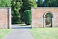 Entrance through the wall - geograph.org.uk - 2143290.jpg 3,872 × 2,592; 4.62 MB
-
 Entrance to Blair Drummond Sawmill - geograph.org.uk - 5291900.jpg 1,600 × 1,054; 351 KB
-
 Farm house at West Moss- side - geograph.org.uk - 1591590.jpg 640 × 480; 93 KB
-
 Farm track, Ochtertyre - geograph.org.uk - 5928238.jpg 1,024 × 683; 368 KB
-
 Farmland beside the Forth - geograph.org.uk - 2629547.jpg 640 × 360; 241 KB
-
 Farmland, Flanders Moss - geograph.org.uk - 2557783.jpg 640 × 359; 63 KB
-
 Farmland, Flanders Moss - geograph.org.uk - 5932129.jpg 1,024 × 683; 404 KB
-

-
 Field beside Flanders Moss National Nature Reserve - geograph.org.uk - 6126734.jpg 1,600 × 1,141; 472 KB
-
 Field by Glenericht Cottages - geograph.org.uk - 2615490.jpg 640 × 360; 232 KB
-
 Field entrance - geograph.org.uk - 5500288.jpg 800 × 600; 183 KB
-
 Fields and fence - geograph.org.uk - 5311230.jpg 800 × 600; 170 KB
-
 Fields at the edge of Thornhill - geograph.org.uk - 6036923.jpg 1,600 × 999; 468 KB
-
 Fields by the River Forth - geograph.org.uk - 5701964.jpg 1,024 × 682; 83 KB
-
 Filling station on the A84 south of Doune - geograph.org.uk - 5241007.jpg 1,024 × 682; 77 KB
-
 Flanders Moss - geograph.org.uk - 2933209.jpg 2,048 × 1,536; 885 KB
-
 Flanders Moss - geograph.org.uk - 2933221.jpg 2,048 × 1,536; 1.01 MB
-
 Flanders Moss Floods - geograph.org.uk - 5322592.jpg 1,600 × 1,201; 373 KB
-
 Flanders Moss National Nature Reserve - geograph.org.uk - 6125624.jpg 1,600 × 994; 373 KB
-
 Flanders Moss National Nature Reserve - geograph.org.uk - 6125632.jpg 1,600 × 937; 347 KB
-
 Flanders Moss National Nature Reserve - geograph.org.uk - 6125645.jpg 1,600 × 984; 435 KB
-
 Flanders Moss National Nature Reserve - geograph.org.uk - 6125654.jpg 1,600 × 1,013; 396 KB
-
 Flanders Moss seen from Thornhill - geograph.org.uk - 2557769.jpg 640 × 480; 107 KB
-
 Flanders Moss, More Than Moss^ - geograph.org.uk - 4013262.jpg 4,592 × 3,448; 3.69 MB
-
 Flat farmland - geograph.org.uk - 2933270.jpg 2,048 × 1,536; 1.52 MB
-
 Flat farmland, Myme Farm - geograph.org.uk - 2557792.jpg 640 × 359; 71 KB
-
 Flat field of stubble - geograph.org.uk - 2697843.jpg 1,024 × 768; 110 KB
-
 Flat land, Frew - geograph.org.uk - 2557797.jpg 640 × 359; 64 KB
-
 Flat lands, Flanders Moss - geograph.org.uk - 5593849.jpg 1,024 × 683; 366 KB
-
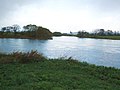 Forth and Teith confluence (2) - geograph.org.uk - 2652393.jpg 1,024 × 768; 119 KB
-
 Forth and Teith confluence (3) - geograph.org.uk - 2652407.jpg 1,024 × 768; 96 KB
-
 Forth and Teith confluence - geograph.org.uk - 2652244.jpg 1,024 × 768; 98 KB
-
 Forth flood plain - geograph.org.uk - 5359258.jpg 1,024 × 576; 272 KB
-
 Frosty field, Briarlands - geograph.org.uk - 5325677.jpg 1,024 × 683; 285 KB
-
 Goodie Water - Downstream View - geograph.org.uk - 1636441.jpg 640 × 480; 102 KB
-
 Goodie Water - geograph.org.uk - 1591602.jpg 640 × 480; 96 KB
-
 Goodie Water - geograph.org.uk - 4591284.jpg 1,189 × 1,600; 526 KB
-
 Goodie Water from Netherton Bridge - geograph.org.uk - 6036917.jpg 1,600 × 1,067; 403 KB
-
 Goodie Water from Netherton Bridge - geograph.org.uk - 6036920.jpg 1,329 × 1,600; 393 KB
-
 Grassland off Rossburn Lane - geograph.org.uk - 1998735.jpg 640 × 359; 73 KB
-
 Ground working, Flanders Moss - geograph.org.uk - 5931324.jpg 1,024 × 683; 363 KB
-
 Hawthorn hedge and arable land at Chalmerston - geograph.org.uk - 4463177.jpg 1,024 × 669; 160 KB
-
 Helicopter at Mains Farm Wigwams - geograph.org.uk - 4937815.jpg 3,504 × 2,336; 3.37 MB
-
 Hill of Drip - geograph.org.uk - 2630759.jpg 640 × 360; 197 KB
-
 Huge Snowman Alert^ - geograph.org.uk - 1636482.jpg 480 × 640; 39 KB
-
 Impressive gates - geograph.org.uk - 2932961.jpg 2,048 × 1,536; 1.55 MB
-
 Junction of Kirk Lane and A84 - geograph.org.uk - 4432117.jpg 3,504 × 2,336; 4 MB
-
 Junction on A84 near Blair Drummond - geograph.org.uk - 5704091.jpg 1,024 × 683; 131 KB
-
 Kilgours House - geograph.org.uk - 2698918.jpg 1,024 × 768; 91 KB
-
 Kincardine in Menteith, Culthill Brae (2) - geograph.org.uk - 2698807.jpg 1,024 × 768; 153 KB
-
 Kincardine in Menteith, Culthill Brae - geograph.org.uk - 2698803.jpg 1,024 × 768; 211 KB
-
 Kincardine in Menteith, ploughed fields - geograph.org.uk - 2698815.jpg 1,024 × 768; 141 KB
-
 Kincardine in Menteith, the A873 - geograph.org.uk - 2698923.jpg 1,024 × 768; 100 KB
-
 Kincardine in Mentieth Church of Scotland - geograph.org.uk - 5061193.jpg 3,710 × 2,782; 4.33 MB
-
 Kippen Road (B822), Thornhill - geograph.org.uk - 4939079.jpg 3,504 × 2,336; 3.47 MB
-
 Kirk Lane - geograph.org.uk - 2856230.jpg 640 × 360; 195 KB
-
 Lade, Mill of Torr - geograph.org.uk - 5698308.jpg 1,024 × 683; 478 KB
-
 Lime Avenue - geograph.org.uk - 2615505.jpg 640 × 360; 256 KB
-
 Lime Avenue - geograph.org.uk - 5322705.jpg 1,024 × 683; 606 KB
-
 Lime Avenue - geograph.org.uk - 5325682.jpg 1,024 × 683; 572 KB
-
 Lime Avenue - geograph.org.uk - 5325684.jpg 1,024 × 683; 624 KB
-
 Lime Avenue, Mill of Torr gate - geograph.org.uk - 2699090.jpg 1,024 × 768; 226 KB
-
 Lime Avenue, near Ochretyre - geograph.org.uk - 2699092.jpg 1,024 × 768; 166 KB
-
 Lion and Unicorn Hotel, Thornhill - geograph.org.uk - 5241250.jpg 1,024 × 803; 129 KB
-
 Lion reserve, Blair Drummond Safari Park - geograph.org.uk - 4406874.jpg 4,608 × 3,456; 6.04 MB
-
 Littleward - geograph.org.uk - 4013287.jpg 4,592 × 3,448; 3.94 MB
-
 Littleward Farm - geograph.org.uk - 1591536.jpg 640 × 480; 62 KB
-
 Littleward farm - geograph.org.uk - 2933255.jpg 2,048 × 1,536; 672 KB
-
 Loch at Blair Drummond Safari Park - geograph.org.uk - 2954786.jpg 640 × 480; 78 KB
-
 Loch, Blair Drummond Safari Park - geograph.org.uk - 4406855.jpg 4,608 × 3,456; 3.9 MB
-
 Lodge Blairhoyle Thornhill - geograph.org.uk - 1591565.jpg 640 × 480; 56 KB
-
 Main Street, Thornhill (Perthshire) - geograph.org.uk - 2624241.jpg 640 × 360; 211 KB
-
 Main Street, Thornhill - geograph.org.uk - 4939028.jpg 3,495 × 2,218; 2.81 MB
-
 Mains Farm Wigwams - geograph.org.uk - 4937808.jpg 3,504 × 2,336; 3.01 MB
-
 Mains of Burnbank - geograph.org.uk - 2851727.jpg 640 × 360; 235 KB
-
 Manse at Burnbank Wood - geograph.org.uk - 6080866.jpg 1,600 × 1,067; 476 KB
-
 Mill Lade - geograph.org.uk - 5698315.jpg 1,024 × 683; 546 KB
-
 Moss-side of Boquhapple - geograph.org.uk - 6036912.jpg 1,600 × 1,067; 261 KB
-
 Myme - geograph.org.uk - 2557779.jpg 640 × 359; 63 KB
-
 Myme Farm - geograph.org.uk - 1591527.jpg 640 × 480; 59 KB
-
 Nailer's Lane - geograph.org.uk - 5311223.jpg 800 × 600; 185 KB
-
 Nailer's Lane - geograph.org.uk - 5311226.jpg 800 × 600; 171 KB


_-_geograph.org.uk_-_2698954.jpg)
_-_geograph.org.uk_-_2698967.jpg)
_-_geograph.org.uk_-_2698990.jpg)
_-_geograph.org.uk_-_2699045.jpg)


_-_geograph.org.uk_-_2698961.jpg)


_-_geograph.org.uk_-_2699056.jpg)


_-_geograph.org.uk_-_2698849.jpg)


_At_Flanders_Moss_-_geograph.org.uk_-_4013301.jpg)
,_Blairdrummond_Safari_Park_-_geograph.org.uk_-_1246989.jpg)


_-_geograph.org.uk_-_2636389.jpg)


_-_geograph.org.uk_-_2652393.jpg)
_-_geograph.org.uk_-_2652407.jpg)


_-_geograph.org.uk_-_2698807.jpg)


,_Thornhill_-_geograph.org.uk_-_4939079.jpg)


_-_geograph.org.uk_-_2624241.jpg)


