Category:Kinder Scout
Jump to navigation
Jump to search
hill in Derbyshire, England, UK _-_geograph.org.uk_-_80943.jpg) | |||||
| Upload media | |||||
| Instance of | |||||
|---|---|---|---|---|---|
| Made from material | |||||
| Located in protected area |
| ||||
| Location | Derbyshire, East Midlands, England | ||||
| Mountain range | |||||
| Topographic prominence |
| ||||
| Elevation above sea level |
| ||||
| Parent peak | |||||
 | |||||
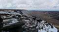
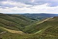
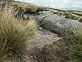
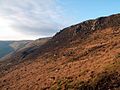
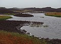
English: Kinder Scout is a moorland plateau (and mountain) in the Dark Peak of the Derbyshire Peak District in the United Kingdom. Part of the moor, at 636 m (2,088 ft) above sea level, is the highest point in the Peak District and the highest point in Derbyshire. It is accessible from the villages of Hayfield and Edale in the High Peak of Derbyshire.
Subcategories
This category has the following 14 subcategories, out of 14 total.
B
C
- Crowden Brook (24 F)
E
- Edale Cross (34 F)
F
- Fairbrook (10 F)
G
- Grindsbrook (112 F)
J
K
- Kinder Downfall (81 F)
- Kinder Low, Derbyshire (57 F)
- Kinder Reservoir (93 F)
M
- Madwoman's Stones (7 F)
R
S
- South Head, High Peak (38 F)
W
- William Clough (41 F)
Media in category "Kinder Scout"
The following 200 files are in this category, out of 318 total.
(previous page) (next page)-
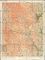 Ordnance Survey One-Inch Tourist Map of the Peak District, Published 1924.jpg 12,011 × 15,987; 89.55 MB
-
 A cairn on Kinder River - geograph.org.uk - 712807.jpg 640 × 480; 92 KB
-
 A cold morning above Kinder Reservoir - geograph.org.uk - 2177920.jpg 3,872 × 2,592; 1.79 MB
-
 A distant Kinder Scout - geograph.org.uk - 1063678.jpg 640 × 439; 78 KB
-

-
 A tributary of Red Brook - geograph.org.uk - 1713570.jpg 2,272 × 1,712; 943 KB
-
 Above Kinder Downfall - geograph.org.uk - 2128272.jpg 768 × 1,024; 303 KB
-

-
 Approaching the Kinder Gates - geograph.org.uk - 2525924.jpg 427 × 640; 251 KB
-
 Ashop Clough - geograph.org.uk - 155854.jpg 640 × 480; 83 KB
-
 Ashop Head in snow - geograph.org.uk - 1759686.jpg 1,600 × 1,067; 227 KB
-
 At Small Clough, Vale of Edale - geograph.org.uk - 3493053.jpg 3,646 × 2,604; 2.06 MB
-
 Blackden Brook looking to Blackden Rind - geograph.org.uk - 632801.jpg 640 × 480; 108 KB
-
 Blackden Moor - geograph.org.uk - 67442.jpg 640 × 441; 60 KB
-
 Blackden Moor looking to Cowberry Tor - geograph.org.uk - 633198.jpg 640 × 480; 73 KB
-
 Blackden Moor looking to Seal Stones - geograph.org.uk - 637626.jpg 640 × 480; 87 KB
-
 Blackley Hey - geograph.org.uk - 67434.jpg 640 × 480; 60 KB
-
 Bleaklow6354.JPG 2,048 × 1,536; 793 KB
-
 Boulder Near Sandy Heys - geograph.org.uk - 1814696.jpg 640 × 480; 259 KB
-
 Boulder, near Sandy Heys - geograph.org.uk - 2525611.jpg 640 × 427; 239 KB
-
 Bridleway below Kinder End - geograph.org.uk - 988277.jpg 640 × 426; 116 KB
-
 Bridleway to Oaken Clough - geograph.org.uk - 2063328.jpg 2,048 × 1,536; 1.26 MB
-
 Bridleway to Phoside - geograph.org.uk - 1066201.jpg 640 × 480; 90 KB
-
 Broad Clough - geograph.org.uk - 1194149.jpg 481 × 640; 107 KB
-
 Broad Clough looking to Kinder Low - geograph.org.uk - 711603.jpg 640 × 480; 104 KB
-

-
 Brown Knoll from Kinder - geograph.org.uk - 2383.jpg 512 × 292; 32 KB
-
 Burnt Hill - geograph.org.uk - 107471.jpg 640 × 397; 104 KB
-
 Cairn at North West End of Kinder Scout - geograph.org.uk - 2801002.jpg 4,000 × 3,000; 4.76 MB
-

-
 Cairn on Kinder Scout - geograph.org.uk - 1473701.jpg 640 × 480; 107 KB
-
 Cairn on summit plateau, Kinder Scout - geograph.org.uk - 989543.jpg 640 × 426; 104 KB
-
 Cairn on the Pennine Way - geograph.org.uk - 991623.jpg 640 × 426; 114 KB
-
 Cheshire hills - geograph.org.uk - 5674609.jpg 20,000 × 2,358; 7.3 MB
-

-
-
-

-
-
-

-

-

-

-

-

-

-
 Crossing the plateau - geograph.org.uk - 1714705.jpg 2,272 × 1,712; 808 KB
-
 Crowden Clough, Kinder Plateau - geograph.org.uk - 2376.jpg 512 × 384; 40 KB
-
 Crowden Head - geograph.org.uk - 80987.jpg 640 × 480; 165 KB
-
 Crowden Tower - geograph.org.uk - 379960.jpg 640 × 480; 55 KB
-
 Dean Hill from Blackden Edge - geograph.org.uk - 218064.jpg 640 × 480; 153 KB
-
 Descending from the Kinder Plateau - geograph.org.uk - 991639.jpg 426 × 640; 104 KB
-
 Descending from the Kinder Plateau - geograph.org.uk - 991669.jpg 640 × 426; 104 KB
-
 Dinting6219.JPG 2,048 × 1,536; 760 KB
-
 Dried Up Stream Bed, Kinder Scout - geograph.org.uk - 2365039.jpg 427 × 640; 275 KB
-
 East from Lantern Pike - geograph.org.uk - 221604.jpg 640 × 480; 262 KB
-
 Edale 359390151 9566151a98 o.jpg 500 × 335; 35 KB
-
 Edale rock. - geograph.org.uk - 2411554.jpg 480 × 640; 53 KB
-
 Edale Rocks - geograph.org.uk - 2351970.jpg 640 × 479; 339 KB
-
 Edale Rocks - geograph.org.uk - 3016788.jpg 640 × 480; 65 KB
-
 Edale Rocks near Kinder Low - geograph.org.uk - 616486.jpg 640 × 480; 112 KB
-
 Edale, UK - panoramio (10).jpg 3,888 × 2,592; 1.93 MB
-
 Edale, UK - panoramio (11).jpg 3,888 × 2,592; 1.83 MB
-
 Edale, UK - panoramio (13).jpg 3,888 × 2,592; 1.95 MB
-
 Edale, UK - panoramio (14).jpg 3,888 × 2,592; 1.33 MB
-
 Edale, UK - panoramio (15).jpg 3,888 × 2,592; 934 KB
-
 Edale, UK - panoramio (2).jpg 3,888 × 2,592; 1.53 MB
-
 Edale, UK - panoramio (3).jpg 3,888 × 2,592; 1.23 MB
-
 Edale, UK - panoramio (4).jpg 3,576 × 2,016; 1.97 MB
-
 Edale, UK - panoramio (6).jpg 3,888 × 2,592; 1.26 MB
-
 Edge of the Kinder plateau - geograph.org.uk - 267634.jpg 640 × 480; 65 KB
-
 Edge on Kinder Scout - geograph.org.uk - 2128310.jpg 768 × 1,024; 280 KB
-
 Eroded rocky feature on Kinder Scout - geograph.org.uk - 308013.jpg 640 × 480; 87 KB
-
 Erosion control, Kinder Scout - geograph.org.uk - 211323.jpg 640 × 480; 147 KB
-
 Exposed Peat on Kinder Scout - geograph.org.uk - 2525907.jpg 640 × 427; 258 KB
-
 Flagged path above William Clough - geograph.org.uk - 991866.jpg 640 × 426; 112 KB
-
 Footbridge over the River Kinder - geograph.org.uk - 2767809.jpg 4,000 × 3,000; 2.34 MB
-
 Footpath at Edale Head - geograph.org.uk - 2511531.jpg 768 × 1,024; 147 KB
-
 Footpath works towards Grindslow Knoll - geograph.org.uk - 3102764.jpg 1,024 × 768; 168 KB
-
 From the corner looking back - geograph.org.uk - 3306596.jpg 3,456 × 2,304; 2.4 MB
-

-
 Frozen pond on Mill Hill - geograph.org.uk - 2178115.jpg 3,872 × 2,592; 5.03 MB
-
-
 Grass amongst the peat haggs - geograph.org.uk - 712778.jpg 640 × 480; 101 KB
-
 Grindsbrook.jpg 2,448 × 1,632; 1.49 MB
-
 Grindslow Knoll, Peak District - geograph.org.uk - 2368.jpg 512 × 343; 38 KB
-

-
 Gritstone,hags and groughs - geograph.org.uk - 1442130.jpg 640 × 480; 67 KB
-
 Grouse butt, Crookstone Knoll - geograph.org.uk - 218068.jpg 640 × 480; 129 KB
-
 Hayfield, UK - panoramio (1).jpg 3,888 × 2,592; 2.01 MB
-
 Hayfield, UK - panoramio.jpg 3,888 × 2,592; 2.15 MB
-
 Helicopter over Kinder - geograph.org.uk - 2767822.jpg 4,000 × 3,000; 2.52 MB
-
 Hillside of The Knott towards Kinder - geograph.org.uk - 995203.jpg 640 × 480; 156 KB
-
 Hollingworth Clough and Burnt Hill - geograph.org.uk - 80939.jpg 640 × 480; 126 KB
-
 Hope Brink - geograph.org.uk - 769059.jpg 640 × 480; 61 KB
-
 Jacobs ladder da1.JPG 614 × 461; 56 KB
-
 Kinder Coldwell Clough 0104.JPG 2,592 × 1,944; 1.19 MB
-
 Kinder Coldwell Clough 0105.JPG 2,592 × 1,944; 1.23 MB
-
 Kinder Coldwell Clough 0106.JPG 2,592 × 1,944; 1.22 MB
-
 Kinder Coldwell Clough Tree 0102.JPG 2,592 × 1,944; 1.22 MB
-
 Kinder Coldwell Clough Tree 0103.JPG 1,944 × 2,592; 1.13 MB
-
 Kinder from Crookstone Knoll - geograph.org.uk - 218067.jpg 640 × 480; 132 KB
-
 Kinder Gates - geograph.org.uk - 1123760.jpg 640 × 480; 108 KB
-
 Kinder Gates - geograph.org.uk - 1830893.jpg 640 × 428; 47 KB
-
 Kinder Gates - geograph.org.uk - 2083524.jpg 640 × 480; 68 KB
-
 Kinder Gates - geograph.org.uk - 2177939.jpg 3,872 × 2,592; 1.84 MB
-
 Kinder Gates - geograph.org.uk - 80997.jpg 640 × 480; 132 KB
-
 Kinder Oaken Clough 0110.JPG 1,944 × 2,592; 1.14 MB
-
 Kinder Oaken Clough0108.JPG 2,592 × 1,944; 1.34 MB
-
 Kinder Oaken Clough0109.JPG 2,592 × 1,944; 1.23 MB
-
 Kinder pan res.jpg 720 × 104; 25 KB
-
 Kinder Plateau hags and groughs da1.jpg 614 × 461; 32 KB
-
 Kinder plateau in mist - geograph.org.uk - 1749956.jpg 2,272 × 1,712; 551 KB
-
 Kinder plateau snow.JPG 3,840 × 2,160; 3.8 MB
-
 Kinder plateau.jpg 2,469 × 3,306; 5.64 MB
-
 Kinder River above Kinder Downfall - geograph.org.uk - 4047215.jpg 4,000 × 2,248; 5.88 MB
-
 Kinder Scout & Kinder Reservoir.jpg 4,624 × 3,472; 3.96 MB
-
 Kinder Scout (northwestern end) - geograph.org.uk - 80943.jpg 640 × 480; 138 KB
-
 Kinder Scout - geograph.org.uk - 178552.jpg 640 × 480; 85 KB
-
 Kinder Scout - geograph.org.uk - 2788106.jpg 3,648 × 2,736; 4.54 MB
-
 Kinder Scout - geograph.org.uk - 2970149.jpg 3,648 × 2,736; 3.76 MB
-
 Kinder Scout - geograph.org.uk - 3494874.jpg 3,480 × 3,268; 2.63 MB
-
 Kinder Scout - geograph.org.uk - 3786037.jpg 4,608 × 3,456; 3.16 MB
-
 Kinder Scout - geograph.org.uk - 434303.jpg 640 × 480; 81 KB
-
 Kinder Scout - geograph.org.uk - 4446904.jpg 4,608 × 3,456; 3.69 MB
-
 Kinder Scout and Little Hayfield from Lantern Pike - geograph.org.uk - 1734045.jpg 3,872 × 2,592; 3.26 MB
-
 Kinder Scout in extreme mist.jpg 2,048 × 1,536; 994 KB
-
 Kinder Scout Plateau.jpg 1,000 × 562; 147 KB
-
 Kinder Scout Rock Formation with a Secret Santa? - geograph.org.uk - 3786065.jpg 4,608 × 3,456; 3.05 MB
-
 Kinder Scout summer showers - geograph.org.uk - 3094689.jpg 3,648 × 2,736; 2.03 MB
-
 Kinder Scout Trig. Point - geograph.org.uk - 2525904.jpg 640 × 427; 235 KB
-
 Kinder Scout, High Peak, United Kingdom (Unsplash).jpg 4,000 × 2,670; 5.98 MB
-
 Kinder Scout, the northern edge - geograph.org.uk - 80958.jpg 640 × 480; 129 KB
-
 Kinder scout.jpg 3,504 × 2,336; 6.58 MB
-
 Kinder Stoney Ford 0111.JPG 2,592 × 1,944; 1.2 MB
-
 KinderCrowden4759.JPG 2,016 × 1,512; 904 KB
-
 KinderCrowden4762.JPG 2,016 × 1,512; 736 KB
-
 KinderEdaleRocks6448.JPG 2,048 × 1,536; 745 KB
-
 KinderEdaleRocks6450.JPG 2,048 × 1,536; 794 KB
-
 KinderEstate 0135.JPG 1,944 × 2,592; 1.15 MB
-
 KinderGates6422.JPG 2,048 × 1,536; 813 KB
-
 KinderGates6423.JPG 2,048 × 1,536; 783 KB
-
 KinderGates6424.JPG 2,048 × 1,536; 804 KB
-
 KinderGates6425.JPG 2,048 × 1,536; 790 KB
-
 KinderGates6426.JPG 2,048 × 1,536; 782 KB
-
 KinderJacobsLadder6455.JPG 2,048 × 1,536; 792 KB
-
 KinderJacobsLadder6456.JPG 2,048 × 1,536; 765 KB
-
 KinderJacobsLadder6457.JPG 2,048 × 1,536; 761 KB
-
 KinderJacobsLadder6458.JPG 2,048 × 1,536; 753 KB
-
 KinderJacobsLadder6459.JPG 2,048 × 1,536; 740 KB
-
 KinderJacobsLadder6460.JPG 2,048 × 1,536; 742 KB
-
 KinderJacobsLadder6461.JPG 2,048 × 1,536; 741 KB
-
 KinderJacobsLadder6464.JPG 2,048 × 1,536; 745 KB
-
 KinderJacobsLadder6466.JPG 2,048 × 1,536; 750 KB
-
 KinderReservoir.JPG 2,048 × 1,536; 646 KB
-
 KinderScoutPlateau.jpg 1,600 × 1,200; 171 KB
-
 Lantern Pike view to Kinder Scout - geograph.org.uk - 2543111.jpg 4,000 × 3,000; 4 MB
-
 Leygatehead Moor - geograph.org.uk - 2178148.jpg 3,872 × 2,592; 5.2 MB
-
 Leygatehead Moor - geograph.org.uk - 80934.jpg 640 × 480; 147 KB
-
 Life's a beach on Kinder Scout - geograph.org.uk - 3118730.jpg 4,608 × 3,072; 3.13 MB
-
 Look Out, near Kinder Downfall - geograph.org.uk - 211361.jpg 640 × 480; 85 KB
-
 Looking down on Upper House - geograph.org.uk - 90543.jpg 640 × 480; 166 KB
-
-
 Looking west from Upper Red Brook - geograph.org.uk - 80964.jpg 640 × 480; 145 KB
-
 Lynettewilloughby cropped.jpg 173 × 344; 21 KB
-
 Lynettewilloughby.jpg 453 × 604; 52 KB
-
 Mass Trespass Plaque, Bowden Quarry - geograph.org.uk - 50842.jpg 2,048 × 1,536; 721 KB
-
 Middle Moor and Sandy Heys - geograph.org.uk - 43602.jpg 640 × 480; 144 KB
-
 Mill Hill in the Snow - geograph.org.uk - 210627.jpg 640 × 480; 71 KB
-
 Mill Hill towards Kinder - geograph.org.uk - 3079826.jpg 2,048 × 1,536; 590 KB
-
 Millstone outcrop above the valley of The River Kinder - geograph.org.uk - 3118750.jpg 4,608 × 3,072; 3.49 MB
-
 Mist over Kinder - geograph.org.uk - 323577.jpg 640 × 480; 95 KB
-
 Moorland crossed by the Pennine Way - geograph.org.uk - 1750000.jpg 2,272 × 1,712; 575 KB
-
 Moorland, Kinder Scout - geograph.org.uk - 222514.jpg 640 × 480; 349 KB
-

-
 Nether Red Brook - geograph.org.uk - 80969.jpg 480 × 640; 152 KB
-
 Nether Redbrook from The Edge - geograph.org.uk - 712752.jpg 640 × 480; 98 KB
-
 Nether Tor and Hartshorn - geograph.org.uk - 632743.jpg 640 × 480; 85 KB
-
 Nether Tor edge path - geograph.org.uk - 632750.jpg 640 × 480; 95 KB
-
 Nether Tor path to Edale Moor - geograph.org.uk - 632783.jpg 640 × 480; 73 KB
-
 North Flank Kinder Scout.JPG 614 × 461; 109 KB
-
 Old Sign (17276086471).jpg 4,608 × 2,592; 4.15 MB
-
 Ollerbrook Clough - geograph.org.uk - 5305.jpg 600 × 414; 43 KB
-
 On Kinder Scout plateau - geograph.org.uk - 3102892.jpg 1,024 × 742; 164 KB
-

-
 On The Pennine Way - geograph.org.uk - 4720916.jpg 4,608 × 3,456; 3.48 MB
-
 One of the tributaries of Red Brook - geograph.org.uk - 2177929.jpg 3,872 × 2,592; 1.63 MB
-
 Ordnance Survey One-Inch Sheet 37 Barnsley & Sheffield, Published 1924.jpg 12,120 × 8,403; 44.51 MB
-
 Ordnance Survey Outdoor Leisure Map of the Dark Peak, Published 1972.jpg 14,334 × 18,498; 76.32 MB
-
 Outcrop on The Edge - geograph.org.uk - 1714810.jpg 2,272 × 1,712; 857 KB
-
 Path junction at Ashop head. - geograph.org.uk - 2984961.jpg 640 × 480; 74 KB
-
 Path junction near Stoney Ford - geograph.org.uk - 2064595.jpg 2,048 × 1,536; 1.33 MB
-
 Path to Kinder from William Clough - geograph.org.uk - 1472826.jpg 640 × 428; 63 KB
-
 Path-side Cairn - Kinder Scout - geograph.org.uk - 2805529.jpg 4,000 × 3,000; 4.09 MB
-
 Paths meeting below Mill Hill - geograph.org.uk - 3118760.jpg 4,381 × 2,921; 2.79 MB
-
 Peaceful place for a picnic - Kinder Scout - geograph.org.uk - 3118726.jpg 4,608 × 3,072; 3.15 MB
-
 Peat Haggs, Kinder Scout - geograph.org.uk - 2525917.jpg 640 × 427; 250 KB
-
 Peat Hags on Crowden Head - geograph.org.uk - 2525991.jpg 427 × 640; 248 KB
-
 Peat on Kinder plateau - geograph.org.uk - 1714679.jpg 2,272 × 1,712; 1.28 MB


.jpg)
.jpg)
.jpg)
.jpg)
.jpg)
.jpg)
.jpg)
.jpg)
.jpg)
.jpg)


.jpg)
.jpg)
.jpg)
.jpg)
.jpg)
.jpg)
.jpg)
.jpg)
.jpg)


.jpg)


.jpg)


.jpg)


.jpg)
.jpg)