Category:Kingswood, Stroud
Jump to navigation
Jump to search
village in Stroud District, Gloucestershire, UK  | |||||
| Upload media | |||||
| Instance of | |||||
|---|---|---|---|---|---|
| Location | Stroud, Gloucestershire, South West England, England | ||||
 | |||||
English: Kingswood is a village and civil parish within the District of Stroud in Gloucestershire, England. It is south west of Wotton-under-Edge and has a population of 1,290.
Subcategories
This category has the following 2 subcategories, out of 2 total.
K
- Kingswood Abbey (3 F)
Media in category "Kingswood, Stroud"
The following 150 files are in this category, out of 150 total.
-
 A byway off the B3058 - geograph.org.uk - 5360470.jpg 1,024 × 768; 244 KB
-

-
 B4058 to Wotton - geograph.org.uk - 2872664.jpg 1,024 × 577; 261 KB
-

-
 B4060 near Neathwood Farm - geograph.org.uk - 4223150.jpg 1,024 × 768; 95 KB
-
 B4060 Wickwar Road - geograph.org.uk - 2860547.jpg 1,024 × 577; 281 KB
-
 Bradley Green, the castellated tollhouse - geograph.org.uk - 3060021.jpg 1,000 × 749; 542 KB
-
 Broad Bridge - geograph.org.uk - 5362282.jpg 1,024 × 768; 285 KB
-
-

-

-
 Cemetery at Kingswood - geograph.org.uk - 5362155.jpg 1,024 × 768; 240 KB
-
 Charfield Barns Office Park - geograph.org.uk - 3201681.jpg 640 × 498; 60 KB
-
 Chase House Farmhouse - geograph.org.uk - 2827856.jpg 1,024 × 792; 105 KB
-
 Chase Lane - geograph.org.uk - 5148795.jpg 1,024 × 768; 277 KB
-
 Chase Lane Farm - geograph.org.uk - 5183352.jpg 2,592 × 1,944; 1.39 MB
-
 Chasehouse Farm - geograph.org.uk - 5148817.jpg 1,024 × 768; 309 KB
-

-
 Cotswold Way by Elmtree Farm - geograph.org.uk - 5437928.jpg 3,264 × 2,448; 2.59 MB
-
 Country road approaching Nind Farm - geograph.org.uk - 5362182.jpg 1,024 × 576; 175 KB
-
 Dead tree in a field - geograph.org.uk - 5148811.jpg 800 × 600; 114 KB
-
 Decorated village green - geograph.org.uk - 4935924.jpg 3,264 × 2,448; 3.03 MB
-
 Distinctive signpost, Kingswood - geograph.org.uk - 4262130.jpg 2,560 × 1,920; 2.81 MB
-
 Drive and river near Park Farm, Alderley - geograph.org.uk - 5362280.jpg 1,024 × 576; 214 KB
-
 Drive to Leys Farm - geograph.org.uk - 5362210.jpg 1,024 × 768; 340 KB
-
 Drive to Mounteney's Farm - geograph.org.uk - 5148812.jpg 1,024 × 768; 297 KB
-
 Entrance to Renishaw New Mills - geograph.org.uk - 5876147.jpg 1,600 × 800; 558 KB
-
 Farmland at Upper Barns Farm - geograph.org.uk - 5362164.jpg 1,024 × 768; 199 KB
-
 Field near Leys Farm - geograph.org.uk - 5502523.jpg 3,264 × 2,448; 2.77 MB
-
 Fields below Wortley Hill - geograph.org.uk - 5092346.jpg 6,000 × 4,000; 5.22 MB
-

-

-
 Green Fields - geograph.org.uk - 5681220.jpg 4,032 × 3,024; 3.66 MB
-

-

-
 Horse Bridge, Wickwar - geograph.org.uk - 6153955.jpg 3,296 × 2,472; 3.42 MB
-
 House beside the B4058 - geograph.org.uk - 2837988.jpg 1,024 × 629; 70 KB
-
 House on Chase Lane - geograph.org.uk - 5148820.jpg 800 × 600; 148 KB
-
-
 Joining the B4060 at Kingswood - geograph.org.uk - 2837980.jpg 1,024 × 698; 110 KB
-
 Katharine, Lady Berkeley's school - geograph.org.uk - 343264.jpg 640 × 480; 88 KB
-
 Keep Kingswood a village^ - geograph.org.uk - 4223146.jpg 1,024 × 768; 108 KB
-
 Kingswood 'The Chipping' - geograph.org.uk - 4638825.jpg 5,500 × 3,667; 7 MB
-
 Kingswood 'The Chipping' - geograph.org.uk - 4638831.jpg 6,000 × 4,000; 6.81 MB
-
 Kingswood Abbey Gatehouse - geograph.org.uk - 4935930.jpg 3,264 × 2,448; 2.69 MB
-
 Kingswood Abbey Gatehouse - geograph.org.uk - 5360526.jpg 1,024 × 768; 242 KB
-
 Kingswood Abbey Gatehouse - geograph.org.uk - 5360530.jpg 1,024 × 768; 189 KB
-
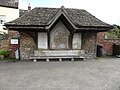
 Kingswood bus shelter - geograph.org.uk - 4638767.jpg 6,000 × 4,000; 6.26 MB
-
 Kingswood shop and pub - geograph.org.uk - 4638761.jpg 6,000 × 4,000; 6.68 MB
-
 Kingswood war memorial - geograph.org.uk - 5360591.jpg 768 × 1,024; 121 KB
-
 Kingswood war memorial - geograph.org.uk - 5360594.jpg 768 × 1,024; 151 KB
-
 Kingswood, 'The Chipping' - geograph.org.uk - 4638822.jpg 5,500 × 3,667; 7 MB
-
 Kingswood, A garden gate - geograph.org.uk - 4638788.jpg 3,667 × 5,500; 7.17 MB
-
 Kingswood, A lot to say - geograph.org.uk - 4638774.jpg 5,500 × 3,667; 7.37 MB
-
 Kingswood, bus stop - geograph.org.uk - 4638770.jpg 6,000 × 4,000; 6.23 MB
-
 Kingswood, campaigns and advertising - geograph.org.uk - 4638777.jpg 6,000 × 4,000; 7.42 MB
-
 Kingswood, Chapel Datestone - geograph.org.uk - 4638838.jpg 6,000 × 4,000; 6.85 MB
-
 Kingswood, Chipping House - geograph.org.uk - 4638810.jpg 6,000 × 4,000; 6.36 MB
-
 Kingswood, Chipping House - geograph.org.uk - 4638814.jpg 6,000 × 4,000; 7.04 MB
-
 Kingswood, Dinneywicks - geograph.org.uk - 4638798.jpg 3,667 × 5,500; 6.9 MB
-
 Kingswood, Fingerpost - geograph.org.uk - 4638779.jpg 4,000 × 6,000; 5.96 MB
-
 Kingswood, fingerpost - geograph.org.uk - 4638791.jpg 4,000 × 6,000; 7.15 MB
-
 Kingswood, High Street - geograph.org.uk - 4638783.jpg 6,000 × 4,000; 6.13 MB
-
 Kingswood, Housing estate - geograph.org.uk - 4638764.jpg 6,000 × 4,000; 4.47 MB
-
 Kingswood, Looking North - geograph.org.uk - 4638849.jpg 6,000 × 4,000; 6.5 MB
-
 Kingswood, Payphone - geograph.org.uk - 4638795.jpg 4,000 × 6,000; 5.18 MB
-
 Kingswood, South Gloucestershire ... post office with GL12 181. (6838896436).jpg 3,508 × 2,776; 4.76 MB
-
 Looking west along Chase Lane - geograph.org.uk - 2827868.jpg 1,024 × 979; 110 KB
-
 Minor road near Folly Farm - geograph.org.uk - 2837959.jpg 1,024 × 769; 75 KB
-
 Names on Kingswood war memorial - geograph.org.uk - 5360587.jpg 768 × 1,024; 225 KB
-
 New Mills, Kingswood - geograph.org.uk - 3718678.jpg 640 × 414; 102 KB
-
 Nind Lane - geograph.org.uk - 5362201.jpg 768 × 1,024; 206 KB
-
 Nind Lane passing through Nind Farm - geograph.org.uk - 3081754.jpg 1,024 × 804; 116 KB
-
-
 Oak trees beside a no through road - geograph.org.uk - 5148809.jpg 1,024 × 768; 259 KB
-
-
 Old dye works, Kingswood - geograph.org.uk - 3936208.jpg 4,320 × 3,240; 3.4 MB
-
 Old farm, Wotton-under-edge - geograph.org.uk - 343261.jpg 640 × 480; 61 KB
-
 Old Rectory, Kingswood - geograph.org.uk - 5360579.jpg 800 × 600; 82 KB
-

-

-
 Parish notice board - geograph.org.uk - 4638754.jpg 6,000 × 4,000; 6.74 MB
-
 Passing the Wotton Road turning - geograph.org.uk - 2989943.jpg 1,024 × 681; 127 KB
-
 Primary school in Kingswood - geograph.org.uk - 5360566.jpg 1,024 × 768; 281 KB
-
 Private entrance off Hillmill Lane - geograph.org.uk - 2837917.jpg 1,024 × 769; 103 KB
-
 Railway bridge over B4060 - geograph.org.uk - 4223153.jpg 1,024 × 674; 103 KB
-
 Railway bridge over the B4060 - geograph.org.uk - 2860544.jpg 1,024 × 577; 298 KB
-
 Renishaw PLC, New Mills - geograph.org.uk - 367256.jpg 640 × 480; 79 KB
-
 Renishaw, Charfield - geograph.org.uk - 3201366.jpg 640 × 459; 62 KB
-
 River, Kingswood, nr Wotton Under Edge, Gloucestershire 2014 - geograph.org.uk - 5843580.jpg 3,872 × 2,592; 2.17 MB
-
 River, Kingswood, nr Wotton Under Edge, Gloucestershire 2014 - geograph.org.uk - 5843632.jpg 3,699 × 2,353; 2.41 MB
-
 Rivet on Horse Bridge - geograph.org.uk - 6153952.jpg 3,296 × 2,472; 3.55 MB
-
 Road junction in Kingswood - geograph.org.uk - 5360599.jpg 1,024 × 768; 168 KB
-

-
 Road to Merryford Farm - geograph.org.uk - 5360550.jpg 1,024 × 768; 197 KB
-
 Roundabout east of Charfield - geograph.org.uk - 3058871.jpg 1,000 × 750; 442 KB
-
 Sheep, near Trench Farm - geograph.org.uk - 367401.jpg 640 × 480; 54 KB
-
-
 Solar farm, South Gloucestershire - geograph.org.uk - 5449930.jpg 640 × 480; 402 KB
-
-
 South Gloucestershire countryside - geograph.org.uk - 2860552.jpg 1,024 × 577; 285 KB
-
 St Mary's church, Kingswood - geograph.org.uk - 4261733.jpg 2,560 × 1,920; 2.81 MB
-
 St Mary's church, Kingswood - geograph.org.uk - 5360536.jpg 768 × 1,024; 199 KB
-

-
-
-
 The B4060 passing the entrance to Day House Farm - geograph.org.uk - 3081782.jpg 1,024 × 686; 136 KB
-
 The Belvedere, Alderley - geograph.org.uk - 5362226.jpg 1,024 × 768; 159 KB
-
 The Belvedere, Alderley - geograph.org.uk - 5363416.jpg 1,024 × 768; 167 KB
-
 The Chipping, Kingswood - geograph.org.uk - 288248.jpg 640 × 480; 77 KB
-

-

-
 The Cotswold Way at Winterspring Lane - geograph.org.uk - 3450816.jpg 800 × 600; 151 KB
-
 The Cotswold Way at Winterspring Lane - geograph.org.uk - 3450823.jpg 800 × 600; 147 KB
-
 The Cotswold Way below Alderley - geograph.org.uk - 5092349.jpg 6,000 × 4,000; 6.18 MB
-

-
 The Cotswold Way heading towards Alderley - geograph.org.uk - 5089620.jpg 6,000 × 4,000; 5.44 MB
-
 The Cotswold Way heading towards Wortley - geograph.org.uk - 5483169.jpg 3,776 × 2,520; 3.94 MB
-
 The Cotswold Way towards Alderley - geograph.org.uk - 3450830.jpg 800 × 600; 140 KB
-
 The Cotswold Way towards Alderley - geograph.org.uk - 3450839.jpg 800 × 600; 140 KB
-
 The Cotswold Way towards Alderley - geograph.org.uk - 3450851.jpg 800 × 600; 172 KB
-
-

-
 The grounds of Renishaw New Mills - geograph.org.uk - 3142197.jpg 4,752 × 3,168; 2.53 MB
-
 The grounds of Renishaw New Mills - geograph.org.uk - 3142204.jpg 4,752 × 3,168; 3.23 MB
-
-
 The river from Horse Bridge - geograph.org.uk - 6153978.jpg 2,472 × 3,296; 3.12 MB
-

-

-
 Tyndale View, Kingswood - geograph.org.uk - 2860560.jpg 1,024 × 577; 304 KB
-
 Upper Green Farm, Wickwar - geograph.org.uk - 4538823.jpg 1,024 × 683; 783 KB
-
 Vaulting in Kingswood Abbey Gatehouse - geograph.org.uk - 5360540.jpg 600 × 800; 113 KB
-
 View to Wortley Hill - geograph.org.uk - 5362176.jpg 1,024 × 576; 206 KB
-

-

-
 War memorial in Kingswood - geograph.org.uk - 5360583.jpg 1,024 × 768; 247 KB
-

-
 Welcome to Kingswood - geograph.org.uk - 4223143.jpg 1,024 × 768; 89 KB
-

-
 Wickwar Road, Kingswood - geograph.org.uk - 2860556.jpg 1,024 × 577; 265 KB
-

-
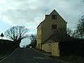 Yellow house - geograph.org.uk - 2837984.jpg 1,024 × 769; 102 KB
-
 Burrough Hill Farm - geograph.org.uk - 367234.jpg 640 × 477; 74 KB
-
 Day House Farm, near Kingswood - geograph.org.uk - 367379.jpg 640 × 480; 64 KB
-
 Farmland between Kingswood and Hillesley - geograph.org.uk - 314184.jpg 640 × 426; 126 KB
-

-
 Footpath to Kingswood - geograph.org.uk - 382344.jpg 640 × 480; 115 KB
-
 Nind Lane - geograph.org.uk - 427583.jpg 640 × 480; 99 KB
-
 The Boundary House, Kingswood - geograph.org.uk - 367375.jpg 640 × 480; 69 KB
-
 Upper Barns Farm - geograph.org.uk - 382346.jpg 640 × 480; 53 KB


.jpg)


