Category:Kington, Herefordshire
Jump to navigation
Jump to search
town and civil parish in Herefordshire, England  | |||||
| Upload media | |||||
| Instance of | |||||
|---|---|---|---|---|---|
| Location | Herefordshire, West Midlands, England | ||||
| Said to be the same as | Kington (Wikimedia duplicated page, civil parish) | ||||
 | |||||
Cymraeg: Tref yn Swydd Henffordd, Lloegr ydy Kington, Herefordshire . Mae ganddi boblogaeth o oddeutu 3,200. (→Kington, Swydd Henffordd)
Deutsch: Kington ist eine Minderstadt und Civil parish in Herefordshire, England. Bei der Zählung von 2001 hatte Kington 2597 Einwohner. (→Kington (Herefordshire))
English: Kington is a market town, electoral ward and civil parish in Herefordshire, England. According to the Parish, the ward had a population of 3,240 while the 2011 census had a population of 2,626. (→Kington, Herefordshire)
فارسی: کینگتون، هرفوردشر (به انگلیسی: Kington, Herefordshire) یک شهرک در بریتانیا است که در هرفوردشر واقع شدهاست. (→کینگتون، هرفوردشر)
Bahasa Indonesia: Kington adalah sebuah kota pasar, kawasan pemilihan dan paroki sipil di Herefordshire, Inggris. Menurut Paroki tersebut, kawasan tersebut memiliki penduduk sejumlah 3,240 orang sementara menurut sensus 2011 menyatakan bahwa kawasan tersebut memiliki penduduk sejumlah 2,626 orang. (→Kington, Herefordshire)
Italiano: Kington è un paese di 2.597 abitanti della contea dell' Herefordshire, in Inghilterra. (→Kington (Herefordshire))
Nederlands: Kington is een plaats in het bestuurlijke gebied Herefordshire, in het gelijknamige Engelse graafschap. De plaats telt ongeveer 3.200 inwoners (2009) en ligt op zo'n 34 km ten noordwesten van Hereford.
(→Kington (Herefordshire))
(→Kington (Herefordshire))
Norsk nynorsk: Kington er ein by i grevskapet Herefordshire i England. Han har kring 3000 innbyggjarar. (→Kington i Herefordshire)
Polski: Kington – miasto w Anglii, w hrabstwie Herefordshire. Leży 27 km na północny zachód od miasta Hereford i 214 km na zachód od Londynu. W 2009 miasto liczyło 3200 mieszkańców. (→Kington (Herefordshire))

Subcategories
This category has the following 13 subcategories, out of 13 total.
1
- 11, The Square, Kington (2 F)
H
- Hergest Croft (46 F)
K
- Kington Museum (10 F)
- Kington railway station (10 F)
- Kington Town Hall (5 F)
- Kington War memorial (10 F)
P
S
- Shops in Kington, Herefordshire (25 F)
- St Bede's Church, Hereford (3 F)
Media in category "Kington, Herefordshire"
The following 200 files are in this category, out of 376 total.
(previous page) (next page)-
 1, The Square, Kington.jpg 4,000 × 3,000; 942 KB
-

-

-
 21 and 22, Church Street, Kington.jpg 4,000 × 3,000; 996 KB
-
 27 and 28, Church Street, Kington.jpg 3,000 × 4,000; 821 KB
-
 29 Church Street, Kington - geograph.org.uk - 1902319.jpg 3,311 × 2,456; 4.56 MB
-
 29, Church Street, Kington.jpg 4,000 × 3,000; 877 KB
-
 29, High Street, Kington.jpg 3,000 × 4,000; 758 KB
-
 32 and 33, Church Street, Kington 02.jpg 4,000 × 3,000; 1.18 MB
-
 32 and 33, Church Street, Kington.jpg 4,000 × 3,000; 890 KB
-
 35 Bridge Street, Kington - geograph.org.uk - 1913603.jpg 3,411 × 2,323; 7.41 MB
-
 A field near Kington - geograph.org.uk - 6145142.jpg 1,024 × 683; 256 KB
-
 A gaping hole in the Burton Hotel - geograph.org.uk - 5786857.jpg 1,024 × 680; 273 KB
-
 A misty morning in Kington - geograph.org.uk - 5544175.jpg 1,024 × 684; 278 KB
-
 A selection of doorsteps, Bridge Street - geograph.org.uk - 1912710.jpg 3,222 × 2,522; 5.28 MB
-
 A Yew Tree and A Yew Hedge - geograph.org.uk - 4401028.jpg 1,050 × 1,574; 1.22 MB
-
 A44 heads SE away from Kington - geograph.org.uk - 3538765.jpg 800 × 495; 115 KB
-
 A44 Kington bypass - geograph.org.uk - 2588110.jpg 640 × 480; 79 KB
-
 A44 roundabout, Kington - geograph.org.uk - 3027208.jpg 800 × 530; 95 KB
-

-
 Albion House, Bridge Street, Kington - geograph.org.uk - 1912366.jpg 3,063 × 2,538; 5.14 MB
-
 Arrow Brewery - geograph.org.uk - 4045573.jpg 640 × 853; 476 KB
-
 Arrow Mill - geograph.org.uk - 1731917.jpg 640 × 427; 255 KB
-
 Arrow Mill - geograph.org.uk - 2942605.jpg 640 × 480; 99 KB
-
 Arrow Mill, Kington - geograph.org.uk - 4469663.jpg 640 × 452; 102 KB
-
 Arrow Mills, Kington - geograph.org.uk - 1913631.jpg 3,356 × 2,434; 5.29 MB
-

-
 Avenue of trees at the park - geograph.org.uk - 1714331.jpg 640 × 480; 160 KB
-
 Azalea garden, Hergest Croft Gardens - geograph.org.uk - 5789836.jpg 1,024 × 680; 374 KB
-
 Azalea garden, Hergest Croft Gardens - geograph.org.uk - 5789840.jpg 1,024 × 680; 399 KB
-
 Azaleas at Hergest Croft - geograph.org.uk - 5789834.jpg 1,024 × 680; 409 KB
-
 B4355 roundabout, Kington bypass - geograph.org.uk - 2588101.jpg 640 × 480; 74 KB
-
 Back Brook - geograph.org.uk - 3943283.jpg 4,320 × 3,240; 5.9 MB
-
 Back Brook - geograph.org.uk - 449811.jpg 640 × 480; 141 KB
-
 Bamboo Garden, Kington - geograph.org.uk - 3530192.jpg 800 × 799; 141 KB
-
 Baptist Church, Kington - geograph.org.uk - 1912696.jpg 3,345 × 2,333; 6.51 MB
-
 Black-faced Sheep - geograph.org.uk - 639348.jpg 640 × 480; 95 KB
-
 Board School Lane, Kington - geograph.org.uk - 3536975.jpg 800 × 733; 264 KB
-

-

-
 Bradnor View Close, Kington - geograph.org.uk - 3531076.jpg 800 × 602; 165 KB
-
 Bridge embankment - geograph.org.uk - 1878433.jpg 1,024 × 683; 294 KB
-
 Bridge Street - geograph.org.uk - 1730630.jpg 640 × 427; 240 KB
-
 Bridge Street Kington - geograph.org.uk - 3533320.jpg 800 × 754; 149 KB
-
 Bridge Street Wash House, Kington - geograph.org.uk - 3534874.jpg 676 × 800; 133 KB
-
 Bridge Street, Kington - geograph.org.uk - 2478831.jpg 640 × 480; 118 KB
-
 Bridge street, Kington - geograph.org.uk - 957992.jpg 640 × 480; 77 KB
-
 Bridge street, Kington - geograph.org.uk - 957993.jpg 640 × 480; 77 KB
-
 Bridge street, Kington - geograph.org.uk - 957996.jpg 640 × 480; 71 KB
-
 Broad path up Hergest Ridge - geograph.org.uk - 2308837.jpg 640 × 480; 38 KB
-
 Building overhang, High Street, Kington - geograph.org.uk - 3530104.jpg 791 × 795; 192 KB
-
 Burton Hotel, Kington - geograph.org.uk - 1900533.jpg 4,119 × 2,167; 4.17 MB
-
 Castle Hill Cottage, Kington (geograph 7323549).jpg 1,024 × 768; 142 KB
-
 Castle House, Church Street - geograph.org.uk - 4053297.jpg 4,000 × 2,952; 3.03 MB
-
 Castle House, Church Street, Kington - geograph.org.uk - 1902324.jpg 3,456 × 2,592; 6.53 MB
-

-
-
 Church House (Kington) - geograph.org.uk - 6347644.jpg 3,648 × 2,736; 2.44 MB
-
 Church House, Kington (geograph 7323496).jpg 1,024 × 768; 246 KB
-
 Church in Kington, Herefordshire - geograph.org.uk - 2308904.jpg 640 × 480; 117 KB
-
 Church Street (Kington) - geograph.org.uk - 6347394.jpg 3,648 × 2,056; 1.3 MB
-
 Church Street (Kington) - geograph.org.uk - 6347411.jpg 3,648 × 2,056; 1.6 MB
-
 Church Street - geograph.org.uk - 1728396.jpg 640 × 427; 267 KB
-
 Church Street in winter - geograph.org.uk - 1728395.jpg 640 × 480; 80 KB
-
 Church Street, Kington - geograph.org.uk - 1902311.jpg 3,375 × 2,035; 4.1 MB
-
 Church Street, Kington - geograph.org.uk - 1911053.jpg 3,075 × 2,397; 5.33 MB
-
 Church Street, Kington - geograph.org.uk - 5544155.jpg 1,024 × 684; 245 KB
-
 Church Street, Kington - geograph.org.uk - 5683745.jpg 1,024 × 576; 255 KB
-
 Church Street, Kington - geograph.org.uk - 6235396.jpg 1,024 × 768; 683 KB
-
 Church street, Kington - geograph.org.uk - 958011.jpg 640 × 480; 103 KB
-
 Clock on Pavilion at Kington Recreation Ground - geograph.org.uk - 6347343.jpg 3,648 × 2,736; 1.45 MB
-
 Coach House and Gents Toilet, Kington - geograph.org.uk - 438195.jpg 640 × 480; 76 KB
-
 Cooper's Yard, Kington - geograph.org.uk - 2519365.jpg 512 × 640; 387 KB
-

-
 Cottage below Haywood Farm, Kington - geograph.org.uk - 2351806.jpg 640 × 480; 114 KB
-
 Cottage in Kington in April - geograph.org.uk - 2351813.jpg 640 × 480; 105 KB
-
 Cottages by Back Brook, Kington - geograph.org.uk - 3027833.jpg 800 × 530; 157 KB
-
 Crabtree Road car park, Kington - geograph.org.uk - 3529833.jpg 800 × 521; 113 KB
-
 Crash damaged Burton Hotel - geograph.org.uk - 5786861.jpg 680 × 1,024; 267 KB
-
 Crooked Well houses, Kington - geograph.org.uk - 3531002.jpg 800 × 619; 151 KB
-
 Croquet lawn at Hergest Croft - geograph.org.uk - 5789830.jpg 1,024 × 680; 314 KB
-

-
 Doctors Lane, Kington - geograph.org.uk - 3531106.jpg 800 × 708; 190 KB
-
 Duke Street east of Sun Lane, Kington - geograph.org.uk - 3536933.jpg 800 × 729; 141 KB
-
 Duke Street, Kington (geograph 7329084).jpg 1,024 × 768; 134 KB
-
 Duke Street, Kington (geograph 7329097).jpg 1,024 × 768; 152 KB
-
 Duke Street, Kington - geograph.org.uk - 1912315.jpg 2,967 × 2,478; 5.12 MB
-
 Duke Street, Kington - geograph.org.uk - 2519481.jpg 640 × 480; 364 KB
-
 Duke Street, Kington - geograph.org.uk - 4714517.jpg 4,000 × 3,000; 2.04 MB
-
 Eastern arm of the Kington bypass - geograph.org.uk - 2588099.jpg 640 × 480; 80 KB
-
 Eastern boundary of Kington - geograph.org.uk - 3538566.jpg 800 × 610; 135 KB
-

-
 Elizabeth Road Kington - geograph.org.uk - 3537113.jpg 800 × 545; 111 KB
-
 Ellan Lane, Kington - geograph.org.uk - 2519371.jpg 512 × 640; 333 KB
-
 End of Ridgebourne Road - geograph.org.uk - 1728320.jpg 480 × 640; 115 KB
-
 End of the tarmac, Hergest Ridge - geograph.org.uk - 3027945.jpg 800 × 530; 182 KB
-
 Entrance to St. Mary's Church (Bell Tower ^ Kington) - geograph.org.uk - 6347468.jpg 2,736 × 3,648; 2.59 MB
-
 Entrance to St. Mary's Church (Bell Tower ^ Kington) - geograph.org.uk - 6347471.jpg 2,736 × 3,648; 2.54 MB
-
 Farmland near Bollingham - geograph.org.uk - 439472.jpg 640 × 426; 131 KB
-
 Farmland near Kington - geograph.org.uk - 439452.jpg 640 × 426; 112 KB
-
 Field off Ridgebourne Road in April - geograph.org.uk - 2351783.jpg 640 × 480; 49 KB
-
 Field off Ridgebourne Road, Kington - geograph.org.uk - 2308813.jpg 640 × 480; 91 KB
-
 Filled in bridge - geograph.org.uk - 1879397.jpg 1,024 × 683; 283 KB
-
 Flowing past the houses - geograph.org.uk - 1881214.jpg 1,024 × 683; 179 KB
-
 Footpath west of Kington - geograph.org.uk - 474078.jpg 640 × 421; 61 KB
-
 Former Drill Hall, Kington - geograph.org.uk - 4202656.jpg 5,683 × 3,994; 4.29 MB
-
 Former Drill Hall, Kington - geograph.org.uk - 4202663.jpg 4,836 × 3,104; 2.5 MB
-
 Former Drill Hall, Kington - geograph.org.uk - 4202673.jpg 5,477 × 3,650; 2.71 MB
-
 Furlong Lane - geograph.org.uk - 1730591.jpg 415 × 640; 259 KB
-
 Glasshouse at Hergest Croft - geograph.org.uk - 3597627.jpg 1,600 × 1,200; 433 KB
-
 Goods shed by the station - geograph.org.uk - 1878387.jpg 1,024 × 683; 150 KB
-
 Goods shed by the station 2 - geograph.org.uk - 1878399.jpg 1,024 × 683; 117 KB
-
 Goods Shed, Kington - geograph.org.uk - 1944177.jpg 3,456 × 2,592; 3.78 MB
-
 Gravel Hill Drive, Kington - geograph.org.uk - 3538790.jpg 800 × 608; 162 KB
-
 Hatton Gardens phonebox, Kington - geograph.org.uk - 3538723.jpg 800 × 572; 146 KB
-
 Haywood Common, Kington - geograph.org.uk - 4118401.jpg 1,024 × 681; 177 KB
-
 Headbrook, Kington - geograph.org.uk - 6145152.jpg 1,024 × 683; 242 KB
-
 Heol Ridgebourne Road, Kington - geograph.org.uk - 4512342.jpg 640 × 493; 121 KB
-
 Hergest Croft - geograph.org.uk - 5789024.jpg 1,024 × 680; 294 KB
-
 Hergest Croft - geograph.org.uk - 5789028.jpg 1,024 × 680; 362 KB
-
 Hergest Croft - geograph.org.uk - 5789049.jpg 1,024 × 680; 342 KB
-
 Hergest Croft Gardens - geograph.org.uk - 5789030.jpg 1,024 × 680; 387 KB
-
 Hergest Croft Gardens - geograph.org.uk - 5789035.jpg 680 × 1,024; 384 KB
-
 Hergest Croft Gardens - geograph.org.uk - 5789047.jpg 1,024 × 680; 369 KB
-
 Hergest Croft, Kington - geograph.org.uk - 6029532.jpg 1,600 × 1,200; 411 KB
-

-
 Hergest Mill - crown wheel - geograph.org.uk - 4476639.jpg 640 × 427; 79 KB
-
 Hergest Mill - geograph.org.uk - 4469697.jpg 640 × 427; 91 KB
-
 Hergest Mill - geograph.org.uk - 4475511.jpg 640 × 416; 90 KB
-
 Hergest Mill - hurst frames - geograph.org.uk - 4475522.jpg 640 × 427; 75 KB
-
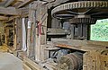 Hergest Mill - hurst frames - geograph.org.uk - 4475538.jpg 640 × 416; 94 KB
-
 Hergest Mill - still producing power - geograph.org.uk - 4475559.jpg 640 × 427; 68 KB
-
 Hergest Mill - unusual bedstone - geograph.org.uk - 4476531.jpg 640 × 427; 92 KB
-
 Hergest Mill - unusual view - geograph.org.uk - 4475548.jpg 427 × 640; 104 KB
-
 Hergest Mill, Kington - geograph.org.uk - 2351850.jpg 640 × 480; 120 KB
-
 High Street, Kington - geograph.org.uk - 1467106.jpg 640 × 480; 71 KB
-
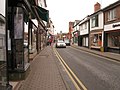 High Street, Kington - geograph.org.uk - 2141301.jpg 640 × 480; 72 KB
-
 High Street, Kington - geograph.org.uk - 3027189.jpg 800 × 530; 125 KB
-
 High Street, Kington - geograph.org.uk - 3855501.jpg 1,500 × 1,125; 1.43 MB
-
 High Street, Kington - geograph.org.uk - 4045565.jpg 640 × 480; 268 KB
-
 House on Ridgebourne Road - geograph.org.uk - 1728305.jpg 640 × 480; 91 KB
-

-
 House to NW of St Mary's church, Kington - geograph.org.uk - 1750250.jpg 1,898 × 1,298; 2.8 MB
-
 Houses in The Square, Kington - geograph.org.uk - 3531177.jpg 800 × 619; 122 KB
-
 Houses on Victoria Road - geograph.org.uk - 4053156.jpg 1,024 × 792; 242 KB
-
 HSBC bank, Kington - geograph.org.uk - 5544178.jpg 1,024 × 684; 283 KB
-
 HSBC Kington - geograph.org.uk - 3534850.jpg 799 × 800; 130 KB
-
 HSBC, Kington branch - geograph.org.uk - 1912269.jpg 3,322 × 2,478; 5.56 MB
-
 Informal recreation area, Kington - geograph.org.uk - 6145147.jpg 1,024 × 683; 237 KB
-
 Inlet Weir at Arrow Mill - geograph.org.uk - 2950617.jpg 640 × 480; 90 KB
-
 Ironwork, Kington Market Hall - geograph.org.uk - 1900562.jpg 3,027 × 1,955; 4.63 MB
-
 Junction of Oxford Lane and Duke Street, Kington - geograph.org.uk - 1949265.jpg 3,640 × 2,180; 3.63 MB
-
 Kingdom Hall - geograph.org.uk - 1730616.jpg 640 × 427; 249 KB
-
 Kington - geograph.org.uk - 36252.jpg 640 × 399; 67 KB
-
 Kington - geograph.org.uk - 5544180.jpg 1,024 × 684; 257 KB
-
-
 Kington 01 - Kington Horse Show and Agricultural Society Past presidents board.JPG 3,008 × 2,000; 2.44 MB
-
 Kington 02 - Kington Horse Show and Agricultural Society Past presidents board.JPG 2,000 × 3,008; 2.42 MB
-
 Kington 03 - Kington Horse Show and Agricultural Society Past presidents board.JPG 2,000 × 3,008; 2.43 MB
-
 Kington 04 - Bollard optimized Kington, Herefordshire.jpg 1,802 × 2,780; 5.74 MB
-
 Kington 04 - Bollard.JPG 2,000 × 3,008; 2.43 MB
-
 Kington 05 - Last day for local raspberries.JPG 3,008 × 2,000; 2.01 MB
-
 Kington 06 - Cliff Hodges (mens wear).JPG 2,000 × 3,008; 2.15 MB
-
 Kington 07 - corner building.JPG 3,008 × 2,000; 2.09 MB
-
 Kington 08 - Old Radnor Trading Company etched logo.JPG 3,008 × 2,000; 2 MB
-
 Kington 09 - Old Radnor Trading Company etched logo.JPG 3,008 × 2,000; 1.9 MB
-
 Kington 10 - Posting box.JPG 3,008 × 2,000; 2.12 MB
-
 Kington 11 - Post Office.JPG 2,000 × 3,008; 2.62 MB
-
 Kington 12 - Post Office.JPG 3,008 × 2,000; 2.71 MB
-
 Kington 16 - Parkers mosaic.JPG 2,000 × 3,008; 2.46 MB
-
 Kington 17 - Arrow Bitter chalk board.JPG 2,000 × 3,008; 2.22 MB
-
 Kington 18 - narrow lane.JPG 2,000 × 3,008; 2.66 MB
-
 Kington 20 - stone jar from Keysell & Co of Ludlow.JPG 2,000 × 3,008; 2.16 MB
-
 Kington 21 - antique garden tools.JPG 2,000 × 3,008; 1.83 MB
-
 Kington 23 - Offas Dyke Way - concrete signpost.JPG 3,008 × 2,000; 3.32 MB
-
 Kington 24 - Georgian doorway.JPG 2,000 × 3,008; 2.21 MB
-
 Kington 25 - Board School Lane street name plate.JPG 3,008 × 2,000; 2.73 MB
-
 Kington 26 - Herbert & Young fire hydrant cover.JPG 3,008 × 2,000; 3.33 MB
-
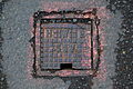 Kington 27 - stop cock cover.JPG 3,008 × 2,000; 2.93 MB
-
 Kington 28 - Wainwright mosaic in shop doorway.JPG 3,008 × 2,000; 2.59 MB
-
 Kington 30 - grille above gate.JPG 3,008 × 2,000; 2.09 MB
-
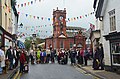 Kington and people, 2012 - geograph.org.uk - 3027163.jpg 800 × 530; 124 KB
-
 Kington building overhang - 2015-07-15 - Andy Mabbett - 01.JPG 2,592 × 3,872; 2.74 MB
-
 Kington building overhang - 2015-07-15 - Andy Mabbett - 02.JPG 2,592 × 3,872; 2.87 MB
-
 Kington building overhang - 2015-07-15 - Andy Mabbett - 03.JPG 2,592 × 3,872; 3.76 MB
-
 Kington Cemetery - geograph.org.uk - 3943218.jpg 4,320 × 3,240; 5.36 MB
-
 Kington Court, Kington - geograph.org.uk - 3537025.jpg 800 × 617; 114 KB
-
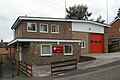 Kington Fire Station - geograph.org.uk - 460727.jpg 640 × 427; 212 KB
-
 Kington High Street - Upper Cross end - geograph.org.uk - 1911074.jpg 3,456 × 2,592; 5.44 MB
-
 Kington Korean War Memorial - geograph.org.uk - 6347332.jpg 3,648 × 2,736; 2.47 MB
-
 Kington Library - geograph.org.uk - 1902033.jpg 3,403 × 2,392; 4.63 MB
-
 Kington Medical Practice, The Meads - geograph.org.uk - 2519441.jpg 640 × 427; 325 KB
-
 Kington post office - geograph.org.uk - 3534830.jpg 799 × 800; 179 KB
-
 Kington Post Office - geograph.org.uk - 4045576.jpg 640 × 480; 278 KB
-
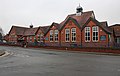 Kington Primary School - geograph.org.uk - 1728744.jpg 640 × 405; 222 KB
-
 Kington Primary School - geograph.org.uk - 2478850.jpg 3,504 × 2,336; 1.97 MB
-
 Kington Primary School - geograph.org.uk - 6011050.jpg 1,024 × 683; 164 KB
-
 Kington Recreation Ground - geograph.org.uk - 6347320.jpg 3,648 × 2,056; 1.25 MB
-
 Kington Recreation Ground - geograph.org.uk - 6347330.jpg 3,648 × 2,056; 1.57 MB
-
 Kington station - geograph.org.uk - 1879383.jpg 1,024 × 683; 222 KB


_-_geograph.org.uk_-_6347661.jpg)


.jpg)


_-_geograph.org.uk_-_6347644.jpg)
.jpg)

_-_geograph.org.uk_-_6347394.jpg)
_-_geograph.org.uk_-_6347411.jpg)


.jpg)
.jpg)


_-_geograph.org.uk_-_6347468.jpg)
_-_geograph.org.uk_-_6347471.jpg)


.JPG)


