Category:Kinneff and Catterline
Jump to navigation
Jump to search
Scottish parish in Aberdeenshire, Scotland, UK | |||||
| Upload media | |||||
| Instance of | |||||
|---|---|---|---|---|---|
| Named after | |||||
| Location |
| ||||
| Population |
| ||||
| Area |
| ||||
 | |||||
Subcategories
This category has the following 2 subcategories, out of 2 total.
C
K
Media in category "Kinneff and Catterline"
The following 200 files are in this category, out of 281 total.
(previous page) (next page)-
 A Catterline school - geograph.org.uk - 5460493.jpg 4,896 × 3,672; 6.82 MB
-
 A Long Cave - geograph.org.uk - 3490971.jpg 640 × 427; 438 KB
-
 A minor road near Catterline - geograph.org.uk - 2724915.jpg 640 × 480; 84 KB
-
 A Rocky Coast - geograph.org.uk - 3490822.jpg 640 × 416; 427 KB
-

-
 A92 heading to Inverbervie - geograph.org.uk - 1979530.jpg 640 × 480; 68 KB
-
 A92 nearing Roadside of Kinneff - geograph.org.uk - 1979505.jpg 640 × 480; 90 KB
-
 Access drive to Fernieflatt - geograph.org.uk - 2495385.jpg 640 × 480; 77 KB
-
 Across the river mouth - geograph.org.uk - 5037273.jpg 4,320 × 3,240; 4.54 MB
-

-

-

-
 Barley field below the Brow of Bervie - geograph.org.uk - 887701.jpg 640 × 419; 74 KB
-
 Barley, Fernieflatt - geograph.org.uk - 2974315.jpg 640 × 480; 100 KB
-
 Barn, Bellfield - geograph.org.uk - 3742858.jpg 640 × 480; 59 KB
-
 Barras Smithy - geograph.org.uk - 1371645.jpg 640 × 480; 118 KB
-
 Barras Smithy garage - geograph.org.uk - 1371638.jpg 616 × 429; 63 KB
-
 Bervie Bay, Inverbervie - geograph.org.uk - 2139198.jpg 3,648 × 2,736; 2.49 MB
-
 Bervie Estuary - geograph.org.uk - 5850859.jpg 5,184 × 3,888; 3.99 MB
-
 Boat by Kinneff - geograph.org.uk - 1955842.jpg 3,456 × 2,304; 1.09 MB
-
 Braidon Cottages - geograph.org.uk - 2724895.jpg 640 × 480; 72 KB
-
 Braidon Cottages - geograph.org.uk - 3742853.jpg 640 × 480; 56 KB
-
 Brakes of Barras - geograph.org.uk - 1954890.jpg 3,456 × 2,304; 1.31 MB
-
 Bridge over Catterline Burn - geograph.org.uk - 6105917.jpg 6,000 × 4,000; 6.54 MB
-
 Burnes Memorial (1969) - geograph.org.uk - 6107622.jpg 3,729 × 4,973; 4.2 MB
-
 Bus Stops - geograph.org.uk - 1978143.jpg 640 × 480; 73 KB
-
 By Fernieflatt - geograph.org.uk - 2436119.jpg 3,456 × 2,304; 938 KB
-
 By Swallow Cove - geograph.org.uk - 5826648.jpg 3,204 × 2,136; 4.6 MB
-
 Campsite, Inverbervie - geograph.org.uk - 2139195.jpg 3,648 × 2,736; 2.36 MB
-
 Caravan site, Cloak - geograph.org.uk - 2724912.jpg 640 × 419; 56 KB
-
 Caravan site, Cloak - geograph.org.uk - 3742831.jpg 640 × 480; 69 KB
-
 Catterline - geograph.org.uk - 4628426.jpg 800 × 601; 486 KB
-
 Catterline and its beach - geograph.org.uk - 4628411.jpg 800 × 601; 525 KB
-
 Catterline Bay - geograph.org.uk - 1832526.jpg 640 × 480; 74 KB
-
 Catterline Bay - geograph.org.uk - 2567404.jpg 4,000 × 3,000; 2.65 MB
-
 Catterline Bay - geograph.org.uk - 6104067.jpg 6,000 × 4,000; 4.95 MB
-
 Catterline Bay and Pier - geograph.org.uk - 4127510.jpg 3,264 × 2,448; 3.05 MB
-
 Catterline Bay and the Kaim of Forley - geograph.org.uk - 4127456.jpg 3,264 × 2,448; 4.03 MB
-
 Catterline boathouse - geograph.org.uk - 6104071.jpg 6,000 × 4,000; 4.83 MB
-
 Catterline Burn - geograph.org.uk - 2724909.jpg 640 × 480; 138 KB
-
 Catterline coastal rocks - geograph.org.uk - 6104073.jpg 6,000 × 4,000; 4.8 MB
-
 Catterline coastal scene - geograph.org.uk - 6104079.jpg 6,000 × 4,000; 4.85 MB
-
 Catterline cottages... - geograph.org.uk - 6104103.jpg 5,622 × 3,955; 6.16 MB
-
 Catterline harvest - geograph.org.uk - 4127495.jpg 3,264 × 2,448; 4.2 MB
-
 Catterline kirkyard - geograph.org.uk - 6105028.jpg 6,000 × 4,000; 6.06 MB
-
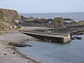
 Catterline pier - geograph.org.uk - 1832521.jpg 640 × 480; 70 KB
-
 Catterline Pier - geograph.org.uk - 5826635.jpg 4,272 × 2,848; 4.86 MB
-
 Catterline school - geograph.org.uk - 6105010.jpg 5,148 × 3,793; 5.06 MB
-
 Catterline vista... - geograph.org.uk - 6104099.jpg 6,000 × 4,000; 6.06 MB
-
 Catterline war memorial… - geograph.org.uk - 6105892.jpg 3,304 × 4,410; 3.17 MB
-
 Caves near Inverbervie - geograph.org.uk - 3490931.jpg 640 × 427; 456 KB
-
 Chapel Of Barras Farm - geograph.org.uk - 1955943.jpg 2,832 × 2,024; 752 KB
-
 Chapel Pond - geograph.org.uk - 1955921.jpg 3,456 × 2,304; 1.84 MB
-
 Cliffside Bothy - geograph.org.uk - 5818628.jpg 4,272 × 2,848; 3.41 MB
-
 Coastal farmland, Crowhillock - geograph.org.uk - 3742895.jpg 640 × 480; 62 KB
-
 Coastal farmland, Kinneff - geograph.org.uk - 3742887.jpg 640 × 480; 64 KB
-
 Coastal field near Catterline - geograph.org.uk - 6104091.jpg 6,000 × 4,000; 5.65 MB
-
 Coastal roads junction - geograph.org.uk - 3742876.jpg 640 × 480; 44 KB
-
 Conglomerate cliff, Inverbervie - geograph.org.uk - 2140466.jpg 3,648 × 2,736; 2.37 MB
-
 Conglomerate rocks at Todhead point - geograph.org.uk - 6107828.jpg 6,000 × 4,000; 5.78 MB
-
 Conglomerate shoreline south of Todhead Point - geograph.org.uk - 2495308.jpg 1,111 × 797; 452 KB
-
 Cotbank of Hilton - geograph.org.uk - 3742827.jpg 640 × 480; 76 KB
-
 Cottages by the roadside - geograph.org.uk - 3064799.jpg 640 × 480; 84 KB
-
 Cottages in Midtown of Barras - geograph.org.uk - 1371487.jpg 575 × 451; 97 KB
-
 Craig David - geograph.org.uk - 3490815.jpg 640 × 427; 331 KB
-
 Craigdavid Croft ^ Craig David - geograph.org.uk - 5040141.jpg 4,320 × 3,240; 4.74 MB
-
 Crossroads, Fernieflatt - geograph.org.uk - 2724892.jpg 640 × 480; 76 KB
-
 Crowhillock - geograph.org.uk - 3742888.jpg 640 × 480; 63 KB
-
 Daffodil Crop Ready - geograph.org.uk - 5360475.jpg 4,272 × 2,848; 3.68 MB
-
 Daffodil Fields - geograph.org.uk - 2436283.jpg 3,456 × 2,304; 1,003 KB
-
 Daffodil plantation - geograph.org.uk - 6110623.jpg 6,000 × 4,000; 6.25 MB
-
 Defensive concrete - geograph.org.uk - 5037282.jpg 4,320 × 3,240; 4.67 MB
-
 Downhill towards the A92 - geograph.org.uk - 3742904.jpg 640 × 480; 59 KB
-
 East Bendings - geograph.org.uk - 5311800.jpg 4,272 × 2,848; 1.79 MB
-
 Electricity pylon by A90 dual carriageway - geograph.org.uk - 6107579.jpg 4,683 × 2,983; 2.24 MB
-
 Episcopal Church - geograph.org.uk - 5818630.jpg 4,272 × 2,848; 3.13 MB
-
 Episcopal trio - geograph.org.uk - 6105867.jpg 5,324 × 3,551; 5.94 MB
-
 Farm road to Muir of Barras - geograph.org.uk - 3293471.jpg 1,200 × 797; 417 KB
-
 Farm, Crowhillock - geograph.org.uk - 3742893.jpg 640 × 480; 39 KB
-
 Farmland near Bellfield - geograph.org.uk - 3742865.jpg 640 × 480; 58 KB
-
 Farmland near Braidon Cottages - geograph.org.uk - 3742851.jpg 640 × 480; 58 KB
-
 Farmland near Catterline - geograph.org.uk - 3742848.jpg 640 × 480; 68 KB
-
 Farmland near Grange - geograph.org.uk - 3742900.jpg 640 × 480; 53 KB
-
 Farmland near Mill of Uras - geograph.org.uk - 3742821.jpg 640 × 480; 50 KB
-
-
 Farmland west of the A92 - geograph.org.uk - 3742906.jpg 640 × 480; 62 KB
-
 Farmland, Mains of Hilton - geograph.org.uk - 3742836.jpg 640 × 480; 52 KB
-
 Fawsyde Grazing - geograph.org.uk - 1955854.jpg 3,456 × 2,304; 1.05 MB
-
 Ferniebrae Farm - geograph.org.uk - 3293472.jpg 1,200 × 797; 487 KB
-
 Fernieflatt - geograph.org.uk - 3742868.jpg 640 × 480; 51 KB
-
 Fernieflatt Farm - geograph.org.uk - 2436099.jpg 640 × 427; 40 KB
-
 Fiddes Turbine - geograph.org.uk - 5311782.jpg 4,272 × 2,848; 1.23 MB
-
 Field by Westown - geograph.org.uk - 5311771.jpg 4,272 × 2,848; 1.18 MB
-
 Fields at Fiddes - geograph.org.uk - 5422057.jpg 1,024 × 684; 104 KB
-
 Fields by Barras - geograph.org.uk - 5311721.jpg 4,272 × 2,848; 1.65 MB
-
 Fields near St John's Hill - geograph.org.uk - 3034408.jpg 640 × 480; 45 KB
-
 Fields west of Catterline - geograph.org.uk - 2495485.jpg 640 × 540; 69 KB
-
 Fishing at Bay of Bervie, Inverbervie - geograph.org.uk - 2140472.jpg 3,648 × 2,736; 2.43 MB
-
 Fishing bothy, Catterline - geograph.org.uk - 4628416.jpg 800 × 601; 547 KB
-
 Forley Craig at Catterline - geograph.org.uk - 4127477.jpg 3,264 × 2,448; 4.5 MB
-
 Former episcopal school, Catterline - geograph.org.uk - 6105898.jpg 4,411 × 3,178; 3.36 MB
-
 Former parsonage, Catterline - geograph.org.uk - 6105903.jpg 6,000 × 4,000; 6.97 MB
-
 Fortification, Inverbervie - geograph.org.uk - 2139226.jpg 3,648 × 2,736; 2.37 MB
-
 Glasslin Burn - geograph.org.uk - 2436190.jpg 3,456 × 2,304; 1.4 MB
-
 Green and blue at Tod Head - geograph.org.uk - 1546364.jpg 640 × 480; 119 KB
-
 Haar - geograph.org.uk - 2974298.jpg 640 × 480; 72 KB
-
 Hallhill Farm - geograph.org.uk - 2435958.jpg 3,456 × 2,304; 1.18 MB
-
 Hallhill farm - geograph.org.uk - 6105947.jpg 5,133 × 3,289; 4.67 MB
-
 Hallhill Farm - geograph.org.uk - 800932.jpg 640 × 427; 214 KB
-
 Harebell wood - geograph.org.uk - 1880501.jpg 2,112 × 2,816; 2.87 MB
-
 Harley House - geograph.org.uk - 1371620.jpg 564 × 409; 71 KB
-
 Harvested barley at Bellfield - geograph.org.uk - 4127084.jpg 3,264 × 2,448; 4.36 MB
-
-
 Heading up the hill... - geograph.org.uk - 6105035.jpg 6,000 × 4,000; 6.91 MB
-
 Herding Cattle, 21st Century Style - geograph.org.uk - 800406.jpg 640 × 427; 270 KB
-
 Heron, Bervie Water - geograph.org.uk - 2724054.jpg 640 × 480; 85 KB
-
 Honours of Scotland replicas - geograph.org.uk - 3683893.jpg 640 × 461; 59 KB
-
 Houses at Whistleberry - geograph.org.uk - 800634.jpg 640 × 427; 293 KB
-
 Intertidal area, Catterline - geograph.org.uk - 4628418.jpg 800 × 601; 478 KB
-
 Into the sea - geograph.org.uk - 5037281.jpg 4,320 × 3,240; 4.78 MB
-
 Inverbervie Bay from Pillbox - geograph.org.uk - 2140474.jpg 3,648 × 2,736; 2.41 MB
-
 Inverbervie from the shore - geograph.org.uk - 5040150.jpg 4,320 × 3,240; 5.08 MB
-
 Inverbervie, looking over Bervie Bay - geograph.org.uk - 2139212.jpg 3,648 × 2,736; 2.41 MB
-
 Job done by the big yellow machine - geograph.org.uk - 4127367.jpg 3,264 × 2,448; 4.07 MB
-
 Kine on Erick Law - geograph.org.uk - 1371479.jpg 640 × 480; 82 KB
-
 Kineff old kirk - geograph.org.uk - 6110614.jpg 4,614 × 3,463; 3.76 MB
-
 Kineff old manse - geograph.org.uk - 6110616.jpg 6,000 × 4,000; 6.88 MB
-
 Kirkcorner - geograph.org.uk - 2724080.jpg 640 × 480; 67 KB
-
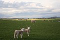 Lambs by Todhead - geograph.org.uk - 2435987.jpg 3,456 × 2,304; 1.11 MB
-

-
 Large open tank, Wardhead - geograph.org.uk - 2970022.jpg 640 × 480; 64 KB
-
 Largie Farm - geograph.org.uk - 800370.jpg 640 × 427; 266 KB
-
 Layby on the Southbound A90 - geograph.org.uk - 6186201.jpg 800 × 533; 488 KB
-
 Lobster or crab pots - geograph.org.uk - 1880516.jpg 2,816 × 2,112; 2.96 MB
-
 Looking North from near Whistleberry - geograph.org.uk - 800642.jpg 640 × 427; 281 KB
-
 Martin Terrace - geograph.org.uk - 6255303.jpg 640 × 389; 68 KB
-
 Meadow Saxifrage (Saxifraga granulata) - geograph.org.uk - 800950.jpg 427 × 640; 221 KB
-
 Midtown of Barras - geograph.org.uk - 1371481.jpg 640 × 480; 162 KB
-
 Midtown of Barras - geograph.org.uk - 5311758.jpg 4,272 × 2,848; 1.26 MB
-
 Mill of Barras - geograph.org.uk - 1371538.jpg 640 × 480; 137 KB
-
 Mill of Barras - geograph.org.uk - 1371549.jpg 640 × 480; 124 KB
-
 Mill of Barras - geograph.org.uk - 5311750.jpg 4,272 × 2,848; 1.69 MB
-
 Mill of Barras outbuildings - geograph.org.uk - 1371562.jpg 640 × 480; 129 KB
-
 Milton of Barras - geograph.org.uk - 1955963.jpg 3,454 × 2,302; 952 KB
-
 Minor road at Cotbank of Barras - geograph.org.uk - 3293480.jpg 1,200 × 797; 448 KB
-
 Minor road near Little Barras - geograph.org.uk - 3293482.jpg 1,200 × 797; 472 KB
-
 Minor road near Mitton of Barras - geograph.org.uk - 3293479.jpg 1,200 × 797; 369 KB
-
 Minor road near Muir of Barras - geograph.org.uk - 3293470.jpg 1,200 × 797; 393 KB
-
 Minor road near West Town - geograph.org.uk - 3293477.jpg 1,200 × 797; 386 KB
-
 Minor road near Whistleberry - geograph.org.uk - 2974307.jpg 640 × 480; 106 KB
-
 Minor road to Mitton of Barras - geograph.org.uk - 3293478.jpg 1,200 × 797; 436 KB
-
 Minor road, Kinneff - geograph.org.uk - 2724085.jpg 640 × 456; 61 KB
-
 Misty track - geograph.org.uk - 4707467.jpg 640 × 480; 28 KB
-
 Modern house near Whistleberry - geograph.org.uk - 3742884.jpg 640 × 480; 95 KB
-
 National Cycle Route 1 - geograph.org.uk - 3742829.jpg 640 × 480; 45 KB
-
 National Cycle Route 1 - geograph.org.uk - 3742830.jpg 640 × 480; 88 KB
-
 National Cycle Route 1 - geograph.org.uk - 3742849.jpg 640 × 480; 82 KB
-
 National Cycle Route 1 - geograph.org.uk - 3742856.jpg 640 × 480; 61 KB
-
 National Cycle Route 1 - geograph.org.uk - 3742863.jpg 640 × 480; 55 KB
-
 National Cycle Route 1 - geograph.org.uk - 3742866.jpg 640 × 480; 69 KB
-
 National Cycle Route 1 - geograph.org.uk - 3742872.jpg 640 × 480; 71 KB
-
 National Cycle Route 1 - geograph.org.uk - 3742879.jpg 640 × 480; 66 KB
-
 National Cycle Route 1 - geograph.org.uk - 3742889.jpg 640 × 480; 74 KB
-
 National Cycle Route 1 - geograph.org.uk - 3742896.jpg 640 × 480; 54 KB
-
 National Cycle Route 1 - geograph.org.uk - 3742898.jpg 640 × 480; 49 KB
-
 National Cycle Route 1 heading south - geograph.org.uk - 3742833.jpg 640 × 480; 75 KB
-
 National Cycle Route 1 heading south - geograph.org.uk - 3742846.jpg 640 × 480; 65 KB
-
 New house, Cotbank of Hilton - geograph.org.uk - 3742828.jpg 640 × 480; 48 KB
-
 Nissen hut, Catterline - geograph.org.uk - 6104111.jpg 4,654 × 3,526; 4.18 MB
-
 Not for Landing^ - geograph.org.uk - 3490879.jpg 640 × 417; 343 KB
-
 Oilseed rape - geograph.org.uk - 2724068.jpg 640 × 480; 97 KB
-

-
 Old Pub at Kinneff - geograph.org.uk - 987996.jpg 640 × 457; 50 KB
-
 On the rocks - geograph.org.uk - 6107817.jpg 6,000 × 4,000; 5.8 MB
-
 Only Just^ - geograph.org.uk - 800532.jpg 640 × 427; 273 KB
-
 Picnic Spot by A92 - geograph.org.uk - 1979495.jpg 640 × 480; 32 KB
-
 Pier, Catterline - geograph.org.uk - 4628372.jpg 800 × 601; 452 KB
-
 Pillbox and Tank Traps - geograph.org.uk - 3490974.jpg 640 × 427; 441 KB
-
 Pitcarry Farm - geograph.org.uk - 5311668.jpg 4,272 × 2,848; 2.01 MB
-
 Pitcarry Fields - geograph.org.uk - 5311658.jpg 4,272 × 2,848; 1.45 MB
-
 Pitcarry Valley from the east - geograph.org.uk - 3034770.jpg 800 × 600; 108 KB
-
 Playing fields, Catterline - geograph.org.uk - 1832518.jpg 640 × 480; 44 KB
-
 Ploughed field - geograph.org.uk - 3742871.jpg 640 × 480; 94 KB
-
 Potato Fields - geograph.org.uk - 1412802.jpg 640 × 427; 54 KB
-
 Quarry by the Bervie Water - geograph.org.uk - 3490774.jpg 640 × 427; 482 KB
-
 Red soil of the Mearns - geograph.org.uk - 2436025.jpg 3,456 × 2,304; 936 KB
-
-
 Road end, Catterline pier - geograph.org.uk - 4628401.jpg 800 × 601; 413 KB
-
 Road junction by the Smithy - geograph.org.uk - 1371635.jpg 551 × 405; 72 KB
-
 Road junction south of Midtown of Barras - geograph.org.uk - 1371497.jpg 640 × 480; 108 KB
-
 Road north to Druidsdale - geograph.org.uk - 1371469.jpg 640 × 480; 104 KB
-
 Road to Catterline - geograph.org.uk - 1978425.jpg 640 × 480; 72 KB
-
 Road to Catterline - geograph.org.uk - 1978464.jpg 640 × 480; 53 KB
-
 Road to Catterline - geograph.org.uk - 1978507.jpg 640 × 480; 59 KB
-
 Road to Catterline - geograph.org.uk - 1978559.jpg 640 × 480; 65 KB
-
 Road to Catterline - geograph.org.uk - 1979473.jpg 640 × 480; 59 KB
-
 Road to Kinneff - geograph.org.uk - 1978566.jpg 640 × 480; 71 KB
-
 Road to Mill of Barras - geograph.org.uk - 1371537.jpg 637 × 420; 51 KB
-
 Roadside Bus Shelter - geograph.org.uk - 5311692.jpg 4,102 × 2,725; 1.92 MB
-
 Roadside Cottage - geograph.org.uk - 988230.jpg 640 × 427; 46 KB


_-_geograph.org.uk_-_6107622.jpg)


_-_geograph.org.uk_-_800950.jpg)


