Category:Kirby Underdale
Jump to navigation
Jump to search
English: Kirby Underdale is a village and civil parish in the East Riding of Yorkshire, England. It is situated approximately 6 miles (9.7 km) north of Pocklington town centre and lies 1 mile (1.6 km) north of the main A166 road from York to Driffield.
village and civil parish in East Riding of Yorkshire, United Kingdom  | |||||
| Upload media | |||||
| Instance of | |||||
|---|---|---|---|---|---|
| Location | East Riding of Yorkshire, Yorkshire and the Humber, England | ||||
 | |||||
Subcategories
This category has the following 4 subcategories, out of 4 total.
Media in category "Kirby Underdale"
The following 200 files are in this category, out of 264 total.
(previous page) (next page)-

-
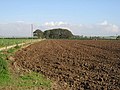 A Harrowing Site - geograph.org.uk - 262097.jpg 640 × 480; 109 KB
-

-
 A mast on the A166, Garrowby Street - geograph.org.uk - 2325638.jpg 800 × 600; 193 KB
-
 A Sunken Farm - geograph.org.uk - 262169.jpg 640 × 480; 98 KB
-
 A tree topped Tumulus in arable crop - geograph.org.uk - 4524375.jpg 4,608 × 3,456; 3.74 MB
-
 A166 and mast. - geograph.org.uk - 2884577.jpg 640 × 480; 37 KB
-
 A166 towards Fridaythorpe - geograph.org.uk - 1838193.jpg 640 × 480; 51 KB
-
 A166 towards York - geograph.org.uk - 1838218.jpg 640 × 480; 47 KB
-

-
 All Saints Church, Kirby Underdale - geograph.org.uk - 4391400.jpg 3,936 × 2,572; 1.73 MB
-
 All Saints Church, Kirby Underdale - geograph.org.uk - 5599366.jpg 796 × 1,600; 464 KB
-
 All Saints Church, Kirby Underdale - geograph.org.uk - 5599378.jpg 1,276 × 1,402; 595 KB
-
 All Saints Church, Kirby Underdale - geograph.org.uk - 5599380.jpg 1,064 × 1,600; 495 KB
-
 All Saints Church, Kirby Underdale - geograph.org.uk - 5599383.jpg 1,228 × 1,600; 627 KB
-
 All Saints Church, Kirby Underdale - geograph.org.uk - 5599428.jpg 1,600 × 1,064; 406 KB
-
 All Saints Church, Kirby Underdale - geograph.org.uk - 5599432.jpg 911 × 1,207; 323 KB
-
 All Saints Church, Kirby Underdale - geograph.org.uk - 5599435.jpg 938 × 1,600; 650 KB
-
 All Saints Church, Kirby Underdale - geograph.org.uk - 5599437.jpg 649 × 1,600; 276 KB
-
 All Saints Church, Kirby Underdale - geograph.org.uk - 5599443.jpg 654 × 1,600; 427 KB
-
 All Saints Church, Kirby Underdale - geograph.org.uk - 5599445.jpg 755 × 1,600; 421 KB
-
 All Saints Church, Kirby Underdale - geograph.org.uk - 5599446.jpg 1,600 × 1,064; 492 KB
-
 All Saints Church, Kirby Underdale - geograph.org.uk - 5599450.jpg 1,600 × 1,064; 685 KB
-

-
 Along Bugthorpe Lane - geograph.org.uk - 3941976.jpg 640 × 427; 55 KB
-
 Along Painsthorpe Lane - geograph.org.uk - 3942016.jpg 640 × 427; 120 KB
-
 Along Painsthorpe Lane - geograph.org.uk - 3942041.jpg 640 × 427; 109 KB
-
 Approaching gloom - geograph.org.uk - 3959000.jpg 1,024 × 768; 215 KB
-
 Approaching Kirby Underdale - geograph.org.uk - 3942008.jpg 640 × 427; 89 KB
-
 Approaching Megdale Plantation - geograph.org.uk - 3966981.jpg 1,024 × 768; 365 KB
-
 Approaching the A166 - geograph.org.uk - 1839390.jpg 640 × 480; 50 KB
-
 At the edge of the Wolds - geograph.org.uk - 6089877.jpg 4,319 × 2,769; 1.87 MB
-
-
 Barns at Painsthorpe Wold Farm - geograph.org.uk - 3942056.jpg 640 × 427; 70 KB
-
 Barns in Painsthorpe - geograph.org.uk - 3942021.jpg 640 × 427; 103 KB
-
 Beech Farm - geograph.org.uk - 4996536.jpg 1,500 × 1,000; 1.59 MB
-
 Bench with a view - geograph.org.uk - 3942001.jpg 640 × 427; 88 KB
-

-
 Boggy Pasture near Megdale Plantation - geograph.org.uk - 1838492.jpg 640 × 480; 123 KB
-
 Bridleway across Painsthorpe Wold - geograph.org.uk - 3942093.jpg 640 × 427; 81 KB
-
 Bridleway along the Roman Road - geograph.org.uk - 3942050.jpg 640 × 427; 74 KB
-
 Bridleway and track to Worm Dale - geograph.org.uk - 4804881.jpg 4,608 × 3,456; 5.7 MB
-

-
 Bridleway in Painsthorpe Wold - geograph.org.uk - 3942072.jpg 640 × 427; 74 KB
-
 Bridleway near Painsthorpe Wold Farm - geograph.org.uk - 1838240.jpg 640 × 480; 47 KB
-
 Bridleway near Painsthrope Wold Farm - geograph.org.uk - 3942070.jpg 640 × 427; 80 KB
-

-
 Bridleway to Thixen Dale - geograph.org.uk - 3959076.jpg 1,024 × 768; 130 KB
-
 Byway at Cheese Cake Wold - geograph.org.uk - 5599704.jpg 1,600 × 1,064; 690 KB
-
 Byway at Megdale Brow - geograph.org.uk - 5599700.jpg 1,600 × 1,064; 1.05 MB
-
 Byway to Garrowby Hill Top - geograph.org.uk - 5600126.jpg 1,600 × 1,064; 949 KB
-
 Byway to Garrowby Hill Top - geograph.org.uk - 5600131.jpg 1,600 × 1,064; 1.19 MB
-
 Byway to Megdale Brow - geograph.org.uk - 5599685.jpg 1,600 × 1,064; 720 KB
-
 Byway to Megdale Brow - geograph.org.uk - 5599688.jpg 1,600 × 1,064; 844 KB
-
 Byway to Megdale Brow - geograph.org.uk - 5599691.jpg 1,600 × 1,064; 1.1 MB
-
 Byway to Megdale Brow - geograph.org.uk - 5599695.jpg 1,600 × 1,064; 885 KB
-
 Byway to Megdale Brow - geograph.org.uk - 5599697.jpg 1,600 × 1,064; 910 KB
-
 Calvary beside A166 near top of Garrowby Hill - geograph.org.uk - 5609293.jpg 5,184 × 2,920; 5.36 MB
-
 Canada Plantation from a Public Footpath - geograph.org.uk - 269914.jpg 640 × 480; 122 KB
-
 Canada Plantation from a Public Footpath - geograph.org.uk - 269923.jpg 640 × 480; 117 KB
-
 Cattle Grid - geograph.org.uk - 3333137.jpg 1,024 × 683; 154 KB
-
 Climbing To The Roman Road - geograph.org.uk - 259608.jpg 640 × 480; 106 KB
-
 Cloudscape, Field and Wood - geograph.org.uk - 259611.jpg 640 × 480; 102 KB
-
 Communication Mast - geograph.org.uk - 125345.jpg 480 × 640; 118 KB
-
 Communication mast off the A166 - geograph.org.uk - 1839381.jpg 491 × 640; 48 KB
-
 Communications Mast on Garrowby Hill - geograph.org.uk - 4516943.jpg 1,024 × 768; 107 KB
-
 Cross, Kirby Underdale - geograph.org.uk - 1838474.jpg 480 × 640; 61 KB
-
 Dutch barn at Painsthorpe Wold Farm - geograph.org.uk - 3967322.jpg 1,024 × 768; 132 KB
-
 Edge of a plantation - geograph.org.uk - 3958996.jpg 1,024 × 768; 275 KB
-
 Electricity pole and Fordham Plantation - geograph.org.uk - 3959070.jpg 1,024 × 768; 138 KB
-
 Entering Kirby Underdale - geograph.org.uk - 3959064.jpg 1,024 × 768; 176 KB
-
 Estate cottages at Kirby Underdale - geograph.org.uk - 3966972.jpg 1,024 × 768; 224 KB
-
 Farm alongside track to Painsthorpe Lane - geograph.org.uk - 4804831.jpg 4,608 × 3,456; 6.13 MB
-
 Farm road descending to Megdale Plantation - geograph.org.uk - 4996526.jpg 1,500 × 745; 1.33 MB
-
 Farm road heading north - geograph.org.uk - 4996516.jpg 1,500 × 1,000; 1.37 MB
-
 Farm track leading to Uncleby Hill (road) - geograph.org.uk - 5599231.jpg 1,600 × 1,064; 700 KB
-
 Farm track leading to Uncleby Hill (road) - geograph.org.uk - 5599239.jpg 1,600 × 1,064; 695 KB
-
 Farm track near Fordham Farm - geograph.org.uk - 1838226.jpg 640 × 480; 86 KB
-
 Farm, Garrowby Hill Top - geograph.org.uk - 1838509.jpg 640 × 357; 40 KB
-
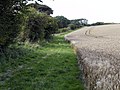
 Farmland beside the Roman Road - geograph.org.uk - 3942047.jpg 640 × 427; 87 KB
-

-
 Farmland looking Buck Wood - geograph.org.uk - 1838505.jpg 640 × 480; 75 KB
-

-

-
 Farmland near Glebe Farm - geograph.org.uk - 1838432.jpg 640 × 480; 81 KB
-
 Farmland near Howe Lane - geograph.org.uk - 3942005.jpg 640 × 427; 87 KB
-
 Farmland near Uncleby - geograph.org.uk - 1838413.jpg 640 × 480; 83 KB
-
 Farmland near Wayrham Farm - geograph.org.uk - 1839400.jpg 640 × 480; 89 KB
-
 Farmland off Howe Lane - geograph.org.uk - 3941981.jpg 640 × 427; 73 KB
-
 Farmland off Painsthorpe Lane - geograph.org.uk - 3942015.jpg 640 × 427; 84 KB
-
 Farmland on the north side of Callis Wold - geograph.org.uk - 3524653.jpg 1,024 × 768; 156 KB
-
 Farmland, Cheese Cake Wold - geograph.org.uk - 1838502.jpg 640 × 480; 116 KB
-
 Field on south side of Painsthorpe Lane - geograph.org.uk - 4996543.jpg 1,499 × 778; 909 KB
-
 Field south of Kirby Underdale - geograph.org.uk - 2659545.jpg 4,032 × 3,024; 3.92 MB
-
 Field to Glebe Farm - geograph.org.uk - 2772173.jpg 3,264 × 2,448; 1.84 MB
-
 Fields off Bugthorpe Lane - geograph.org.uk - 3941978.jpg 640 × 427; 58 KB
-
 Fields west of Kirby Underdale - geograph.org.uk - 2772167.jpg 640 × 480; 82 KB
-
 Fifty-six pound weight - geograph.org.uk - 4996520.jpg 1,500 × 1,000; 1.76 MB
-
 Footbridge over Kirby Beck at Kirby Underdale - geograph.org.uk - 5599358.jpg 1,600 × 1,064; 1.02 MB
-
 Footbridge over Uncleby Beck - geograph.org.uk - 5599265.jpg 1,600 × 1,064; 1.07 MB
-
 Footpath at Painsthorpe - geograph.org.uk - 3967058.jpg 1,024 × 768; 415 KB
-
 Footpath near Painsthorpe Hall - geograph.org.uk - 1838489.jpg 640 × 480; 86 KB
-
 Footpath through fields called Fitteses - geograph.org.uk - 4242062.jpg 4,000 × 3,000; 2.64 MB
-
 Footpath to Uncleby - geograph.org.uk - 6089888.jpg 4,319 × 2,752; 1.59 MB
-
 Footpath to Wood Leys - geograph.org.uk - 1439613.jpg 640 × 480; 101 KB
-
 Fordham Dale - geograph.org.uk - 5984557.jpg 1,024 × 768; 140 KB
-
 Former Rectory, Kirby Underdale - geograph.org.uk - 5599680.jpg 1,600 × 1,064; 548 KB
-
 Furrowed field on Garrowby Wold - geograph.org.uk - 4996518.jpg 1,500 × 793; 1.25 MB
-
 Garrowby Estate - geograph.org.uk - 3166937.jpg 2,362 × 1,663; 2.06 MB
-
 Garrowby Hill transmitter - geograph.org.uk - 5532736.jpg 768 × 1,024; 549 KB
-
 Gate pillar at the Old Rectory - geograph.org.uk - 3966908.jpg 768 × 1,024; 301 KB
-
 Gatehowe Road - geograph.org.uk - 3941999.jpg 640 × 427; 81 KB
-
 Glebe Farm - geograph.org.uk - 1838428.jpg 640 × 480; 89 KB
-
 Halifax graves - geograph.org.uk - 3967028.jpg 1,024 × 768; 249 KB
-
 Harrow at rest - geograph.org.uk - 3967323.jpg 1,024 × 768; 321 KB
-
 Harrowing - geograph.org.uk - 262095.jpg 640 × 480; 106 KB
-
 Harvest time^ - geograph.org.uk - 1437816.jpg 640 × 480; 70 KB
-
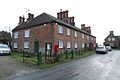
 Houses on Painsthorpe Lane, Kirby Underdale - geograph.org.uk - 5599681.jpg 1,600 × 1,064; 423 KB
-
 Howe Lane - geograph.org.uk - 3941982.jpg 640 × 427; 123 KB
-
 Hundle Dale and South Wold Dale - geograph.org.uk - 1350998.jpg 640 × 480; 70 KB
-
 Junction for Thixendale - geograph.org.uk - 3942521.jpg 640 × 427; 70 KB
-
 Kirby Underdale - geograph.org.uk - 3942009.jpg 640 × 427; 73 KB
-
 Kirby Underdale - geograph.org.uk - 4996527.jpg 1,500 × 730; 1,009 KB
-
 Kirby Underdale Church - geograph.org.uk - 3942011.jpg 640 × 427; 99 KB
-
 Kirby Underdale from the South - geograph.org.uk - 2772163.jpg 3,264 × 2,448; 1.98 MB
-
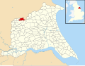 Kirby Underdale UK parish locator map.svg 1,425 × 1,107; 1.68 MB
-
 Lake at Painsthorpe - geograph.org.uk - 3967039.jpg 1,024 × 768; 150 KB
-

-
 Looking down Water Lane - geograph.org.uk - 3966984.jpg 1,024 × 768; 354 KB
-
 Looking north towards Uncleby Wold - geograph.org.uk - 2325649.jpg 800 × 600; 286 KB
-
 Looking towards Kirby Underdale from the Roman Road - geograph.org.uk - 1880214.jpg 1,600 × 1,200; 253 KB
-

-
 Main Street Kirby Underdale.jpg 640 × 427; 64 KB
-
 Manor Farm, Uncleby - geograph.org.uk - 5599252.jpg 1,600 × 1,064; 1.15 MB
-
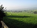
 Megdale - geograph.org.uk - 172245.jpg 640 × 480; 146 KB
-
 Megdale - geograph.org.uk - 3967019.jpg 1,024 × 768; 114 KB
-
 Megdale and the Wolds edge - geograph.org.uk - 3967023.jpg 1,024 × 768; 149 KB
-
 Megdale Brow - geograph.org.uk - 3967013.jpg 1,024 × 768; 151 KB
-
 Megdale Plantation - geograph.org.uk - 1838496.jpg 640 × 480; 160 KB
-

-
 Minor Road off Stone Dale - geograph.org.uk - 3905851.jpg 800 × 532; 260 KB
-
 Near the head of Wayrham Dale - geograph.org.uk - 3967774.jpg 1,024 × 768; 223 KB
-
 Northdale Head - geograph.org.uk - 4254346.jpg 1,024 × 768; 153 KB
-
 Not All The Mist Dispersed - geograph.org.uk - 259603.jpg 640 × 480; 100 KB
-
 Oilseed rape field, Garrowby Hill Top - geograph.org.uk - 3524252.jpg 1,024 × 768; 165 KB
-
 Old School Kirby Underdale.jpg 640 × 427; 61 KB
-
 One of the two Garrowby Reservoirs - geograph.org.uk - 3524289.jpg 1,024 × 768; 154 KB
-
 Out into the sun - geograph.org.uk - 3967738.jpg 1,024 × 768; 193 KB
-
 Painsthorpe Dale - geograph.org.uk - 3967069.jpg 1,024 × 768; 164 KB
-
 Painsthorpe Dale - geograph.org.uk - 4804855.jpg 4,606 × 3,452; 5.42 MB
-
 Painsthorpe Farm - geograph.org.uk - 3942032.jpg 640 × 427; 90 KB
-
 Painsthorpe Hall - geograph.org.uk - 1838483.jpg 640 × 506; 65 KB
-
 Painsthorpe Hall - geograph.org.uk - 3959067.jpg 1,024 × 768; 177 KB
-
 Painsthorpe Hall from public footpath - geograph.org.uk - 3801131.jpg 4,000 × 2,664; 2.76 MB
-
 Painsthorpe Lane - geograph.org.uk - 3942024.jpg 427 × 640; 100 KB
-
 Painsthorpe Lane - geograph.org.uk - 3942035.jpg 640 × 427; 70 KB
-
 Painsthorpe Lane approaching Painsthorpe - geograph.org.uk - 4804838.jpg 4,608 × 3,456; 4.88 MB
-
 Painsthorpe Wold Farm - geograph.org.uk - 1838236.jpg 640 × 480; 73 KB
-
 Painsthorpe Wold Farm - geograph.org.uk - 3942053.jpg 640 × 427; 91 KB
-
 Painsthorpe Wold Farm - geograph.org.uk - 3967314.jpg 1,024 × 768; 221 KB
-
 Painsthorpe Wold Farm in the mist - geograph.org.uk - 4254865.jpg 1,024 × 768; 98 KB
-
 Path leading to Kirby Underdale - geograph.org.uk - 5651342.jpg 1,600 × 1,064; 699 KB
-
 Path leading to Longhowes Plantation - geograph.org.uk - 5595208.jpg 1,600 × 1,064; 771 KB
-
 Path leading to Longhowes Plantation - geograph.org.uk - 5595210.jpg 1,600 × 1,064; 1.14 MB
-
 Path leading to Longhowes Plantation - geograph.org.uk - 5595214.jpg 1,600 × 1,064; 999 KB
-
 Path leading to Longhowes Plantation - geograph.org.uk - 5595216.jpg 1,600 × 1,064; 974 KB
-
 Path leading to Longhowes Plantation - geograph.org.uk - 5595219.jpg 1,600 × 1,064; 969 KB
-
 Path leading to Longhowes Plantation - geograph.org.uk - 5595220.jpg 1,600 × 1,064; 988 KB
-
 Path leading to Longhowes Plantation - geograph.org.uk - 5595261.jpg 1,600 × 1,064; 827 KB
-
 Path leading to Longhowes Plantation - geograph.org.uk - 5595267.jpg 1,600 × 1,044; 781 KB
-
 Path leading to Longhowes Plantation - geograph.org.uk - 5595268.jpg 1,600 × 1,064; 842 KB
-
 Path leading towards Kirby Underdale - geograph.org.uk - 5599256.jpg 1,600 × 1,064; 925 KB
-
 Path leading towards Kirby Underdale - geograph.org.uk - 5599259.jpg 1,600 × 1,064; 1.01 MB
-
 Permitted Bridleway south of Kirby Underdale - geograph.org.uk - 2659540.jpg 4,032 × 3,024; 5.24 MB
-
 Picnic area off the A166 - geograph.org.uk - 1838173.jpg 640 × 480; 131 KB
-
 Pit and beech trees - geograph.org.uk - 4254351.jpg 1,024 × 713; 142 KB
-
 Plantation along Megdale Brow - geograph.org.uk - 4524429.jpg 4,608 × 3,456; 5.79 MB
-

-
 Postbox on Painsthorpe Lane, Kirby Underdale - geograph.org.uk - 5651348.jpg 1,600 × 1,064; 717 KB
-
 Road sign on the outskirts of Kirby Underdale - geograph.org.uk - 3333146.jpg 1,024 × 683; 206 KB
-
 Road to Kirby Underdale - geograph.org.uk - 3942006.jpg 640 × 427; 81 KB
-
 Roadway to Broadholme Farm - geograph.org.uk - 3967329.jpg 1,024 × 768; 136 KB
-
 Roman Road towards Uncleby Wold - geograph.org.uk - 1838305.jpg 640 × 480; 80 KB
-
 Salamanca Beck - geograph.org.uk - 1838443.jpg 640 × 480; 150 KB
-
 Salamanca Beck - geograph.org.uk - 2772179.jpg 3,264 × 2,448; 3.09 MB
-
 Sheep above Painsthorpe Dale - geograph.org.uk - 3942045.jpg 640 × 427; 88 KB
-
 Slope with hawthorn bushes - geograph.org.uk - 4996594.jpg 1,500 × 1,000; 1.97 MB
-
 Snow blown trees at the head of Painsthorpe Dale - geograph.org.uk - 4804867.jpg 3,328 × 4,514; 7.55 MB
-
 South Wold Dale - geograph.org.uk - 3959062.jpg 1,024 × 768; 174 KB
-
 South Wold Dale and spring fed pond in bottom - geograph.org.uk - 4804820.jpg 4,608 × 3,456; 6.17 MB
-
 South Wold Dale with Kirby Beck in the bottom - geograph.org.uk - 4804805.jpg 4,608 × 3,456; 5.45 MB
-
 South Wold Farm - geograph.org.uk - 4517427.jpg 1,024 × 768; 156 KB
-
 Stacked timber alongside track to Megdale Brow - geograph.org.uk - 4524416.jpg 4,608 × 3,456; 5.96 MB
-
 Stubble field at Glebe Farm - geograph.org.uk - 3117008.jpg 3,264 × 2,448; 1.95 MB
-
 The beginning of the path to Painsthorpe - geograph.org.uk - 3966977.jpg 1,024 × 768; 182 KB
-
 The junction with Painthorpe Lane (left) - geograph.org.uk - 2325656.jpg 800 × 600; 178 KB
-
 The lake below Painsthorpe Hall - geograph.org.uk - 3333153.jpg 1,024 × 683; 268 KB
-
 The Prospect Of A Walk - geograph.org.uk - 261802.jpg 640 × 480; 101 KB
-
 The Road To Breckenholme Farm - geograph.org.uk - 262102.jpg 640 × 480; 107 KB
-
 The Roman Road, The Bence - geograph.org.uk - 1319178.jpg 640 × 427; 305 KB


_-_geograph.org.uk_-_2138158.jpg)


_-_geograph.org.uk_-_5599231.jpg)
_-_geograph.org.uk_-_5599239.jpg)


_-_geograph.org.uk_-_2325656.jpg)


