Category:Kirche Cämmerswalde
Jump to navigation
Jump to search
| Object location | | View all coordinates using: OpenStreetMap |
|---|
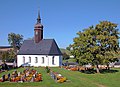
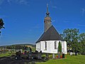
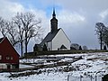
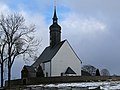
church building in Neuhausen, Germany  | |||||
| Upload media | |||||
| Instance of | |||||
|---|---|---|---|---|---|
| Location | Neuhausen, Mittelsachsen, Saxony, Germany | ||||
| Heritage designation | |||||
 | |||||
| (Wikidata) |
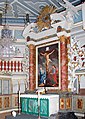
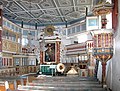
Media in category "Kirche Cämmerswalde"
The following 36 files are in this category, out of 36 total.
-
 20060923060DR Cämmerswalde (Neuhausen) Dorfkirche.jpg 2,433 × 1,772; 2.89 MB
-
 20060923065DR Cämmerswalde (Neuhausen) Dorfkirche.jpg 2,464 × 1,868; 2.48 MB
-
 20060923070DR Cämmerswalde (Neuhausen) Dorfkirche.jpg 1,352 × 1,467; 1.56 MB
-
 20060925160MDR Cämmerswalde (Neuhausen) Dorfkirche Altar.jpg 2,468 × 1,878; 3.45 MB
-
 20060925165DR Cämmerswalde (Neuhausen) Dorfkirche Altar.jpg 1,778 × 2,496; 3.79 MB
-
 20060925170DR Cämmerswalde (Neuhausen) Dorfkirche Altarbild.jpg 1,232 × 1,871; 2.1 MB
-
 20060925175DR Cämmerswalde (Neuhausen) Dorfkirche Kanzel.jpg 2,461 × 1,869; 3.39 MB
-
 20060925180DR Cämmerswalde (Neuhausen) Dorfkirche Kanzel.jpg 2,509 × 1,916; 3.6 MB
-
 20060925185DR Cämmerswalde (Neuhausen) Dorfkirche.jpg 2,502 × 1,875; 3.15 MB
-
 20060925190DR Cämmerswalde (Neuhausen) Dorfkirche Holzfiguren.jpg 2,018 × 1,554; 1.59 MB
-
 20060925195DR Cämmerswalde (Neuhausen) Dorfkirche Kanzel.jpg 1,728 × 2,487; 2.66 MB
-
 20060925200DR Cämmerswalde (Neuhausen) Dorfkirche Taufstein.jpg 1,582 × 2,379; 2.31 MB
-
 20060925205DR Cämmerswalde (Neuhausen) Dorfkirche Orgel.jpg 2,506 × 1,812; 3.57 MB
-
 Caemmerswalde 2009-April-004.JPG 1,944 × 2,592; 1.25 MB
-
 Caemmerswalde 2009-April-005.JPG 1,944 × 2,592; 666 KB
-
 Caemmerswalde 2009-April-006.JPG 1,944 × 2,592; 553 KB
-
 Caemmerswalde 2009-April-007.JPG 1,017 × 706; 212 KB
-
 Caemmerswalde 2009-April-008.JPG 1,944 × 2,592; 1.29 MB
-
 Caemmerswalde kirche.JPG 2,592 × 1,944; 2 MB
-
 Cämmerswalde Oehme-Orgel 16062011.jpg 1,300 × 975; 323 KB
-
 Cämmerswalde-Friedhof-1.jpg 3,509 × 1,974; 1.93 MB
-
 Cämmerswalde-Friedhof-2.jpg 2,752 × 1,835; 1.41 MB
-
 Cämmerswalde-Kirche-1.jpg 3,557 × 3,680; 2.1 MB
-
 Cämmerswalde-Kirche-2.jpg 2,276 × 3,035; 1.57 MB
-
 Cämmerswalde-Kirche-3.jpg 3,344 × 2,508; 1.74 MB
-
 Cämmerswalde-Kirche-4.jpg 3,270 × 3,234; 1.82 MB
-
 Cämmerswalde-Kirche-5.jpg 2,251 × 3,001; 1.47 MB
-
 Cämmerswalde-Kirche-6.jpg 3,083 × 2,312; 1.84 MB
-
 Cämmerswalde-Kirche-7.jpg 2,980 × 2,235; 1.74 MB
-
 Cämmerswalde-Kirche-8.jpg 2,401 × 3,201; 1.65 MB
-
 Cämmerswalde-Kriegerdenkmal-1.jpg 2,478 × 3,304; 1.42 MB
-
 Cämmerswalde-Kriegerdenkmal-2.jpg 2,310 × 3,080; 1.41 MB
-
 Kirche Cämmerswalde (1).jpg 4,864 × 3,648; 5.96 MB
-
 Kirche Cämmerswalde (2).jpg 4,864 × 3,648; 5.77 MB
-
 Kirche Cämmerswalde (3).jpg 4,864 × 3,648; 5.17 MB
-
 Kirche Cämmerswalde (4).jpg 3,648 × 4,864; 4.99 MB
_Dorfkirche.jpg)
_Dorfkirche.jpg)
_Dorfkirche.jpg)
_Dorfkirche_Altar.jpg)
_Dorfkirche_Altar.jpg)
_Dorfkirche_Altarbild.jpg)
_Dorfkirche_Kanzel.jpg)
_Dorfkirche_Kanzel.jpg)
_Dorfkirche.jpg)
_Dorfkirche_Holzfiguren.jpg)
_Dorfkirche_Kanzel.jpg)
_Dorfkirche_Taufstein.jpg)
_Dorfkirche_Orgel.jpg)


.jpg)
.jpg)
.jpg)
.jpg)