Category:Kirche Dürrweitzschen (Grimma)
Jump to navigation
Jump to search
| Object location | | View all coordinates using: OpenStreetMap |
|---|
church building in Dürrweitzschen, Germany  | |||||
| Upload media | |||||
| Instance of | |||||
|---|---|---|---|---|---|
| Location | Grimma, Landkreis Leipzig, Saxony, Germany | ||||
| Street address |
| ||||
| Heritage designation | |||||
| Inception |
| ||||
 | |||||
| (Wikidata) |
Media in category "Kirche Dürrweitzschen (Grimma)"
The following 13 files are in this category, out of 13 total.
-
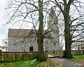 20100413220DR Dürrweitzschen (Grimma) Dorfkirche.jpg 2,406 × 1,899; 5 MB
-
 20100413225DR Dürrweitzschen (Grimma) Dorfkirche Altar.jpg 2,399 × 1,908; 2.71 MB
-
 20100413230DR Dürrweitzschen (Grimma) Dorfkirche Altar.jpg 1,441 × 1,989; 1.21 MB
-
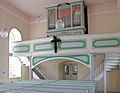 20100413235DR Dürrweitzschen (Grimma) Dorfkirche Orgel.jpg 2,422 × 1,887; 3 MB
-
 DürrweitzschenKirche.JPG 3,648 × 2,736; 2.3 MB
-
 Kirche Dürrweitzschen (Grimma) - Ansicht Kirchturm.jpg 3,024 × 4,032; 5.07 MB
-
 Kirche Dürrweitzschen (Grimma) - Ansicht Nebengebäude.jpg 4,032 × 3,024; 8.25 MB
-
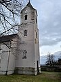
 Kirche Dürrweitzschen (Grimma) - Frontansicht.jpg 4,032 × 3,024; 6.28 MB
-
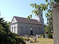
 Kirche Dürrweitzschen (Grimma) - historisches Grabmal.jpg 3,024 × 4,032; 5.33 MB
-
 Kirche Dürrweitzschen (Grimma) - Nebengebäude.jpg 4,013 × 2,724; 6.86 MB
-
 Kirche Dürrweitzschen (Grimma) - Seitenansicht mit Grabmal.jpg 4,032 × 3,024; 4.99 MB
-
 Kirche Dürrweitzschen (Grimma) - Seitenansicht.jpg 4,000 × 2,635; 3.48 MB
-
 Kirche Dürrweitzschen (Grimma) - Turm und Nebengebäude.jpg 3,002 × 3,441; 5.43 MB
_Dorfkirche.jpg)
_Dorfkirche_Altar.jpg)
_Dorfkirche_Altar.jpg)
_Dorfkirche_Orgel.jpg)
_-_Ansicht_Kirchturm.jpg)
_-_Ansicht_Nebengeb%C3%A4ude.jpg)
_-_Frontansicht.jpg)
_-_historisches_Grabmal.jpg)
_-_Nebengeb%C3%A4ude.jpg)
_-_Seitenansicht_mit_Grabmal.jpg)
_-_Seitenansicht.jpg)
_-_Turm_und_Nebengeb%C3%A4ude.jpg)