Category:Kirche Kotitz
Jump to navigation
Jump to search
| Object location | | View all coordinates using: OpenStreetMap |
|---|
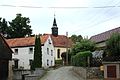
church building in Weißenberg, Germany  | |||||
| Upload media | |||||
| Instance of | |||||
|---|---|---|---|---|---|
| Location | Kotitz/Kotecy, Q1787204, Saxony, Germany | ||||
| Street address |
| ||||
| Heritage designation | |||||
 | |||||
Media in category "Kirche Kotitz"
The following 11 files are in this category, out of 11 total.
-
 Kotecy Jana Kilianowa dróha.JPG 1,534 × 2,300; 2.23 MB
-
 Kotečanska cyrkej 1.JPG 1,534 × 2,300; 1.56 MB
-
 Kotečanska cyrkej 2.JPG 2,300 × 1,534; 2.22 MB
-
 Kotečanska cyrkej 3.JPG 1,534 × 2,300; 1.99 MB
-
 Kotečanska cyrkej 7.jpg 3,500 × 2,334; 5.25 MB
-
 Weißenberg Kotitz - Jan-Kilian-Straße - Kirche 01 ies.jpg 5,616 × 3,744; 14.11 MB
-
 Weißenberg Kotitz - Jan-Kilian-Straße - Kirche 02 ies.jpg 5,616 × 3,744; 13.88 MB
-
 Weißenberg Kotitz - Jan-Kilian-Straße - Kirche 03 ies.jpg 5,616 × 3,744; 11.77 MB
-
 Weißenberg Kotitz - Jan-Kilian-Straße - Kirche 04 ies.jpg 5,616 × 3,744; 17.21 MB
-
 Weißenberg Kotitz - Jan-Kilian-Straße - Kirche 05 ies.jpg 5,616 × 3,744; 19.44 MB
-
 Weißenberg Kotitz - Jan-Kilian-Straße+Kirche 01 ies.jpg 5,616 × 3,744; 12.15 MB


