Category:Kirche Wengelsdorf
Jump to navigation
Jump to search
| Object location | | View all coordinates using: OpenStreetMap |
|---|
church in Wengelsdorf, Germany  | |||||
| Upload media | |||||
| Instance of | |||||
|---|---|---|---|---|---|
| Location | Weißenfels, Burgenlandkreis, Saxony-Anhalt, Germany | ||||
| Heritage designation | |||||
 | |||||
This is the category of the Saxony-Anhalt Kulturdenkmal (cultural heritage monument) with the ID 09412172 (Wikidata)
|
Subcategories
This category has only the following subcategory.
M
Media in category "Kirche Wengelsdorf"
The following 8 files are in this category, out of 8 total.
-
 Kirche-Wengelsdorf.jpg 675 × 900; 226 KB
-
 Wengelsdorf, Dorfkirche 1, Westturm.jpg 3,000 × 3,549; 3.79 MB
-
 Wengelsdorf, Dorfkirche 2, von Südosten.jpg 3,063 × 2,255; 2.72 MB
-
 Wengelsdorf, Dorfkirche 3, von Osten.jpg 3,000 × 4,000; 4.86 MB
-
 Wengelsdorf, Dorfkirche 4, Portal.jpg 3,000 × 4,000; 4 MB
-
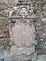
 Wengelsdorf, Dorfkirche, Grabstein 1.jpg 3,000 × 4,000; 4.71 MB
-
 Wengelsdorf, Dorfkirche, Grabstein 2.jpg 3,000 × 4,000; 4.35 MB
-
 WengelsdorfKirche.JPG 3,462 × 2,670; 1.91 MB


