Category:Kirchenbogen (Dorfplatz, Steinen SZ)
Jump to navigation
Jump to search
| Object location | | View all coordinates using: OpenStreetMap |
|---|
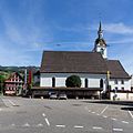
secular building in front of the parish church in Steinen in the canton of Schwyz in Switzerland .jpg) | |||||
| Upload media | |||||
| Instance of | |||||
|---|---|---|---|---|---|
| Part of | |||||
| Location | Steinen, Schwyz District, Schwyz, Switzerland | ||||
| Street address |
| ||||
| Inception |
| ||||
 | |||||
Media in category "Kirchenbogen (Dorfplatz, Steinen SZ)"
The following 3 files are in this category, out of 3 total.
-
 2017-Steinen-Kirchenbogen (cropped).jpg 1,024 × 669; 980 KB
-
 2017-Steinen-Kirchenbogen.jpg 1,280 × 1,280; 1.71 MB
-
 St-Jakob-SteinenSZ-B4034726.jpg 2,865 × 2,175; 4.18 MB

