Category:Kircubbin, County Down
Jump to navigation
Jump to search
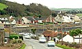
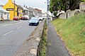
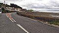
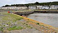
English: Kircubbin is a village in County Down, Northern Ireland on the shores of Strangford Lough, between Newtownards and Portaferry.
village in County Down, Northern Ireland, UK  | |||||
| Upload media | |||||
| Instance of | |||||
|---|---|---|---|---|---|
| Location | Northern Ireland | ||||
 | |||||
Media in category "Kircubbin, County Down"
The following 58 files are in this category, out of 58 total.
-
 "Gilmore's", Kircubbin - geograph.org.uk - 2577663.jpg 614 × 645; 93 KB
-
 A20, Rowreagh Road - geograph.org.uk - 2907465.jpg 640 × 480; 86 KB
-
 Approaching Kircubbin - geograph.org.uk - 1126688.jpg 640 × 381; 85 KB
-
 Arable land seawards of Rowreagh Road - geograph.org.uk - 2986587.jpg 1,024 × 766; 94 KB
-
 Ballyhemlin Road near Kircubbin - geograph.org.uk - 806650.jpg 640 × 555; 281 KB
-
 Bus, Kircubbin - geograph.org.uk - 3569697.jpg 640 × 365; 71 KB
-
 Church clock, Kircubbin - geograph.org.uk - 3569674.jpg 640 × 519; 95 KB
-
 Coastal drumlin, Kircubbin - geograph.org.uk - 2577494.jpg 640 × 339; 58 KB
-
 Coastal farmland south of Kircubbin - geograph.org.uk - 2986578.jpg 1,024 × 754; 132 KB
-
 Cook's Brae, Kircubbin - geograph.org.uk - 3569739.jpg 640 × 419; 98 KB
-
 Coulter's Hill, Rowreagh - geograph.org.uk - 1509897.jpg 640 × 480; 107 KB
-
 Flush Bracket, Kircubbin - geograph.org.uk - 2005892.jpg 590 × 640; 196 KB
-
 Gransha Road, Kircubbin - geograph.org.uk - 1509995.jpg 640 × 480; 86 KB
-
 Holy Trinity Church, Kircubbin - geograph.org.uk - 738492.jpg 512 × 640; 63 KB
-
 K6 telephone box, Kircubbin (2013-1) - geograph.org.uk - 3569656.jpg 640 × 383; 111 KB
-
 K6 telephone box, Kircubbin (2013-2) - geograph.org.uk - 3569659.jpg 640 × 455; 69 KB
-
 K6 telephone box, Kircubbin (2013-3) - geograph.org.uk - 3569660.jpg 640 × 412; 95 KB
-
 Kircubbin - geograph.org.uk - 5100960.jpg 640 × 360; 327 KB
-
 Kircubbin Bay (1) - geograph.org.uk - 806659.jpg 640 × 480; 255 KB
-
 Kircubbin Bay (2) - geograph.org.uk - 806660.jpg 640 × 522; 309 KB
-
 Kircubbin Bay and Boatyard - geograph.org.uk - 3590.jpg 640 × 202; 22 KB
-
 Kircubbin Bay from the air - geograph.org.uk - 1440181.jpg 640 × 427; 41 KB
-
 Kircubbin harbour (1) - geograph.org.uk - 2577416.jpg 640 × 379; 88 KB
-
 Kircubbin harbour (2) - geograph.org.uk - 2577436.jpg 640 × 366; 98 KB
-
 Kircubbin Harbour - geograph.org.uk - 24115.jpg 640 × 427; 66 KB
-
 Kircubbin Presbyterian Church - geograph.org.uk - 2986542.jpg 1,024 × 549; 85 KB
-
 Kircubbin Village from the air - geograph.org.uk - 1442596.jpg 640 × 427; 93 KB
-
 Letter box, Kircubbin (2) - geograph.org.uk - 3569762.jpg 640 × 457; 99 KB
-
 Letter box, Kircubbin - geograph.org.uk - 3569718.jpg 640 × 409; 105 KB
-
 Lisbane Chapel - geograph.org.uk - 1510037.jpg 640 × 480; 88 KB
-
 Lisbane Roman Catholic Church - geograph.org.uk - 878450.jpg 640 × 480; 57 KB
-
 Main Street, Kircubbin (1) - geograph.org.uk - 738490.jpg 640 × 530; 79 KB
-
 Main Street, Kircubbin (2) - geograph.org.uk - 738491.jpg 640 × 373; 59 KB
-
 Monaghan Bank off Kircubbin - geograph.org.uk - 2986548.jpg 1,024 × 749; 69 KB
-
 Mooring post, Kircubbin - geograph.org.uk - 2577452.jpg 640 × 362; 110 KB
-
 Parsonage Road near Kircubbin - geograph.org.uk - 806651.jpg 640 × 482; 226 KB
-
 Parsonage Road, Kircubbin - geograph.org.uk - 806655.jpg 640 × 622; 335 KB
-
 Pillar box, Kircubbin - geograph.org.uk - 2577567.jpg 640 × 388; 65 KB
-
 Pineapple gate pillar, Kircubbin - geograph.org.uk - 3569865.jpg 560 × 518; 102 KB
-
 Public toilets, Kircubbin - geograph.org.uk - 3569561.jpg 640 × 387; 56 KB
-
 Rowreagh Townland - geograph.org.uk - 2907464.jpg 640 × 480; 51 KB
-
 Saltings at Doctor's Bay, Kircubbin - geograph.org.uk - 2986571.jpg 1,024 × 509; 72 KB
-
 Sanctuary Cove from the air - geograph.org.uk - 1440195.jpg 640 × 427; 93 KB
-
 Sign and Field at Echlinville - geograph.org.uk - 1509951.jpg 640 × 480; 164 KB
-
 Solar panel, Kircubbin - geograph.org.uk - 2577585.jpg 640 × 416; 163 KB
-
 Strangford Lough near Kircubbin - geograph.org.uk - 2326945.jpg 640 × 480; 36 KB
-
 Sunset over Strangord Lough - geograph.org.uk - 586277.jpg 640 × 480; 43 KB
-
 Telephone box, Kircubbin - geograph.org.uk - 2931641.jpg 640 × 401; 85 KB
-
 The Ballybryan Road near Kircubbin - geograph.org.uk - 513662.jpg 640 × 427; 97 KB
-
 The loughshore near Kircubbin - geograph.org.uk - 265677.jpg 640 × 426; 145 KB
-
 The main street, Kircubbin - geograph.org.uk - 2577554.jpg 640 × 346; 61 KB
-
 The Saltwater Brig - geograph.org.uk - 878446.jpg 640 × 480; 67 KB
-
 The Ulster Bank, Kircubbin - geograph.org.uk - 3569903.jpg 640 × 422; 77 KB
-
 Towards Inishargy - geograph.org.uk - 806667.jpg 640 × 399; 224 KB
-
 Tubber Road, Kircubbin - geograph.org.uk - 1510044.jpg 640 × 480; 108 KB
-
 Vacant terrace, Kircubbin - geograph.org.uk - 3569887.jpg 640 × 408; 87 KB
-
 Very Cheap Fuel at Saltwater Bridge^ - geograph.org.uk - 1510033.jpg 640 × 480; 71 KB
-
 View northwestwards across Kircubbin Bay - geograph.org.uk - 2986524.jpg 1,024 × 736; 95 KB


_-_geograph.org.uk_-_3569656.jpg)
_-_geograph.org.uk_-_3569659.jpg)
_-_geograph.org.uk_-_3569660.jpg)

_-_geograph.org.uk_-_806659.jpg)
_-_geograph.org.uk_-_806660.jpg)

_-_geograph.org.uk_-_2577416.jpg)
_-_geograph.org.uk_-_2577436.jpg)


_-_geograph.org.uk_-_3569762.jpg)


_-_geograph.org.uk_-_738490.jpg)
_-_geograph.org.uk_-_738491.jpg)


