Category:Kirk Bramwith
Jump to navigation
Jump to search
English: Kirk Bramwith is a village and civil parish in the Metropolitan Borough of Doncaster in South Yorkshire, England. It has a population of 200.
Nederlands: Kirk Bramwith is een dorp (village) en civil parish in het bestuurlijke gebied Doncaster, in het Engelse graafschap South Yorkshire. De civil parish telt
village and civil parish in South Yorkshire, United Kingdom | |||||
| Upload media | |||||
| Instance of | |||||
|---|---|---|---|---|---|
| Location | Doncaster, South Yorkshire, Yorkshire and the Humber, England | ||||
| Population |
| ||||
 | |||||
Subcategories
This category has the following 2 subcategories, out of 2 total.
B
- Braithwaite, South Yorkshire (7 F)
M
Media in category "Kirk Bramwith"
The following 175 files are in this category, out of 175 total.
-
-
 A snowy Lodge Lane - geograph.org.uk - 1657733.jpg 640 × 480; 75 KB
-

-
 Amenities and Road Junction in Braithwaite - geograph.org.uk - 5495476.jpg 3,152 × 2,329; 2.2 MB
-
 Beside the River Don at Stainforth - geograph.org.uk - 4283579.jpg 4,000 × 2,248; 4.01 MB
-
 Braithwaite Lodge - geograph.org.uk - 3923933.jpg 1,024 × 614; 66 KB
-
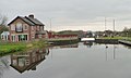
 Bramwith Swing Bridge - geograph.org.uk - 5209.jpg 640 × 359; 40 KB
-
 Bridge over a drain east of Kirk Bramwith - geograph.org.uk - 3842026.jpg 1,600 × 1,200; 570 KB
-
 Bridge over New Junction Canal - geograph.org.uk - 2429069.jpg 1,600 × 1,200; 345 KB
-
 Bridge over the disused railway west of Braithwaite - geograph.org.uk - 4827524.jpg 1,600 × 1,200; 595 KB
-
 Bringing a boat through Top Lane Bridge (2) - geograph.org.uk - 3170959.jpg 1,024 × 768; 165 KB
-
 Bringing a boat through Top Lane Bridge (3) - geograph.org.uk - 3170964.jpg 1,024 × 793; 144 KB
-
 Bringing a boat through Top Lane Bridge (4) - geograph.org.uk - 3170966.jpg 1,024 × 822; 146 KB
-
 Bringing a boat through Top Lane Bridge (5) - geograph.org.uk - 3170972.jpg 1,024 × 663; 137 KB
-
 Bringing a boat through Top Lane Bridge (6) - geograph.org.uk - 3170984.jpg 1,024 × 768; 150 KB
-
 Bringing a boat through Top Lane Bridge (7) - geograph.org.uk - 3170987.jpg 1,024 × 768; 176 KB
-
 Bringing a boat through Top Lane Bridge (8) - geograph.org.uk - 3170989.jpg 1,024 × 768; 170 KB
-
 Bringing a boat through Top Lane Bridge - geograph.org.uk - 3170953.jpg 1,024 × 768; 140 KB
-
 Cafe at Threeways, Braithwaite - geograph.org.uk - 6123971.jpg 1,600 × 1,065; 1 MB
-
 Canal Junction from the south - geograph.org.uk - 524630.jpg 640 × 485; 89 KB
-
 Cattle grazing by Bramwith Bridge - geograph.org.uk - 3183427.jpg 1,024 × 768; 208 KB
-
 Cattle, east bank, New Junction Canal - geograph.org.uk - 3923648.jpg 1,024 × 768; 163 KB
-
 Chapel, Braithwaite Village - geograph.org.uk - 2429068.jpg 1,600 × 1,200; 362 KB
-
 Cottages in Kirk Bramwith - geograph.org.uk - 3184486.jpg 1,024 × 768; 125 KB
-

-

-
 Don't look. I'm still getting the hang of this. - geograph.org.uk - 3183433.jpg 1,024 × 768; 247 KB
-
 Downhill to Braithwaite - geograph.org.uk - 3048315.jpg 1,024 × 646; 92 KB
-
 East side, New Junction Canal aqueduct - geograph.org.uk - 3922664.jpg 1,024 × 614; 91 KB
-
 Entrance to Neville Hall Farm - geograph.org.uk - 642836.jpg 640 × 466; 60 KB
-
 Farm on Woodhouse Green - geograph.org.uk - 1235432.jpg 640 × 480; 80 KB
-
 Farm Track and Byway near Braithwaite - geograph.org.uk - 5495479.jpg 3,264 × 2,448; 3.93 MB
-
 Farm, Braithwaite village - geograph.org.uk - 2429066.jpg 1,600 × 1,200; 315 KB
-
 Fields off Lodge Lane - geograph.org.uk - 1235757.jpg 640 × 480; 88 KB
-
-
 Footpath alongside Green Dike - geograph.org.uk - 4790447.jpg 640 × 480; 93 KB
-
 Footpath and Number - geograph.org.uk - 264113.jpg 640 × 480; 98 KB
-
 Footpath at Green Dyke - geograph.org.uk - 5344196.jpg 3,745 × 2,825; 2.64 MB
-
 Footpath beside Green Dike - geograph.org.uk - 5294504.jpg 1,600 × 1,200; 689 KB
-
 Grazing by the River Don - geograph.org.uk - 4715177.jpg 4,608 × 3,456; 3.83 MB
-

-
 Hedged farmland, east of New Junction Canal - geograph.org.uk - 3923682.jpg 1,024 × 614; 74 KB
-
 House next to Kirkhouse Green Lane Bridge - geograph.org.uk - 6125001.jpg 1,600 × 1,065; 747 KB
-
 Houses on Low Lane, Braithwaite - geograph.org.uk - 3923972.jpg 1,024 × 768; 150 KB
-
 Jogger on the New Junction Canal towpath - geograph.org.uk - 3923927.jpg 1,024 × 615; 92 KB
-
-
 Kirk Bramwith - geograph.org.uk - 677325.jpg 640 × 480; 51 KB
-
 Kirk Bramwith - Top Lane Bridge.jpg 640 × 480; 74 KB
-
 Kirk Bramwith Village - geograph.org.uk - 3396181.jpg 4,608 × 3,456; 3.21 MB
-
 Kirkhouse Green Bridge - geograph.org.uk - 3243921.jpg 480 × 640; 90 KB
-
 Kirkhouse Green bridge over New Junction Canal - geograph.org.uk - 2429072.jpg 1,600 × 1,200; 421 KB
-
 Kirkhouse Green Lane Bridge - geograph.org.uk - 6124214.jpg 1,600 × 1,068; 756 KB
-
 Kirkhouse Green Lane Bridge - geograph.org.uk - 6124215.jpg 1,600 × 1,065; 765 KB
-

-
-
 Kirkhouse Green Road closing to road traffic - geograph.org.uk - 3922709.jpg 1,024 × 768; 144 KB
-
 Kirkhouse Green Swing Bridge - geograph.org.uk - 4521713.jpg 800 × 533; 135 KB
-
 Lane toward Braithwaite - geograph.org.uk - 2855180.jpg 3,264 × 2,448; 1.92 MB
-
 Lane toward Braithwaite Lodge - geograph.org.uk - 2855171.jpg 3,264 × 2,448; 1.61 MB
-
 Looking across the New Junction canal - geograph.org.uk - 3184462.jpg 1,024 × 768; 197 KB
-
 Low Lane Bridge - geograph.org.uk - 1235446.jpg 640 × 480; 42 KB
-
 Low Lane Bridge - geograph.org.uk - 3396171.jpg 4,608 × 3,456; 3.07 MB
-
 Low Lane Bridge, Kirk Bramwith - geograph.org.uk - 3170340.jpg 1,024 × 768; 150 KB
-
 Low Lane in Braithwaite Village - geograph.org.uk - 5495470.jpg 3,142 × 2,287; 2.11 MB
-
 Low Lane opening to road traffic - geograph.org.uk - 3924010.jpg 1,024 × 768; 158 KB
-
 Low Lane Swing Bridge at Kirk Bramwith - geograph.org.uk - 5495466.jpg 3,158 × 2,263; 2.27 MB
-
 Low Lane swingbridge open to canal traffic - geograph.org.uk - 3924006.jpg 1,024 × 768; 123 KB
-
 Low Lane swingbridge open to road traffic - geograph.org.uk - 3923990.jpg 1,024 × 614; 92 KB
-
 Low Lane swingbridge opening for canal traffic - geograph.org.uk - 3924001.jpg 1,024 × 768; 134 KB
-

-
 Meadows by the River Don - geograph.org.uk - 2783546.jpg 1,024 × 768; 138 KB
-
 Meg from Selby on the New Junction Canal - geograph.org.uk - 4521714.jpg 800 × 533; 106 KB
-
 Minor road near Kirkhouse Green - geograph.org.uk - 4521709.jpg 800 × 533; 139 KB
-
 Muddy Lane from Westfield Road - geograph.org.uk - 1163522.jpg 640 × 480; 83 KB
-
 Narrowboat heading north, New Junction Canal - geograph.org.uk - 3923637.jpg 1,024 × 614; 52 KB
-
 New Junction Canal - geograph.org.uk - 2429065.jpg 640 × 480; 62 KB
-
 New Junction Canal - geograph.org.uk - 2429070.jpg 1,600 × 1,200; 368 KB
-
 New Junction Canal - geograph.org.uk - 2429075.jpg 1,600 × 1,200; 438 KB
-
 New Junction Canal - geograph.org.uk - 6124209.jpg 1,600 × 1,065; 723 KB
-
 New Junction Canal - geograph.org.uk - 6124211.jpg 1,600 × 1,065; 609 KB
-
 New Junction Canal aqueduct - geograph.org.uk - 524722.jpg 640 × 480; 104 KB
-
 New Junction Canal aqueduct - geograph.org.uk - 524724.jpg 640 × 480; 79 KB
-
 New Junction Canal aqueduct - geograph.org.uk - 524728.jpg 640 × 480; 80 KB
-
 New Junction Canal at Kirkhouse Green - geograph.org.uk - 6562263.jpg 4,882 × 3,156; 3.15 MB
-
 New Junction Canal at Kirkhouse Green Bridge - geograph.org.uk - 3103386.jpg 1,024 × 768; 151 KB
-
 New Junction Canal at Top Lane Bridge - geograph.org.uk - 6124029.jpg 1,600 × 1,065; 543 KB
-
 New Junction Canal Looking South - geograph.org.uk - 2855203.jpg 3,264 × 2,448; 1.65 MB
-
 New Junction Canal north of Top Lane Bridge - geograph.org.uk - 6124206.jpg 1,600 × 1,065; 512 KB
-
 New Junction Canal towpath, Braithwaite - geograph.org.uk - 3923969.jpg 1,024 × 768; 110 KB
-

-

-
 Old Course of River Don - geograph.org.uk - 2855139.jpg 3,264 × 2,448; 1.55 MB
-
 Old Course of River Don - geograph.org.uk - 2855161.jpg 3,264 × 2,448; 2.12 MB
-
 Old Lane towards Jack Row Lane - geograph.org.uk - 6125014.jpg 1,600 × 1,065; 693 KB
-
 Old Lane towards Jack Row Lane - geograph.org.uk - 6125016.jpg 1,600 × 1,065; 820 KB
-
 Old Lane towards Jack Row Lane - geograph.org.uk - 6125018.jpg 1,600 × 1,065; 982 KB
-
 Ordnance Survey Cut Mark - geograph.org.uk - 4964715.jpg 640 × 478; 94 KB
-
 Path alongside the New Junction Canal - geograph.org.uk - 3184458.jpg 1,024 × 768; 178 KB
-
 Path beside New Junction Canal - geograph.org.uk - 2429076.jpg 1,600 × 1,200; 632 KB
-
 Pear Tree Farm, west of the New Junction Canal - geograph.org.uk - 3923660.jpg 1,024 × 768; 163 KB
-
 Plumtree Hill Farm - geograph.org.uk - 1255507.jpg 640 × 480; 46 KB
-
 Pollarded tree. - geograph.org.uk - 1691178.jpg 480 × 640; 61 KB
-
 River Don (old course) - geograph.org.uk - 3842016.jpg 1,600 × 1,200; 630 KB
-
 River Don - geograph.org.uk - 2670003.jpg 640 × 480; 96 KB
-
 River Don aqueduct - geograph.org.uk - 2910.jpg 640 × 480; 23 KB
-
 River Don Aqueduct - geograph.org.uk - 48755.jpg 640 × 426; 100 KB
-
 Riverside Park Mobile Home Park - geograph.org.uk - 3922698.jpg 1,024 × 768; 203 KB
-
 Rivet, Kirkhouse Green Bridge - geograph.org.uk - 3243941.jpg 640 × 480; 136 KB
-
 Road Junction at Wood End - geograph.org.uk - 5344241.jpg 4,224 × 3,065; 3.15 MB
-
 Rose Cottage, Kirk Bramwith.jpg 1,024 × 768; 237 KB
-
 Shattered trees at Braithwaite Hall - geograph.org.uk - 3923937.jpg 1,024 × 768; 156 KB
-
 Silver birch, east bank, New Junction Canal - geograph.org.uk - 3923977.jpg 1,024 × 768; 115 KB
-
 Smithy Farm, Braithwaite - geograph.org.uk - 3170347.jpg 1,024 × 768; 201 KB
-

-

-
 South Bramwith bridges - geograph.org.uk - 1235465.jpg 640 × 480; 64 KB
-
 St Mary's Church, Kirk Bramwith - geograph.org.uk - 3842032.jpg 1,600 × 1,200; 893 KB
-
 St. Mary's, Kirk Bramwith - geograph.org.uk - 3184440.jpg 768 × 1,024; 236 KB
-
 St. Mary's, Kirk Bramwith - south doorway - geograph.org.uk - 3184445.jpg 768 × 1,024; 208 KB
-
 Stainforth - Bridge - from NE - geograph.org.uk - 4181039.jpg 1,600 × 1,200; 666 KB
-
 Stainforth - Bridge - from SW - geograph.org.uk - 4181041.jpg 1,600 × 1,200; 663 KB
-
 Stainforth Bridge - geograph.org.uk - 4283130.jpg 800 × 533; 113 KB
-
 Stainforth Bridge over the River Don - geograph.org.uk - 3840730.jpg 1,600 × 1,200; 803 KB
-
 Stile and hedge near Hawkhouse Green - geograph.org.uk - 4519195.jpg 800 × 533; 174 KB
-
 Stile near Woodhouse Green Farm - geograph.org.uk - 6125370.jpg 1,600 × 1,065; 587 KB
-
 Swing Bridge over canal at Bramwith - geograph.org.uk - 524602.jpg 640 × 413; 80 KB
-
 The New Junction Canal - geograph.org.uk - 5344233.jpg 4,608 × 3,456; 3.51 MB
-

-
 The Old Barn, Braithwaite Lane, Braitwaite - geograph.org.uk - 6124020.jpg 1,600 × 1,065; 554 KB
-
 The rear gate to Kirk Bramwith Church - geograph.org.uk - 1184416.jpg 480 × 640; 102 KB
-

-
 The River Don at Bramwith Bridge - geograph.org.uk - 3183438.jpg 1,024 × 768; 132 KB
-

-
 Throne Tree Farm, Braithwaite - geograph.org.uk - 6124026.jpg 1,600 × 1,065; 475 KB
-

-
 Top Lane Bridge - geograph.org.uk - 1235456.jpg 640 × 480; 52 KB
-
 Top Lane Bridge - geograph.org.uk - 3396187.jpg 4,608 × 3,456; 3.19 MB
-
 Top Lane Bridge - geograph.org.uk - 4519163.jpg 800 × 533; 114 KB
-
 Top Lane Bridge and the New Junction Canal - geograph.org.uk - 3170320.jpg 1,024 × 768; 182 KB
-
 Top Lane closing to road traffic - geograph.org.uk - 3923951.jpg 1,024 × 768; 161 KB
-
 Top Lane liftbridge open for canal traffic - geograph.org.uk - 3923956.jpg 1,024 × 768; 137 KB
-
 Top Lane liftbridge open for road traffic - geograph.org.uk - 3923942.jpg 1,024 × 768; 127 KB
-
 Top Lane liftbridge opening for canal traffic - geograph.org.uk - 3923954.jpg 1,024 × 768; 129 KB
-
 Track leading to Westfield House - geograph.org.uk - 6117081.jpg 1,600 × 1,065; 926 KB
-
 Track off Woodhouse Green Road - geograph.org.uk - 1235754.jpg 640 × 480; 88 KB
-
 Track to Braithwaite - geograph.org.uk - 3103353.jpg 1,024 × 768; 252 KB
-
 Trans Pennine Trail, Braithwaite - geograph.org.uk - 3923946.jpg 1,024 × 768; 152 KB
-

-
 View along Top Lane - geograph.org.uk - 3184475.jpg 1,024 × 768; 104 KB
-
 View towards Braithwaite Lodge - geograph.org.uk - 3184469.jpg 1,024 × 768; 127 KB
-
 Westfield Bridge House - geograph.org.uk - 3105259.jpg 1,024 × 768; 177 KB
-
 Westfield Bridge House, New Junction Canal - geograph.org.uk - 3922652.jpg 1,024 × 768; 95 KB
-
 Westfield Bridge House, New Junction Canal - geograph.org.uk - 6117075.jpg 1,600 × 1,065; 389 KB
-
 Westfield Road at Green Dike - geograph.org.uk - 6562238.jpg 4,881 × 3,661; 4.9 MB
-
 Westfield Road towards Far Bank - geograph.org.uk - 6125005.jpg 1,600 × 1,065; 787 KB
-
 Westfield Road towards Fishlake - geograph.org.uk - 2429074.jpg 1,600 × 1,200; 344 KB
-
 White Gates Farm, Kirkhouse Green - geograph.org.uk - 4827498.jpg 1,600 × 1,200; 557 KB
-
-
 Wiggly hedge, east bank, New Junction Canal - geograph.org.uk - 3923670.jpg 1,024 × 615; 70 KB
-
 Willow Bridge Lane at Braithwaite - geograph.org.uk - 6123965.jpg 1,600 × 1,065; 624 KB
-
 Willow Bridge Lane, Braithwaite - geograph.org.uk - 6123968.jpg 1,600 × 1,065; 656 KB
-
 Wood End Farm - geograph.org.uk - 3171945.jpg 1,024 × 768; 167 KB
-
 Wood End Farm - geograph.org.uk - 5294509.jpg 1,600 × 1,200; 413 KB
-
 Wood End on Westfield Road - geograph.org.uk - 6125003.jpg 1,600 × 1,065; 599 KB
-
 Wood End on Westfield Road - geograph.org.uk - 6125004.jpg 1,600 × 1,065; 620 KB
-
 Wood End on Westfield Road - geograph.org.uk - 6491826.jpg 5,456 × 3,632; 2.43 MB
-
 Woodhouse Green Road towards Fishlake Nab - geograph.org.uk - 6125020.jpg 1,600 × 1,065; 780 KB
-
 Woodland, western edge of Kirk Bramwith - geograph.org.uk - 3924026.jpg 1,024 × 768; 140 KB
-
 Wrancarr Drain - geograph.org.uk - 3184453.jpg 1,024 × 768; 261 KB
-

-
 Lift Bridge and Horse Riders - geograph.org.uk - 264104.jpg 640 × 480; 76 KB
-

-
 Path Between the Greens - geograph.org.uk - 264102.jpg 640 × 480; 114 KB
-
 River Don below the aqueduct - geograph.org.uk - 524733.jpg 640 × 480; 85 KB
-
 South Bramwith - geograph.org.uk - 93467.jpg 640 × 480; 141 KB


_-_geograph.org.uk_-_3170959.jpg)
_-_geograph.org.uk_-_3170964.jpg)
_-_geograph.org.uk_-_3170966.jpg)
_-_geograph.org.uk_-_3170972.jpg)
_-_geograph.org.uk_-_3170984.jpg)
_-_geograph.org.uk_-_3170987.jpg)
_-_geograph.org.uk_-_3170989.jpg)


_-_geograph.org.uk_-_3273908.jpg)


_-_geograph.org.uk_-_3842016.jpg)


